California Historical Landmarks in Monterey County
This list includes properties and districts listed on the California Historical Landmark listing in Monterey County, California, United States. Click the "Map of all coordinates" link to the right to view an online map of all properties and districts with latitude and longitude coordinates in the table below.
| Image | [1] | Landmark name | Location | City or town | Summary |
|---|---|---|---|---|---|
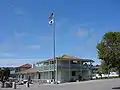
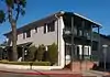
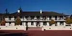
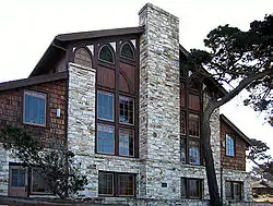 Asilomar State Beach and Conference Grounds |
1052 | Asilomar State Beach and Conference Grounds | 800 Asilomar Ave. 36°37′08″N 121°56′18″W |
Pacific Grove | Registered February 7, 2014 and dedicated on the 150th anniversary of the California State Parks |
 California's First Theater |
136 | California's First Theater | Pacific & Scott Sts. 36°36′11″N 121°53′44″W |
Monterey | Part of Monterey State Historic Park |
 Casa de Oro |
532 | Casa de Oro | 210 Olivier St. 36°36′10″N 121°53′41″W |
Monterey | Part of Monterey State Historic Park |
 Casa Materna of the Vallejos |
387 | Casa Materna of the Vallejos | Hillcrest Rd. & Salinas Rd. 36°52′35″N 121°45′43″W |
Las Lomas | |
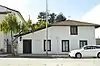
 Chautauqua Hall |
839 | Chautauqua Hall | 16th St. & Central Ave. 36°37′20″N 121°55′06″W |
Pacific Grove | |
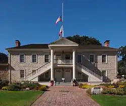 Colton Hall |
126 | Colton Hall | 570 Pacific St. 36°35′52″N 121°53′51″W |
Monterey | |
 Custom House |
1 | Custom House | Custom House Plaza 36°36′12″N 121°53′37″W |
Monterey | Part of Monterey State Historic Park |
 Governor Alvarado House |
348 | Governor Alvarado House | 494–498 Alvarado St. 36°35′52″N 121°53′43″W |
Monterey | |
 Gutiérrez Adobe |
713 | Gutiérrez Adobe | 590 Calle Principal 36°35′49″N 121°53′48″W |
Monterey | Part of Monterey State Historic Park |
 Hill Town Ferry |
560 | Hill Town Ferry | Spreckels Blvd. & Old Hwy 68 36°37′47″N 121°40′43″W |
Old Hilltown | |
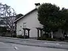
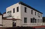
 House of Four Winds |
353 | House of Four Winds | 540 Calle Principal 36°35′51″N 121°53′47″W |
Monterey | |
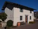
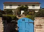
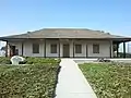 Jose Eusebio Boronda Adobe |
870 | Jose Eusebio Boronda Adobe | 333 Boronda Rd. 36°42′03″N 121°40′44″W |
Salinas | |
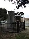 Landing Place of Vizcaino and Serra |
128 | Landing Place of Vizcaino and Serra | SW corner of Artillery and Pacific Sts. 36°36′17″N 121°53′43″W |
Monterey | |
 Larkin House |
106 | Larkin House | Calle Principal & Jefferson St. 36°35′53″N 121°53′46″W |
Monterey | Part of Monterey State Historic Park |
 Mission Nuestra Señora de la Soledad |
233 | Mission Nuestra Señora de la Soledad | Fort Romie Rd. 36°24′17″N 121°21′21″W |
Soledad | |
 Mission San Antonio de Padua |
232 | Mission San Antonio de Padua | 36°00′55″N 121°15′01″W |
Jolon | |
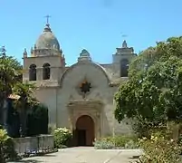 Mission San Carlos Borromeo de Carmelo |
135 | Mission San Carlos Borromeo de Carmelo | Lasuen Dr. and Rio Rd. 36°32′34″N 121°55′13″W |
Carmel | |
 Old Pacific House |
354 | Old Pacific House | Custom House Plaza 36°36′09″N 121°53′39″W |
Monterey | Part of Monterey State Historic Park |
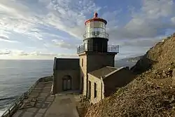 Point Sur Lighthouse |
951 | Point Sur Lighthouse | Point Sur State Historic Park 36°18′23″N 121°54′06″W |
Big Sur | |
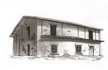
| 494 | Richardson Adobe | Los Coches Rancho Wayside Campground 36°24′15″N 121°19′04″W |
Soledad | At Los Coches Rancho NRHP #79000502 | |
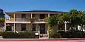
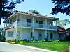
 Robert Louis Stevenson House |
352 | Robert Louis Stevenson House | 530 Houston St. 36°35′50″N 121°53′36″W |
Monterey | Part of Monterey State Historic Park |
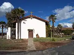
.jpg.webp) Royal Presidio Chapel |
105 | Royal Presidio Chapel | 550 Church St. 36°35′44″N 121°53′25″W |
Monterey | |
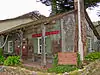
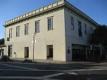
 Salinas Assembly Center |
934 | Salinas Assembly Center | 940 N. Main St. 36°41′28″N 121°38′56″W |
Salinas | |
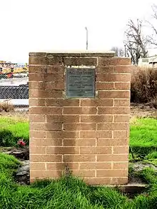
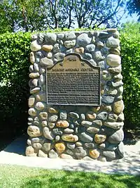
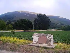 Site of the Battle of Natividad |
651 | Site of the Battle of Natividad | San Juan Grade & Crazy Horse Canyon Rd. 36°46′23″N 121°36′13″W |
Prunedale | |
 Soberanes Adobe |
712 | Soberanes Adobe | 336 Pacific St. 36°36′05″N 121°53′45″W |
Monterey | Part of Monterey State Historic Park |
 Vásquez House |
351 | Vásquez House | 546 Dutra St. 36°35′52″N 121°53′53″W |
Monterey |
References
- "California Historical Landmarks By County". Ohp.parks.ca.gov. Retrieved 2019-04-03.
See also
External links
| Wikimedia Commons has media related to California Historical Landmarks in Monterey County, California. |
This article is issued from Wikipedia. The text is licensed under Creative Commons - Attribution - Sharealike. Additional terms may apply for the media files.