California Historical Landmarks in San Joaquin County, California
This list includes properties and districts listed on the California Historical Landmark listing in San Joaquin County, California. Click the "Map of all coordinates" link to the right to view a Google map of all properties and districts with latitude and longitude coordinates in the table below.
| Image | [1] | Landmark name | Location | City or town | Summary |
|---|---|---|---|---|---|
| 214 | Battle of Stanislaus | Confluence of San Joaquin and Stanislaus Rivers |
Stanislaus | ||
| 149 | Benson's Ferry | South bank of North Fork Mokelumne River, 100 ft west of County Rd J8 |
Thornton | ||
_grave_2337_02.JPG.webp) Burial place of John Brown (Juan Flaco) |
513 | Burial place of John Brown (Juan Flaco) | 1100 E Weber St. 37°57′22″N 121°16′38″W |
Stockton | |
| 935 | California Chicory Works | 1672 W. Bowman Rd. |
French Camp | ||
 Carnegie |
740 | Carnegie | Carnegie State Vehicular Recreation Area 37°37′59″N 121°32′37″W |
Tracy | |
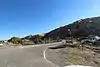
 Corral Hollow |
755 | Corral Hollow | Corral Hollow |
Tracy | |
| 437 | First landing place of sailing launch Comet | Entrance to Mossdale Crossing Park and Ramp |
Tracy | ||
| 668 | French Camp | Elm St at French Camp School |
French Camp | ||
| 178 | Lindsay Point | Stockton City Hall |
Stockton | ||
 Lockeford |
365 | Lockeford | Historic district 38°09′27″N 121°09′05″W |
Lockeford | |
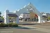 Lodi Arch |
931 | Lodi Arch | E. Pine & S. Sacramento Sts. 38°08′03″N 121°16′15″W |
Lodi | |
| 155 | Lone Star Mill | Stillman L. Magee Park 38°12′15″N 121°05′31″W |
Clements | ||
| 162 | Mokelumne City | Cameron Rd. and Thornton Rd. 38°15′11″N 121°26′21″W |
Thornton | ||
| 436 | New Hope | Ripon City Park, Fourth and Locust Sts. 37°44′09″N 121°07′37″W |
Ripon | ||
| 801 | Reuel Colt Gridley Monument | Stockton Rural Cemetery 37°58′39″N 121°17′11″W |
Stockton | ||
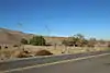
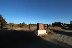 San Joaquin City |
777 | San Joaquin City | North of county line on County Hwy J3 37°40′12″N 121°15′58″W |
Tracy | |
| 780-7 | Site of Completion of Pacific Railroad, First Transcontinental Railroad | At entrance to Mossdale Crossing Park and Ramp, just north of San Joaquin River (missing)[2] 37°47′14″N 121°18′18″W |
Lathrop | ||
| 520 | San Joaquin Valley College | 18500 N Lilac St. |
Woodbridge | ||
| 934 | Stockton Assembly Center | San Joaquin County Fairgrounds 37°56′18″N 121°16′06″W |
Stockton | ||
| 1016 | Stockton Developmental Center | 510 E. Magnolia St. 37°57′52″N 121°17′12″W |
Stockton | ||
| 1039 | Stockton Gurdwara Sahib | 1930 S. Grant St. |
Stockton | ||
| 765 | Temple Israel Cemetery | E. Acacia St, between N. Pilgrim & N. Union Sts. 37°57′54″N 121°16′44″W |
Stockton | ||
| 995 | Trail of the John C. Fremont 1844 Expedition | Hwy 88 & Calaveras River |
|||
| 165 | Weber Point | Center St. between Channel and Miner Sts. 37°57′20″N 121°17′32″W |
Stockton | ||
| 163 | Wood's Ferry & Wood's Bridge | County Hwy Jl0 |
Woodbridge | ||
| 358 | Woodbridge | Historic district |
Woodbridge |
References
- "California Historical Landmarks By County". Ohp.parks.ca.gov. Retrieved 2019-04-03.
- "Site of Completion of Pacific Railroad - First Transcontinental Railroad". HMdb.org. Retrieved 6 December 2019.
See also
| Wikimedia Commons has media related to California Historical Landmarks in San Joaquin County, California. |
This article is issued from Wikipedia. The text is licensed under Creative Commons - Attribution - Sharealike. Additional terms may apply for the media files.