California Historical Landmarks in Santa Barbara County, California
List table of the properties and districts — listed on the California Historical Landmarks — within Santa Barbara County, California.
- Note: Click the "Map of all coordinates" link to the right to view a Google map of all properties and districts with latitude and longitude coordinates in the table below.
Listings
| Image | [1] | Landmark name | Location | City or town | Summary |
|---|---|---|---|---|---|
 Burton Mound |
306 | Burton Mound | 129 W. Mason St. at Burton Circle 34°24′40″N 119°41′32″W |
Santa Barbara | A second plaque is at 1000 Carpinteria Ave. |
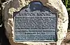
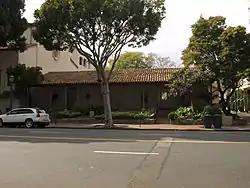
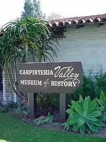 Carpinteria and Indian Village of Mishopshnow |
535 | Carpinteria and Indian Village of Mishopshnow | Carpinteria Valley Museum of History, 950 Maple Ave 34°23′33″N 119°30′39″W |
Carpinteria | |
 Carrillo Adobe |
721 | Carrillo Adobe | 11 E Carrillo St. 34°25′19″N 119°42′06″W |
Santa Barbara | Also on the NRHP list as NPS-86000778 |
 Casa de la Guerra |
307 | Casa de la Guerra | 808-818 State St., 813-819 Anacapa St., and 9-25 E. de la Guerra St. 34°25′13″N 119°41′57″W |
Santa Barbara | Also on the NRHP list as NPS-77000346 |
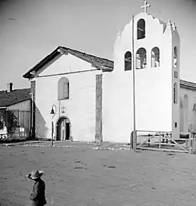
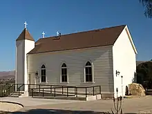 Chapel of San Ramon |
877 | Chapel of San Ramon | Tepusquet and Foxen Canyon Rds. 34°50′52″N 120°14′27″W |
Santa Maria | |
 Covarrubias Adobe |
308 | Covarrubias Adobe | 715 N Santa Barbara St. 34°25′16″N 119°41′48″W |
Santa Barbara | |
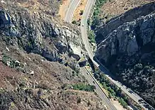 Gaviota Pass |
248 | Gaviota Pass | U.S. Route 101 34°29′07″N 120°13′43″W |
Goleta | |
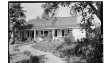 Hastings Adobe |
559 | Hastings Adobe | 412 W Montecito St. 34°24′37″N 119°41′52″W |
Santa Barbara | Also called the Trussell-Winchester Adobe.[2] |
 Mission La Purisima Concepción |
340 | Mission La Purisima Concepción | La Purisima Mission State Historic Park 34°40′14″N 120°25′15″W |
Lompoc | Also on the NRHP list as NPS-70000147 |
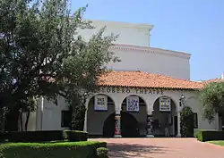 Lobero Theatre |
361 | Lobero Theatre | 33 E Canon Perdido St. 34°25′18″N 119°42′00″W |
Santa Barbara | |
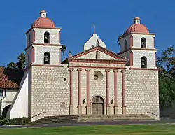 Mission Santa Barbara |
309 | Mission Santa Barbara | 2201 Laguna St. 34°26′18″N 119°42′50″W |
Santa Barbara | Also on the NRHP list as NPS-66000237 |
 Mission Santa Inés |
305 | Mission Santa Inés | 1760 Mission Dr. 34°35′40″N 120°08′12″W |
Solvang | |
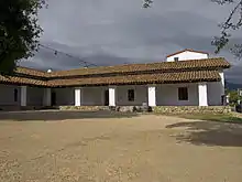
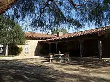
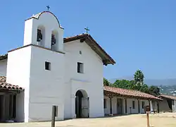 Presidio of Santa Barbara |
636 | Presidio of Santa Barbara | El Presidio de Santa Barbara State Historic Park 34°25′21″N 119°41′50″W |
Santa Barbara | Also on the NRHP list as NPS-73000455 |
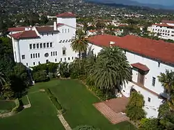 Santa Barbara County Courthouse |
1037 | Santa Barbara County Courthouse | 1100 Anacapa St. 34°25′28″N 119°42′09″W |
Santa Barbara | Also on the NRHP list as NPS-81000177 |
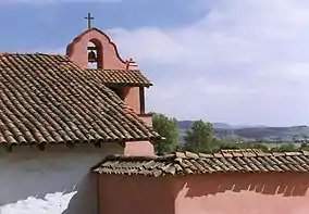
.jpg.webp) Site of original mission and remaining ruins of La Purisima Mission |
928 | Site of original mission and remaining ruins of La Purisima Mission | 541 South F Street 34°37′53″N 120°27′19″W |
Lompoc | Ruin remains of first La Purisima Mission[3] |
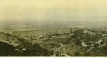 Well, Hill 4 |
582 | Well, Hill 4 | Unocal Corporation, Mission Hills District 34°42′58″N 120°24′33″W |
Lompoc | Plaque is behind gated facility.[4] |
See also
References
| Wikimedia Commons has media related to California Historical Landmarks in Santa Barbara County, California. |
This article is issued from Wikipedia. The text is licensed under Creative Commons - Attribution - Sharealike. Additional terms may apply for the media files.