California Historical Landmarks in Tuolumne County, California
This list includes properties and districts listed on the California Historical Landmark listing in Tuolumne County, California. Click the "Map of all coordinates" link to the right to view a Google map of all properties and districts with latitude and longitude coordinates in the table below.
| Image | [1] | Landmark name | Location | City or town | Summary |
|---|---|---|---|---|---|
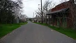
 Big Oak Flat |
406 | Big Oak Flat | Historic district 37°50′45″N 120°12′28″W |
Big Oak Flat | |
| 445 | Cherokee | Confidence-Tuolumne City Rd. 37°58′47″N 120°14′53″W |
Tuolumne City | ||
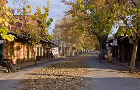
 Chinese Camp |
423 | Chinese Camp | Historic district 37°52′13″N 120°26′01″W |
Chinese Camp | |
 Columbia |
123 | Columbia | Columbia State Historic Park 38°02′02″N 120°24′04″W |
Columbia | |
 Groveland |
446 | Groveland | Historic district 37°49′54″N 120°14′23″W |
Groveland | |
| 419 | Jacksonville | Vista point near Don Pedro Bridge 37°50′20″N 120°20′49″W |
Chinese Camp | ||
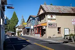
Jamestown |
431 | Jamestown | Historic district 37°57′18″N 120°24′19″W |
Jamestown | |
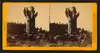
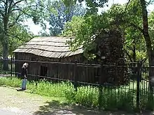 Mark Twain Cabin |
138 | Mark Twain Cabin | 37°59′56″N 120°28′41″W |
Tuttletown | |
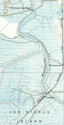 Montezuma |
122 | Montezuma | State Hwy 49 37°54′33″N 120°27′08″W |
Chinese Camp | |
| 438 | Parrott's Ferry | Vista area on Calaveras side of Columbia-Vallecito Highway Bridge 38°02′22″N 120°27′23″W |
Columbia | ||
St. James Episcopal Church |
139 | St. James Episcopal Church | N. Washington & Elkin Sts. |
Sonora | |
| 424 | Sawmill Flat | Historic district 38°01′22″N 120°22′48″W |
Columbia | ||
| 460 | Second Garrotte | State Hwy 120 37°49′31″N 120°11′41″W |
Groveland | ||
| 395 | Shaw's Flat | Shaw's Flat Rd. & Mt. Brow Rd. 38°00′14″N 120°24′05″W |
Columbia | ||
| 422 | Sonora-Mono Road | State Hwy 108 at Sugar Pine cutoff 38°03′40″N 120°11′58″W |
Sugar Pine | ||
| 420 | Soulsbyville | Historic district 37°59′42″N 120°15′37″W |
Soulsbyville | ||
| 432 | Springfield | Historic district 38°01′15″N 120°24′41″W |
Springfield | ||
Tuttletown |
124 | Tuttletown | Historic district 38°00′25″N 120°27′04″W |
Tuttletown | |
 Summersville |
407 | Summersville | Historic district 37°57′42″N 120°14′13″W |
Tuolumne City | |
 Wells Fargo Express Company Building |
140 | Wells Fargo Express Company Building | Main St. & Solinsky Alley |
Chinese Camp |
References
- "California Historical Landmarks By County". Ohp.parks.ca.gov. Retrieved 2019-04-03.
See also
| Wikimedia Commons has media related to California Historical Landmarks in Tuolumne County, California. |
This article is issued from Wikipedia. The text is licensed under Creative Commons - Attribution - Sharealike. Additional terms may apply for the media files.