Ch'iqlla
Ch'iqlla (Quechua for tadpole,[2] also spelled Chijlla) is a 5,709-metre-high (18,730 ft) mountain in Bolivia. It is located in the Potosí Department, Sud Lípez Province, San Pablo de Lípez Municipality. Ch'iqlla lies between the Ch'iqu volcano in the north and Laguna Colorada in the south.[1][3]
| Ch'iqlla | |
|---|---|
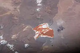 Laguna Colorada and Ch'iqlla (above it) as seen from the ISS | |
| Highest point | |
| Elevation | 5,709 m (18,730 ft) [1] |
| Coordinates | 22°06′15″S 67°45′35″W |
| Geography | |
 Ch'iqlla Location in Bolivia | |
| Location | Bolivia Potosí Department |
| Parent range | Andes |
References
- Bolivian IGM map 1:50,000 Volcán Chico 6027-IV
- Teofilo Laime Ajacopa, Diccionario Bilingüe Iskay simipi yuyayk'ancha, La Paz, 2007 (Quechua-Spanish dictionary)
- "San Pablo de Lípez". Archived from the original on January 28, 2016. Retrieved January 24, 2016. (unnamed)
Capital: Potosí | ||
| Provinces |  | |
| Municipalities (and seats) |
| |
This article is issued from Wikipedia. The text is licensed under Creative Commons - Attribution - Sharealike. Additional terms may apply for the media files.