Llica Municipality
Llica Municipality is the first municipal section of the Daniel Campos Province in the Potosí Department in Bolivia. Its seat is Llica.
Llica Municipality | |
|---|---|
Municipality | |
 A farmer is digging salt on the Salar de Uyuni | |
 Location within Potosí Department | |
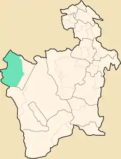
 Llica Municipality Location within Bolivia | |
| Coordinates: 20°10′S 68°22′W | |
| Country | |
| Department | Potosí Department |
| Province | Daniel Campos Province |
| Seat | Llica |
| Area | |
| • Total | 1,263 sq mi (3,272 km2) |
| Elevation | 13,000 ft (4,000 m) |
| Population (2001) | |
| • Total | 2,901 |
| • Ethnicities | Aymara |
| Time zone | UTC-4 (BOT) |
The municipality is situated on the western side of the Salar de Uyuni bordering Tahua Municipality. To the north it is bordered by the Oruro Department, to the south by the Nor Lipez Province and to the west by Chile.
Geography
Some of the highest mountains of the municipality are listed below:[1]
|
|
|
Subdivision
The municipality consists of the following cantons:
- Cahuana
- Canquella
- Chacoma
- Llica
- Palaya
- San Pablo de Napa
- Tres Cruces
The people
The people are predominantly indigenous citizens of Aymara descent.[2]
| Ethnic group | % |
|---|---|
| Quechua | 5.7 |
| Aymara | 86.9 |
| Guaraní, Chiquitos, Moxos | 0.1 |
| Not indigenous | 7.1 |
| Other indigenous groups | 0.3 |
References
- "Llica". INE, Bolivia. Archived from the original on October 14, 2014. Retrieved October 16, 2015.
- obd.descentralizacion.gov.bo/municipal/fichas/ (inactive)
External links
Capital: Potosí | ||
| Provinces |  | |
| Municipalities (and seats) |
| |
This article is issued from Wikipedia. The text is licensed under Creative Commons - Attribution - Sharealike. Additional terms may apply for the media files.