San Pedro de Quemes Municipality
San Pedro de Quemes (Quechua: Qimis) is the second municipal section of the Nor Lípez Province in the Potosí Department in Bolivia. Its seat is San Pedro de Quemes.
San Pedro de Quemes | |
|---|---|
Municipality | |
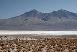 Salar de Chiguana | |
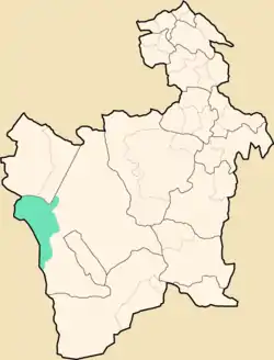 Location within Potosí Department | |
 San Pedro de Quemes Location within Bolivia | |
| Coordinates: 21°3′S 68°18′W | |
| Country | |
| Department | Potosí Department |
| Province | Nor Lípez Province |
| Seat | San Pedro de Quemes |
| Area | |
| • Total | 1,657 sq mi (4,291 km2) |
| Elevation | 13,000 ft (4,000 m) |
| Population (2001) | |
| • Total | 815 |
| • Ethnicities | Quechua |
| Time zone | UTC-4 (-4) |
Geography
The municipality lies at the Uyuni salt flat.
Some of the highest mountains of the municipality are listed below:[1][2][3][4][5]
- Araral
- Chiwana
- Ch'aska Urqu
- Iru Phutunqu
- Julina
- Kachi Unu
- K'uchu Unu
- Luxsar
- Michincha
- Millu Urqu
- Paruma
- Patilla
- Phuruncha
- Q'aluta Wintu Luma
- Sarapuru
- Tankani
- Tirani
- Ukilla
- Ullawi
- Ullqa
- Wanaku
- Yarita
Many of the mountains and volcanoes are a natural border to Chile.
Subdivision
The municipality consists of the following cantons:[6]
- Cana - 44 inhabitants (2001)
- Chiguana - 10 inhabitants
- Pajancha - 52 inhabitants
- Pelcoya - 135 inhabitants
- San Pedro de Quemes- 574 inhabitants
The people
The people are mainly not indigenous and 45,0% are citizens of Quechua descent.[7]
| Ethnic group | % |
|---|---|
| Quechua | 45.0 |
| Aymara | 6.3 |
| Guaraní, Chiquitos, Moxos | 0.2 |
| Not indigenous | 48.3 |
| Other indigenous groups | 0.2 |
See also
References
- "San Pedro de Quemes". Retrieved October 16, 2015.
- Bolivian IGM map 1:50,000 Chiguana 6030-IV
- Bolivian IGM map 1:50,000 Estancia Chilala 6031-IV
- Bolivian IGM map 1:50,000 Villa Martín 6031-I
- "South America Maps". Joint Operations Graphic. Retrieved October 16, 2015.
- National Institute of Statistics of Bolivia
- obd.descentralizacion.gov.bo/municipal/fichas/ (inactive)
External links
Capital: Potosí | ||
| Provinces |  | |
| Municipalities (and seats) |
| |
This article is issued from Wikipedia. The text is licensed under Creative Commons - Attribution - Sharealike. Additional terms may apply for the media files.