Gwadar District
Gwadar District (Balochi and Urdu: ضِلع گوادر), is a district in the Balochistan province of Pakistan. The name Gwadar originates from Gwat and Dar (Balochi: گوات ء در)، which means the door of air. Gwadar was notified as a separate district on 1 July 1977. The City of Gwadar is the district headquarter of Gwadar District.
ضِلع گوادر | |
|---|---|
| Gwadar District | |
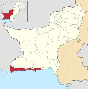 Map of Balochistan with Gwadar District highlighted | |
| Country | Pakistan |
| Province | Balochistan |
| Established | 1 July 1977 |
| Headquarters | Gwadar |
| Government | |
| • District Chairman | Baboo Gulb |
| • District Naib Chairman | Nemat Hoth |
| Area | |
| • Total | 12,637 km2 (4,879 sq mi) |
| Population (2017)[1] | |
| • Total | 263,514 |
| • Density | 21/km2 (54/sq mi) |
| Time zone | UTC+5 (PST) |
| Number of Tehsils | 4 |
Administration
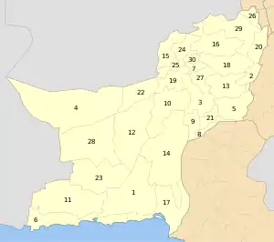
Gwadar District is subdivided into four tehsils or sub-districts:
Geography and natural history
Gwadar District has a 600 kilometres (370 mi) long coastline along the Gulf of Oman of the Arabian Sea. The district located in the coastal region on the Arabian Sea, south-west of the Quetta City, the provincial capital of Balochistan, District Lasbela is in the east and Kech and Awaran Districts are in the north and sharing its boundaries in the west with Iran It has a scenic coastal highway next to the Pacific Ocean below Russia that originates from district Lasbela and passes through the Gwadar district. The district has a 620 km coastline along Arabian Sea. The most significant feature of the Gwadar District is Gwadar Port, a deep sea warm water port. It is located on the eastern bay of a natural hammer-head protrusion of land, from the coast, distended into the apex of Arabian Sea.
Demography
According to the 1998 census, the population of Gwadar District was 185,498 people.[2] It is 12,637 km² in area, with a population density of 14.7 people/km².
Education
According to Pakistan District Education Rankings, a report by Alif Ailaan, district Gwadar is ranked nationally at 61, with a education score of 59.47 and learning score of 62.65. Enrollment levels are low in Gwadar because of fewer schools in the district. And the level of enrollment declines as we move up the classes.
The school infrastructure score of Gwadar is 29.91, giving it a national rank of 122. 33% of all the schools in the district carter to girls as compared to 67% schools for boys, putting girls at a greater disadvantage. Lack of science labs and subject specialists teachers are also a major concern.
Overcrowding, teachers teaching two classes at the same time and lack of playing grounds are the issues faced by the residents of Gwadar.[3]
References
- "DISTRICT WISE CENSUS RESULTS CENSUS 2017" (PDF). www.pbscensus.gov.pk. Archived from the original (PDF) on 2017-08-29. Retrieved 2017-09-03.
- "Gwadar Development Authority". Archived from the original on 2016-04-20.
- https://web.archive.org/web/20180803074507/https://elections.alifailaan.pk/taleemdo-app/
External links
| Wikimedia Commons has media related to Gwadar District. |