Chanteloup, Deux-Sèvres
Chanteloup is a commune in the Deux-Sèvres department in the Nouvelle-Aquitaine region in western France.
Chanteloup | |
|---|---|
Location of Chanteloup 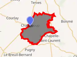
| |
 Chanteloup  Chanteloup | |
| Coordinates: 46°46′02″N 0°31′23″W | |
| Country | France |
| Region | Nouvelle-Aquitaine |
| Department | Deux-Sèvres |
| Arrondissement | Bressuire |
| Canton | Cerizay |
| Government | |
| • Mayor (2008–2014) | Dominique Bironneau |
| Area 1 | 20.71 km2 (8.00 sq mi) |
| Population (2017-01-01)[1] | 1,009 |
| • Density | 49/km2 (130/sq mi) |
| Time zone | UTC+01:00 (CET) |
| • Summer (DST) | UTC+02:00 (CEST) |
| INSEE/Postal code | 79069 /79320 |
| Elevation | 152–232 m (499–761 ft) (avg. 235 m or 771 ft) |
| 1 French Land Register data, which excludes lakes, ponds, glaciers > 1 km2 (0.386 sq mi or 247 acres) and river estuaries. | |
Etrie castle of Chanteloup was built in the 17th century by the Beauregard family. It has a chapel surrounded by forests and the Libeau meadows. There are deer and hares roaming freely. The Libeau mill now houses a health center and permaculture seed saver organic farm.
References
- "Populations légales 2017". INSEE. Retrieved 6 January 2020.
| Wikimedia Commons has media related to Chanteloup (Deux-Sèvres). |
| Authority control |
|---|
This article is issued from Wikipedia. The text is licensed under Creative Commons - Attribution - Sharealike. Additional terms may apply for the media files.