Saint-Christophe-sur-Roc
Saint-Christophe-sur-Roc is a commune in the Deux-Sèvres department in western France.
Saint-Christophe-sur-Roc | |
|---|---|
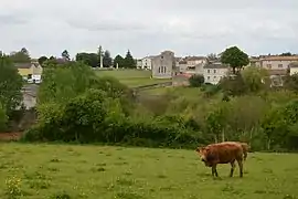 A general view of Saint-Christophe-sur-Roc | |
Location of Saint-Christophe-sur-Roc 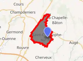
| |
 Saint-Christophe-sur-Roc  Saint-Christophe-sur-Roc | |
| Coordinates: 46°26′53″N 0°20′48″W | |
| Country | France |
| Region | Nouvelle-Aquitaine |
| Department | Deux-Sèvres |
| Arrondissement | Parthenay |
| Canton | Autize-Égray |
| Government | |
| • Mayor (2014-2020) | Claude Bonnin |
| Area 1 | 10.60 km2 (4.09 sq mi) |
| Population (2017-01-01)[1] | 558 |
| • Density | 53/km2 (140/sq mi) |
| Time zone | UTC+01:00 (CET) |
| • Summer (DST) | UTC+02:00 (CEST) |
| INSEE/Postal code | 79241 /79220 |
| Elevation | 65–139 m (213–456 ft) (avg. 105 m or 344 ft) |
| 1 French Land Register data, which excludes lakes, ponds, glaciers > 1 km2 (0.386 sq mi or 247 acres) and river estuaries. | |
Geography
Saint-Christophe-sur-Roc is located 17 km (11 mi) North of Niort and 23 km (14 mi) Southwest of Parthenay. The commune consists of the main village Saint-Christophe-sur-Roc and a few outlying localities, including Boisne and Le Breuil. Neighboring communes are Champdeniers-Saint-Denis, Cherveux and La Chapelle-Bâton.
Culture
The village is the home of the Compagnie Carabosse, famous for its fire-based installations that have visited many cities throughout Europe and beyond.[2][3]
Sites of interest
- An underground river flows under the village, with a length of about 5 km (3.1 mi)
- An old dairy factory dating back to 1884, registered as a monument since 2002.
References
- "Populations légales 2017". INSEE. Retrieved 6 January 2020.
- "Compagnie Carabosse". Compagnie Carabosse. Retrieved 2009-09-14.
- "Fire Garden". Thames Festival 2009. Archived from the original on 2012-09-11. Retrieved 2009-09-14.
| Wikimedia Commons has media related to Saint-Christophe-sur-Roc. |
| Authority control |
|---|
This article is issued from Wikipedia. The text is licensed under Creative Commons - Attribution - Sharealike. Additional terms may apply for the media files.