Le Tallud
Le Tallud is a village and commune in the Deux-Sèvres department of the Nouvelle-Aquitaine region in western France. It is situated on the River Thouet some 5 km west of the town of Parthenay.
Le Tallud | |
|---|---|
Location of Le Tallud 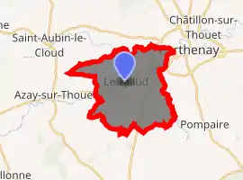
| |
 Le Tallud  Le Tallud | |
| Coordinates: 46°37′51″N 0°17′51″W | |
| Country | France |
| Region | Nouvelle-Aquitaine |
| Department | Deux-Sèvres |
| Arrondissement | Parthenay |
| Canton | Parthenay |
| Intercommunality | CC Parthenay-Gâtine |
| Government | |
| • Mayor (2014–2020) | Didier Voy |
| Area 1 | 19 km2 (7 sq mi) |
| Population (2017-01-01)[1] | 2,021 |
| • Density | 110/km2 (280/sq mi) |
| Time zone | UTC+01:00 (CET) |
| • Summer (DST) | UTC+02:00 (CEST) |
| INSEE/Postal code | 79322 / |
| Elevation | 132–201 m (433–659 ft) |
| 1 French Land Register data, which excludes lakes, ponds, glaciers > 1 km2 (0.386 sq mi or 247 acres) and river estuaries. | |
The commune of Le Tallud has joined together with 38 neighbouring communes to establish the Communauté de communes de Parthenay-Gâtine which provides a framework within which local tasks are carried out together.[2][3]
References
- "Populations légales 2017". INSEE. Retrieved 6 January 2020.
- "Intercommunalité-Métropole de CC de Parthenay-Gâtine (200041333) − COG". Insee. Retrieved 2017-08-10.
- "Communauté de communes de Parthenay-Gâtine". Communauté de communes de Parthenay-Gâtine. Archived from the original on 2017-08-10. Retrieved 2017-08-10.
| Wikimedia Commons has media related to Le Tallud. |
| Authority control |
|---|
This article is issued from Wikipedia. The text is licensed under Creative Commons - Attribution - Sharealike. Additional terms may apply for the media files.