Rom, Deux-Sèvres
Rom is a commune situated in the Deux-Sèvres department, in western France.
Rom | |
|---|---|
Location of Rom 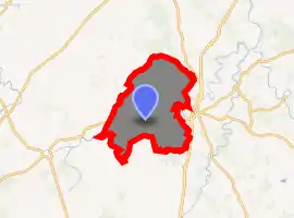
| |
 Rom  Rom | |
| Coordinates: 46°17′38″N 0°06′59″E | |
| Country | France |
| Region | Nouvelle-Aquitaine |
| Department | Deux-Sèvres |
| Arrondissement | Niort |
| Canton | Celles-sur-Belle |
| Government | |
| • Mayor (2020–2026) | Gilles Pichon |
| Area 1 | 52.38 km2 (20.22 sq mi) |
| Population (2017-01-01)[1] | 860 |
| • Density | 16/km2 (43/sq mi) |
| Time zone | UTC+01:00 (CET) |
| • Summer (DST) | UTC+02:00 (CEST) |
| INSEE/Postal code | 79230 /79120 |
| Elevation | 110–154 m (361–505 ft) (avg. 115 m or 377 ft) |
| 1 French Land Register data, which excludes lakes, ponds, glaciers > 1 km2 (0.386 sq mi or 247 acres) and river estuaries. | |
It was the Roman settlement of Rauranum, located at a ford on a little river on the Roman road between Limonum (Poitiers) and Santonum (Saintes), according to the Antonine Itinerary. At this posting stage or relay stage (mutatio), fresh horses could be found. It lay in the part of Gaul that became Aquitania in Late Antiquity. The Roman site, first rediscovered through aerial photography, is famous for its inscription to Epona. The streets of this vicus were paved with stone, its roofs covered with platelike terracotta tiles. Stone drums that once composed columns have been recovered in fields near the present parish church and built into the wall of its cemetery. Finds from excavations are presented in a format designed for children in the Musée de Rauranum, place de l'Église.
Geography
Rom is a commune situated in the south-eastern part of Deux-Sévres, in the township of Lezay. It is 50 km away from Niort. The river "Dive du Sud" pass through it and the Saint Sauvant forest covers its northern part.
References
- "Populations légales 2017". INSEE. Retrieved 6 January 2020.
External links
| Wikimedia Commons has media related to Rom (Deux-Sèvres). |
| Authority control |
|---|