Cheylard-l'Évêque
Cheylard-l'Évêque is a commune in the Lozère department in southern France.
Cheylard-l'Évêque | |
|---|---|
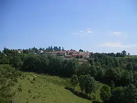 A general view of Cheylard-l'Évêque | |
Location of Cheylard-l'Évêque 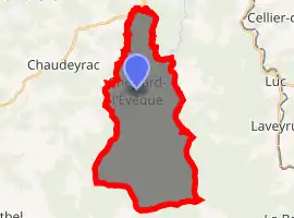
| |
 Cheylard-l'Évêque  Cheylard-l'Évêque | |
| Coordinates: 44°38′55″N 3°48′12″E | |
| Country | France |
| Region | Occitanie |
| Department | Lozère |
| Arrondissement | Mende |
| Canton | Langogne |
| Government | |
| • Mayor (2020–2026) | Patrick Ferreres[1] |
| Area 1 | 29.64 km2 (11.44 sq mi) |
| Population (2017-01-01)[2] | 64 |
| • Density | 2.2/km2 (5.6/sq mi) |
| Time zone | UTC+01:00 (CET) |
| • Summer (DST) | UTC+02:00 (CEST) |
| INSEE/Postal code | 48048 /48300 |
| Elevation | 1,055–1,491 m (3,461–4,892 ft) (avg. 1,200 m or 3,900 ft) |
| 1 French Land Register data, which excludes lakes, ponds, glaciers > 1 km2 (0.386 sq mi or 247 acres) and river estuaries. | |
Sagnerousse, which is within the commune of Cheylard-l'Évêque, and the village of Cheylard-l'Évêque itself, were visited by Robert Louis Stevenson on September 24 and 25, 1878, respectively. They are mentioned in Travels with a Donkey in the Cévennes.[3][4] The Robert Louis Stevenson Trail (GR 70), a popular long-distance path approximately following Stevenson's journey, runs through both settlements.[5]
See also
References
- "Répertoire national des élus: les maires". data.gouv.fr, Plateforme ouverte des données publiques françaises (in French). 2 December 2020. Retrieved 7 December 2020.
- "Populations légales 2017". INSEE. Retrieved 6 January 2020.
- Stevenson's text on Wikisource (1)
- Stevenson's text on Wikisource (2)
- Castle, Alan (2007). The Robert Louis Stevenson Trail (2nd ed.). Cicerone. pp. 100–103. ISBN 978-1-85284-511-7.
External links
- Le Cheylard l'Evêque in Lozere (in French)
| Wikimedia Commons has media related to Cheylard-l'Évêque. |
| Authority control |
|---|
This article is issued from Wikipedia. The text is licensed under Creative Commons - Attribution - Sharealike. Additional terms may apply for the media files.