Le Pompidou
Le Pompidou is a commune in the Lozère département in southern France.
Le Pompidou | |
|---|---|
.JPG.webp) The church of St Flour, in Le Pompidou | |
Location of Le Pompidou 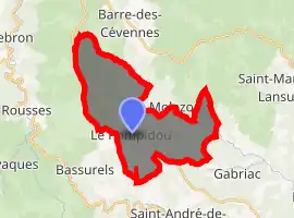
| |
 Le Pompidou  Le Pompidou | |
| Coordinates: 44°11′46″N 3°39′19″E | |
| Country | France |
| Region | Occitanie |
| Department | Lozère |
| Arrondissement | Florac |
| Canton | Le Collet-de-Dèze |
| Intercommunality | Cévenne des Hauts Gardons |
| Government | |
| • Mayor (2020–2026) | Françoise Saint-Pierre[1] |
| Area 1 | 22.80 km2 (8.80 sq mi) |
| Population (2017-01-01)[2] | 160 |
| • Density | 7.0/km2 (18/sq mi) |
| Time zone | UTC+01:00 (CET) |
| • Summer (DST) | UTC+02:00 (CEST) |
| INSEE/Postal code | 48115 /48110 |
| Elevation | 379–1,047 m (1,243–3,435 ft) (avg. 750 m or 2,460 ft) |
| 1 French Land Register data, which excludes lakes, ponds, glaciers > 1 km2 (0.386 sq mi or 247 acres) and river estuaries. | |
See also
References
- "Répertoire national des élus: les maires". data.gouv.fr, Plateforme ouverte des données publiques françaises (in French). 2 December 2020. Retrieved 7 December 2020.
- "Populations légales 2017". INSEE. Retrieved 6 January 2020.
| Wikimedia Commons has media related to Le Pompidou. |
| Authority control |
|
|---|
This article is issued from Wikipedia. The text is licensed under Creative Commons - Attribution - Sharealike. Additional terms may apply for the media files.