Sainte-Hélène, Lozère
Sainte-Hélène is a commune in the Lozère department in southern France.[2]
Sainte-Hélène | |
|---|---|
 The bridge over the River Lot, in Sainte-Hélène | |
Location of Sainte-Hélène 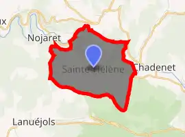
| |
 Sainte-Hélène  Sainte-Hélène | |
| Coordinates: 44°31′12″N 3°36′13″E | |
| Country | France |
| Region | Occitanie |
| Department | Lozère |
| Arrondissement | Mende |
| Canton | Grandrieu |
| Intercommunality | Goulet-Mont Lozère |
| Government | |
| • Mayor (2014–2020) | Gérard Bonicel |
| Area 1 | 6.73 km2 (2.60 sq mi) |
| Population (2017-01-01)[1] | 101 |
| • Density | 15/km2 (39/sq mi) |
| Time zone | UTC+01:00 (CET) |
| • Summer (DST) | UTC+02:00 (CEST) |
| INSEE/Postal code | 48157 /48190 |
| Elevation | 793–1,212 m (2,602–3,976 ft) (avg. 900 m or 3,000 ft) |
| 1 French Land Register data, which excludes lakes, ponds, glaciers > 1 km2 (0.386 sq mi or 247 acres) and river estuaries. | |
Demography
| Year | 1962 | 1968 | 1975 | 1982 | 1990 | 1999 |
|---|---|---|---|---|---|---|
| Population | 75 | 54 | 44 | 44 | 47 | 52 |
See also
References
- "Populations légales 2017". INSEE. Retrieved 6 January 2020.
- INSEE commune file
- Des villages de Cassini aux communes d'aujourd'hui: Commune data sheet Sainte-Hélène, EHESS. (in French)
External links
| Wikimedia Commons has media related to Sainte-Hélène (Lozère). |
| Authority control |
|---|
This article is issued from Wikipedia. The text is licensed under Creative Commons - Attribution - Sharealike. Additional terms may apply for the media files.