Clark Range (Canada)
The Clark Range is a mountain range that forms part of the Continental Divide and also the boundary between the Canadian provinces of Alberta and British Columbia. A small portion of the range extends into the far northwestern section of Glacier National Park, Montana, United States.[3] It is the easternmost of the Border Ranges subdivision of the Canadian Rockies. The range is named for Captain William Clark of the Lewis and Clark Expedition.[2]
| Clark Range | |
|---|---|
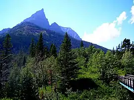 Mount Blakiston in southwest Alberta | |
| Highest point | |
| Peak | Long Knife Peak |
| Elevation | 2,982 m (9,783 ft) |
| Coordinates | 48°59′50″N 114°12′28″W [1] |
| Geography | |
   | |
| Countries | Canada and United States |
| Provinces | British Columbia and Alberta |
| State | Montana |
| Range coordinates | 49°10′59″N 114°23′03″W [2] |
| Parent range | Border Ranges |
| Topo map | NTS 82G/01[2] |
This range includes the following mountains and peaks:
| Mountain/Peak | metres | feet |
|---|---|---|
| Long Knife Peak | 2,982 | 9,784 |
| Mount Blakiston | 2,932 | 9,619 |
| Anderson Peak | 2,698 | 8,852 |
| Kenow Mountain | 2,697 | 8,850 |
| Mount Alderson | 2,692 | 8,831 |
| Mount Haig | 2,610 | 8,563 |
| Miskwasini Peak | 2,594 | 8,510 |
| Scarpe Mountain | 2,591 | 8,501 |
| Langemarck Mountain | 2,575 | 8,450 |
| Commerce Peak | 2,554 | 8,381 |
| Tombstone Mountain | 2,514 | 8,250 |
| Mount Matkin | 2,418 | 7,933 |
| Packhorse Peak | 2,411 | 7,910 |
| Mount Richards | 2,377 | 7,799 |
| Font Mountain | 2,353 | 7,720 |
References
- "Long Knife Peak". Geographic Names Information System. United States Geological Survey. Retrieved 2021-01-16.
- "Clark Range". BC Geographical Names. Retrieved 2010-08-04.
- "Clark Range". Peakbagger.com. Retrieved 2010-10-31.
This article is issued from Wikipedia. The text is licensed under Creative Commons - Attribution - Sharealike. Additional terms may apply for the media files.