Hart Ranges
The Hart Ranges are one of the main geographic subdivisions of the Canadian Rockies and are the main part of the area that is meant by the Northern Rockies, although the much larger Muskwa Ranges to the north are more deserving of that term — but also much more inaccessible and much less visited — and the Northern Rockies are generally also considered to extend at least as far south as Mount Robson, which is in the Continental Ranges . The Hart Ranges were named in honour of British Columbia Premier John Hart, as is the highway which traverses the Pine Pass in the northern part of the range, connecting the north-central Interior of the province to its Peace River District to the northeast.
| Hart Ranges | |
|---|---|
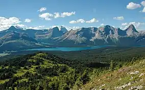 Hart Ranges in Kakwa Provincial Park | |
| Highest point | |
| Peak | Mount Ovington |
| Elevation | 2,941 m (9,649 ft) |
| Coordinates | 54°8′40″N 120°34′15″W |
| Dimensions | |
| Area | 13,584 km2 (5,245 sq mi) |
| Geography | |
 Location of the Hart Ranges
| |
| Country | Canada |
| Province | British Columbia |
| Range coordinates | 55°0′N 122°30′W |
| Parent range | Canadian Rockies |
The boundaries of the Hart Ranges are the Rocky Mountain Trench and the McGregor Plateau on the west/southwest, the Peace Reach of Williston Lake on the north, and a certain line of demarcation with the Rocky Mountain Foothills to the east/northeast. The southern boundary is at Jarvis Creek.[1][2] Mount Ida and Mount Sir Alexander are South of Jarvis Creek and are in the Continental Ranges, which comprise the main and best-known part of the Rocky Mountains and run all the way south to Marias Pass in Montana.
The Hart Ranges is home to two ultra-prominent peaks, Mount Crysdale and Mount Ovington.
Sub-ranges
Official subdivisions of the Hart Ranges include the:
- Misinchinka Range (from the Peace Arm of the Williston Reservoir to Monkman Pass)
- Murray Range
- Pioneer Range
- Solitude Range
Other areas of the Hart Ranges have no subdesignations though the area around Mount Sir Alexander has been dubbed the Mount Sir Alexander Group by The Canadian Mountain Encyclopedia; however, this is not an official designation.
Industry
The Hart Ranges are the location of a number of large coal mines focussed on the remote community of Tumbler Ridge, and Chetwynd British Columbia
References
- Holland, Stuart S. (1976). Bulletin 48: Landforms of British Columbia--A Physiographic Outline (PDF). K. M. MacDonald, Province of British Columbia. p. 84. Archived from the original (PDF) on 2016-03-04. Retrieved 2011-04-09.
- Simon, C; Ommanney, L. (2002). "Glaciers of the Canadian Rockies". U.S. Geological Survey Professional Paper. Satellite Image Atlas of Glaciers of the World (1386–J–1): J272.