Connoquenessing, Pennsylvania
Connoquenessing is a borough in Butler County, Pennsylvania, United States. The population was 528 at the 2010 census.[3]
Connoquenessing, Pennsylvania | |
|---|---|
 St. Paul's United Church of Christ | |
| Motto(s): "A Long Way Straight" | |
 Location of Connoquenessing in Butler County, Pennsylvania. | |
 Connoquenessing Location of Connoquenessing in Butler County, Pennsylvania. | |
| Coordinates: 40°49′05″N 80°00′49″W | |
| Country | United States |
| State | Pennsylvania |
| County | Butler |
| Settled | 1795 |
| Incorporated | 1848 |
| Government | |
| • Type | Borough Council |
| Area | |
| • Total | 1.35 sq mi (3.51 km2) |
| • Land | 1.35 sq mi (3.51 km2) |
| • Water | 0.00 sq mi (0.00 km2) |
| Population (2010) | |
| • Total | 528 |
| • Estimate (2019)[2] | 679 |
| • Density | 501.48/sq mi (193.56/km2) |
| Time zone | UTC-5 (Eastern (EST)) |
| • Summer (DST) | UTC-4 (EDT) |
| Zip code | 16027 |
| FIPS code | 42-15808 |
| Website | connoquenessingboro |
Geography
Connoquenessing is located southwest of the center of Butler County at 40°49′5″N 80°0′49″W (40.818096, -80.013708).[4] It is bordered by Connoquenessing Township to the north, east, and west, and by Forward Township to the south, east, and west. The borough takes its name from Connoquenessing Creek, a Beaver River tributary which flows through a valley just south of the borough.
Pennsylvania Route 68 passes through the borough, leading northeast 8 miles (13 km) to Butler, the county seat, and southwest 4.6 miles (7.4 km) to Evans City.
According to the United States Census Bureau, the borough has a total area of 1.4 square miles (3.5 km2), all of it land.[3]
Demographics
| Historical population | |||
|---|---|---|---|
| Census | Pop. | %± | |
| 1900 | 343 | — | |
| 1910 | 400 | 16.6% | |
| 1920 | 430 | 7.5% | |
| 1930 | 406 | −5.6% | |
| 1940 | 441 | 8.6% | |
| 1950 | 441 | 0.0% | |
| 1960 | 513 | 16.3% | |
| 1970 | 553 | 7.8% | |
| 1980 | 539 | −2.5% | |
| 1990 | 507 | −5.9% | |
| 2000 | 564 | 11.2% | |
| 2010 | 528 | −6.4% | |
| 2019 (est.) | 679 | [2] | 28.6% |
| Sources:[5][6][7] | |||
As of the census[6] of 2000, there were 564 people, 199 households, and 161 families residing in the borough. The population density was 395.4 people per square mile (152.3/km2). There were 204 housing units at an average density of 143.0 per square mile (55.1/km2). The racial makeup of the borough was 99.29% White, 0.18% African American, 0.18% Native American, and 0.35% from two or more races. Hispanic or Latino of any race were 1.42% of the population.
There were 199 households, out of which 41.2% had children under the age of 18 living with them, 71.4% were married couples living together, 9.0% had a female householder with no husband present, and 18.6% were non-families. 14.6% of all households were made up of individuals, and 7.5% had someone living alone who was 65 years of age or older. The average household size was 2.83 and the average family size was 3.18.
In the borough the population was spread out, with 28.5% under the age of 18, 6.4% from 18 to 24, 31.9% from 25 to 44, 21.3% from 45 to 64, and 11.9% who were 65 years of age or older. The median age was 35 years. For every 100 females there were 100.0 males. For every 100 females age 18 and over, there were 91.9 males.
The median income for a household in the borough was $43,864, and the median income for a family was $48,000. Males had a median income of $40,268 versus $28,611 for females. The per capita income for the borough was $17,111. About 4.1% of families and 6.7% of the population were below the poverty line, including 5.9% of those under age 18 and 15.5% of those age 65 or over.
References
- "2019 U.S. Gazetteer Files". United States Census Bureau. Retrieved July 28, 2020.
- "Population and Housing Unit Estimates". United States Census Bureau. May 24, 2020. Retrieved May 27, 2020.
- "Geographic Identifiers: 2010 Demographic Profile Data (G001): Connoquenessing borough, Pennsylvania". U.S. Census Bureau, American Factfinder. Archived from the original on February 12, 2020. Retrieved March 24, 2014.
- "US Gazetteer files: 2010, 2000, and 1990". United States Census Bureau. 2011-02-12. Retrieved 2011-04-23.
- "Census of Population and Housing". U.S. Census Bureau. Retrieved 11 December 2013.
- "U.S. Census website". United States Census Bureau. Retrieved 2008-01-31.
- "Incorporated Places and Minor Civil Divisions Datasets: Subcounty Resident Population Estimates: April 1, 2010 to July 1, 2012". Population Estimates. U.S. Census Bureau. Archived from the original on 11 June 2013. Retrieved 11 December 2013.
External links
| Counties |  Map of the Pittsburgh Tri-State with green counties in the metropolitan area and yellow counties in the combined area | |
|---|---|---|
| Major cities | ||
| Cities and towns 15k–50k (in 2010) | ||
| Airports | ||
| Topics | ||
| ||
Municipalities and communities of Butler County, Pennsylvania, United States | ||
|---|---|---|
| City | 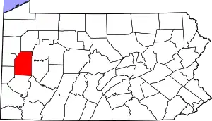 | |
| Boroughs | ||
| Townships | ||
| CDPs | ||
| Unincorporated communities | ||
| Footnotes | ‡This populated place also has portions in an adjacent county or counties | |
| ||