Scott Township, Allegheny County, Pennsylvania
Scott Township is a township in Allegheny County, Pennsylvania, United States. The population was 17,024 at the 2010 census.
Scott Township | |
|---|---|
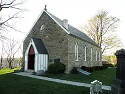
 St. Luke's Episcopal Church | |
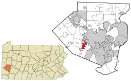
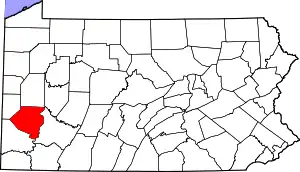
 Location in Allegheny County and state of Pennsylvania | |
| Coordinates: 40°23′29″N 80°4′47″W | |
| Country | United States |
| State | Pennsylvania |
| County | Allegheny |
| Government | |
| • Type | Commissioners |
| • President of Commissioners | David Giudici (D) |
| Area | |
| • Total | 3.91 sq mi (10.12 km2) |
| • Land | 3.91 sq mi (10.12 km2) |
| • Water | 0.00 sq mi (0.00 km2) |
| Population (2010) | |
| • Total | 17,024 |
| • Estimate (2018)[2] | 16,519 |
| • Density | 4,281.47/sq mi (1,652.88/km2) |
| Time zone | UTC-5 (Eastern (EST)) |
| • Summer (DST) | UTC-4 (EDT) |
| ZIP Codes | 15106, 15220, 15243, 15216, 15017 |
| Area code(s) | 412 |
| FIPS code | 42-003-68388 |
| Website | Township website |
Geography
Scott Township is located at 40°23′29″N 80°4′46″W (40.391469, -80.079657).[3]
According to the United States Census Bureau, the township has a total area of 4.0 square miles (10 km2), all of it land.
Surrounding and adjacent communities
Scott Township has nine land borders, including the Pittsburgh neighborhood of East Carnegie and Green Tree to the north, the Pittsburgh neighborhood of Banksville to the northeast, Mt. Lebanon to the east, Upper St. Clair Township to the south, Bridgeville to the southwest, Collier Township and Heidelberg to the west, and Carnegie to the northwest. A short segment of Chartiers Creek separates Scott from Rosslyn Farms to the northwest.
Demographics
| Historical population | |||
|---|---|---|---|
| Census | Pop. | %± | |
| 1870 | 1,807 | — | |
| 1880 | 1,532 | −15.2% | |
| 1890 | 2,651 | 73.0% | |
| 1900 | 3,975 | 49.9% | |
| 1910 | 5,737 | 44.3% | |
| 1920 | 4,927 | −14.1% | |
| 1930 | 6,203 | 25.9% | |
| 1940 | 6,297 | 1.5% | |
| 1950 | 8,686 | 37.9% | |
| 1960 | 19,094 | 119.8% | |
| 1970 | 21,856 | 14.5% | |
| 1980 | 20,413 | −6.6% | |
| 1990 | 17,118 | −16.1% | |
| 2000 | 17,288 | 1.0% | |
| 2010 | 17,024 | −1.5% | |
| 2018 (est.) | 16,519 | [2] | −3.0% |
| Sources:[4][5][6][7][8][9][10] | |||
At the 2000 census there were 17,288 people, 7,835 households, and 4,583 families living in the township. The population density was 4,350.8 people per square mile (1,681.3/km2). There were 8,163 housing units at an average density of 2,054.3/sq mi (793.9/km2). The racial makeup of the township was 91.35% White, 1.15% Black or African American, 0.08% Native American, 6.17% Asian, 0.01% Pacific Islander, 0.23% from other races, and 1.01% from two or more races. Hispanic or Latino of any race were 0.68%.[9]
There were 7,835 households, 22.5% had children under the age of 18 living with them, 48.3% were married couples living together, 7.6% had a female householder with no husband present, and 41.5% were non-families. 36.8% of households were made up of individuals, and 14.7% were one person aged 65 or older. The average household size was 2.14 and the average family size was 2.83.
The age distribution was 18.6% under the age of 18, 5.2% from 18 to 24, 31.6% from 25 to 44, 22.5% from 45 to 64, and 22.1% 65 or older. The median age was 42 years. For every 100 females there were 88.9 males. For every 100 females age 18 and over, there were 84.7 males.
The median household income was $44,434 and the median family income was $54,716. Males had a median income of $42,095 versus $31,499 for females. The per capita income for the township was $24,439. About 4.5% of families and 7.2% of the population were below the poverty line, including 8.1% of those under age 18 and 8.6% of those age 65 or over.
Government and Politics
| Year | Republican | Democratic | Third Parties |
|---|---|---|---|
| 2016 | 45% 3,813 | 53% 4,482 | 2% 89 |
| 2012 | 49% 4,007 | 51% 4,176 | 0% 77 |
Taxes
School tax millage rate- The Chartiers Valley School District (shared with Collier Township, Heidelberg and Bridgeville) in 2017 was 16.61. This ranked 42nd highest/most expensive out of Allegheny County's 45 school districts [between South Allegheny SD (41st highest) and Penn-Trafford SD (43rd highest)].[13] In 2012, it was 19.88.
Earned Income Tax- 1% in 2012. This is one of the lowest rates in the surrounding area. Pittsburgh is currently at 3%. Mt. Lebanon and Upper St. Clair are currently at 1.3%.
Municipality- 5.0000 in 2012
County Taxes- 5.6900 in 2012
Education
Scott Township is served by the Chartiers Valley School District.
Events
Until 2015, the world's largest pinball tournament, Pinburgh, was held in Scott Township at the PAPA facility. In 2015, the tournament was moved to the David L. Lawrence Convention Center in downtown Pittsburgh.[14] The Professional and Amateur Pinball Association (PAPA), still headquartered in Scott Township (Carnegie, PA mailing address), manages Pinburgh, along with the World Pinball Championships.[15]
References
- "2016 U.S. Gazetteer Files". United States Census Bureau. Retrieved Aug 13, 2017.
- Bureau, U. S. Census. "U.S. Census website". United States Census Bureau. US Census Bureau. Retrieved 1 December 2019.
- "US Gazetteer files: 2010, 2000, and 1990". United States Census Bureau. 2011-02-12. Retrieved 2011-04-23.
- "Population of Civil Divisions Less than Counties" (PDF). 1880 United States Census. U.S. Census Bureau. Retrieved 24 November 2013.
- "Population-Pennsylvania" (PDF). U.S. Census 1910. U.S. Census Bureau. Retrieved 22 November 2013.
- "Number and Distribution of Inhabitants:Pennsylvania-Tennessee" (PDF). Fifteenth Census. U.S. Census Bureau.
- "Number of Inhabitants: Pennsylvania" (PDF). 18th Census of the United States. U.S. Census Bureau. Retrieved 22 November 2013.
- "Pennsylvania: Population and Housing Unit Counts" (PDF). U.S. Census Bureau. Retrieved 22 November 2013.
- "U.S. Census website". United States Census Bureau. Retrieved 2008-01-31.
- "Incorporated Places and Minor Civil Divisions Datasets: Subcounty Population Estimates: April 1, 2010 to July 1, 2012". U.S. Census Bureau. Archived from the original on 17 June 2013. Retrieved 25 November 2013.
- EL. "2012 Allegheny County election". Pittsburgh Tribune-Review. Retrieved 15 October 2017.
- EL. "2016 Pennsylvania general election results". Pittsburgh Post-Gazette. Retrieved 15 October 2017.
- EL. "Allegheny County Treasurer". Retrieved 1 September 2017.
- EL. "Pinburgh 2014 wrap up!". Pinball Soul. Retrieved 12 August 2015.
- EL. "PAPA Headquarters and History". PAPA. PAPA. Archived from the original on 12 August 2015. Retrieved 12 August 2015.

