Cootamundra Shire
Cootamundra Shire was a local government area in the Riverina region of New South Wales, Australia. The Shire was located adjacent to the Olympic Highway, the Burley Griffin Way and the Main South railway line. The Shire included the town of Cootamundra and the small towns of Stockinbingal, Brawlin and Wallendbeen and the locality of Frampton. The Shire was created on 1 April 1975 by the amalgamation of Jindalee Shire and the Municipality of Cootamundra.[3]
| Cootamundra Shire New South Wales | |||||||||||||||
|---|---|---|---|---|---|---|---|---|---|---|---|---|---|---|---|
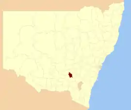 Location in New South Wales | |||||||||||||||
| Coordinates | 34°39′S 148°02′E | ||||||||||||||
| Population | 7,620 (2012)[1] | ||||||||||||||
| • Density | 5.000/km2 (12.950/sq mi) | ||||||||||||||
| Established | 1 April 1975 | ||||||||||||||
| Abolished | 12 May 2016 | ||||||||||||||
| Area | 1,524 km2 (588.4 sq mi) | ||||||||||||||
| Mayor | Jim Slattery | ||||||||||||||
| Council seat | Cootamundra[2] | ||||||||||||||
| Region | South West Slopes | ||||||||||||||
| State electorate(s) | Cootamundra | ||||||||||||||
| Federal Division(s) | Hume | ||||||||||||||
| Website | Cootamundra Shire | ||||||||||||||
| |||||||||||||||
In 2016, it merged with the neighbouring Gundagai Shire to form the Gundagai Council, later renamed to be Cootamundra-Gundagai Regional Council.[4]
Council
Composition and election method
Cootamundra Shire Council was composed of nine councillors elected proportionally to a single ward. All councillors were elected for a fixed four-year term of office. The mayor was elected by the councillors at the first meeting of the Council. The last election was held on 8 September 2012, and the makeup of the Council was as follows:[5]
| Party | Councillors | |
|---|---|---|
| Independents and Unaligned | 9 | |
| Total | 9 | |
The last Council, elected in 2012, was:[5]
| Councillor | Party | Notes | |
|---|---|---|---|
| Doug Phillips | Unaligned | ||
| Craig Stewart | Unaligned | ||
| Dennis Palmer | Unaligned | ||
| Stephen Doidge | Unaligned | ||
| Jim Slattery | Unaligned | Mayor | |
| Paul Braybrooks | Unaligned | ||
| Rosalind Wight | Unaligned | ||
| Mary Donnelly | Independent | ||
| Rod Chalmers | Unaligned | ||
Proposed amalgamation
A 2015 review of local government boundaries recommended that Cootamundra Shire merge with adjoining councils. The NSW Government considered two proposals. The first proposed a merger between the Cootamundra and Gundagai shires to form a new council with an area of 3,981 square kilometres (1,537 sq mi) and support a population of approximately 11,500.[6] The alternative, proposed by Harden Shire on 28 February 2016, was for an amalgamation of the Cootamundra, Gundagai and Harden shires.[7] The outcome of an independent review was announced in May 2016, with the result that Cootamundra merged with Gundagai Shire to form the Gundagai Council.[4]
References
- "3218.0 - Regional Population Growth, Australia, 2012". Australian Bureau of Statistics. 30 August 2013. Retrieved 27 March 2014. Estimated resident population (ERP) at 30 June 2012.
- "Cootamundra Shire". Cootamundra Shire Council. Retrieved 3 April 2015.
- "Local Government Act 1919. Proclamation (40)". Government Gazette of the State of New South Wales. 28 February 1975. p. 690. Retrieved 7 January 2020 – via National Library of Australia.
- "Gundagai Council". New South Wales Government. Archived from the original on 11 June 2016. Retrieved 20 May 2016.
- "Councillors". Cootamundra Shire Council. Retrieved 3 April 2015.
- "Merger proposal: Cootamundra Council, Gundagai Shire Council" (PDF). Government of New South Wales. January 2016. p. 7. Retrieved 10 March 2016.
- Harden Shire Council (28 February 2016). "Fit For Future: Alternate Merger Proposal - Harden Shire Council" (PDF). Government of New South Wales. Retrieved 8 March 2016.