Crews Hill
Crews Hill is an elevated and green-buffered former hamlet of Enfield grown into a small village-size community in the northern outskirts of London centred 12.3 miles (20 km) north of Charing Cross. It forms part of the London Borough of Enfield and economically has many garden centres and plant nurseries. It is the northernmost settlement in the entire county of Greater London. It is in the historic county of Middlesex.
| Crews Hill | |
|---|---|
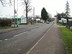 Image of Crews Hill | |
 Crews Hill Location within Greater London | |
| Population | 566 [1][note 1] |
| OS grid reference | TQ315995 |
| London borough | |
| Ceremonial county | Greater London |
| Region | |
| Country | England |
| Sovereign state | United Kingdom |
| Post town | ENFIELD |
| Postcode district | EN2 |
| Dialling code | 020 |
| Police | Metropolitan |
| Fire | London |
| Ambulance | London |
| UK Parliament | |
| London Assembly | |
Etymology
Named from its association with the Crew family, mentioned in local records of the mid-18th century.[2]
Transport
The area has one bus service (route W10). Crews Hill is served by Crews Hill railway station with trains to Hertford North, Stevenage, Hitchin and Letchworth, in the north, and Moorgate, or King's Cross, to the south.
Demography
Crews Hill is part of the large Chase ward, which also covers Botany Bay, Clay Hill and Bulls Cross. The 2011 census showed that 77% of the ward's population was white (64% British, 11% Other, 2% Irish). 5% was Black African and 3% Black Caribbean.[3]
Places of interest
Nearby, there is Crews Hill Golf Course, which dates from 1916. John White, the Tottenham Hotspur and Scotland national football team player, was killed by lightning while sheltering under a tree at the golf course on 21 July 1964.
On Whitewebbs Lane there is the Whitewebbs Museum of Transport.
Further up the road is Whitewebbs Park. This is a country park and includes the Enfield Municipal Golf Course.
Crews Hill originally had a large area of glasshouse production, to serve the nearby London market with cut flowers, pot plants and vegetables. As this became less economic, these sites transformed into a number of garden centres and retail nurseries. Describing the horticultural output of Crews Hill, journalist Ian Jack wrote: "The greenhouses at Crews Hill ('Britain's horticultural mile') used to supply London with flowers and salads. Then came garden centres. Now there are warehouses filled with flowers, chilled at a permanent 7C, the same temperature that has kept them fresh in the six-hour lorry and rail journey through the tunnel from the auctions in Holland."[4]
Turkey Brook flows through Crews Hill.
References
- "Neighbourhood Statistics 2011". Office for National Statistics. 31 January 2013. Retrieved 30 July 2015.
- Mills A. D. Oxford Dictionary of London Place Names (2001) p59 ISBN 0-19-860957-4 Retrieved 30 October 2008
- http://www.ukcensusdata.com/chase-e05000195
- Jack, Ian (16 February 2008). "How roses got caught between the supermarkets and the greens". theguardian.com. Retrieved 28 March 2014.
Note
- Figures shown are for 2011. Please note the population derived from adding Area: E00007030 (Output Area) and Area: E00007032 (Output Area), the latter of which also includes part of Clay Hill
External links
| Wikimedia Commons has media related to Crews Hill. |
- Crews Hill Residents Association
- Crews Hill Golf Club from 1916
- Crews Hill Guide
- Parks around Enfield including Whitewebbs Park
- Whitewebbs Museum of Transport
- Transport in the South East