Upper Edmonton
Upper Edmonton (Postcode N18) is a part of Edmonton, which is located in the south eastern part of the London Borough of Enfield, England. The main shopping area of Upper Edmonton is often referred to as "The Angel" by locals (due to its location, The Angel, Edmonton a former public house that was demolished in 1968 to make improvements to the North Circular Road ) and is situated between Lower Edmonton (N9) and Tottenham (N17).
| Upper Edmonton | |
|---|---|
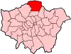
 Upper Edmonton Location within Greater London | |
| Population | 17,374 (2011 Census. Ward)[1] |
| London borough | |
| Ceremonial county | Greater London |
| Region | |
| Country | England |
| Sovereign state | United Kingdom |
| Post town | LONDON |
| Postcode district | N18 |
| Dialling code | 020 |
| Police | Metropolitan |
| Fire | London |
| Ambulance | London |
| UK Parliament | |
| London Assembly | |
Upper Edmonton was once one of the most influential parts of the Borough of Enfield. It is still home to the offices of the area's political parties and provides a range of public services, including the NHS North Middlesex University Hospital.
The area is one of the most multicultural in north London, including Afro-Caribbean, Black African, Albanian, Bangladeshi, Chinese, Greek (from Cyprus and Greece), Portuguese, Pakistani, Somali and Turkish (from Cyprus and Turkey) communities. The houses of worship in Upper Edmonton reflect this diversity: one of the most visited Muslim mosques in the area, the Edmonton Islamic Centre Al-Masjid, as well as churches of varied denominations, such as the Evangelical church, are located there.
Public transportation includes a wide choice of buses serving many locations and British Rail, which has Silver Street and Angel road in the locality.
Deprivation score
Analysis carried out by the Local Government Association indicates that, within Enfield, Upper Edmonton has been calculated to be the 2nd most deprived of the 21 wards in the Borough. In addition, the same analysis estimates that it is within the 10% most deprived wards in both London and England.[2]
Low Income households
Upper Edmonton had the 3rd lowest average (median) household income of the 21 wards in Enfield as estimated by CACI in 2018. Average household income in the ward is below the median level for the borough as a whole. The proportion of households with an income of less than £15,000 was put at 24.2% compared to a Borough average of 16.7%. This was the 3rd highest proportion of the 21 wards.[3]
Benefit Claimaints
At November 2017 the number of people claiming the main working-age DWP benefits was 1,935 – 15.2% of the estimated working age population. This is higher than the Enfield Borough average of 12.8%[4]
Crime
According to data from the Metropolitan Police Service, the crime rate for November 2016 to November 2018 is 281.18 crimes per 1000 population, with the most common offences being related to theft, handling stolen goods, burglary, criminal damage, drugs and robbery. Upper Edmonton has a crime rate 74.87% higher than the overall crime rate for the Borough of Enfield (160.79 crimes per 1000 population for the same time period). During the 12 months to November 2018 compared to the previous 12 months, Upper Edmonton has experienced an 8.48% increase in logged crimes.[5]
Recent trends
In recent years, the area has undergone a huge structural transformation, of which some work is still undergoing, as part of the government's aim to provide the community with a wider range of shops and public facilities. It is the site of regeneration project, Meridian Water.
As in many other parts of the city, a major concern is the level of violent crime, which has steadily increased over the past few years. The effort from local role models to work with government to provide education for local youths is one of the most concentrated methods of trying to overcome this problem.
References
- "Enfield Ward population 2011". Neighbourhood Statistics. Office for National Statistics. Retrieved 21 October 2016.
- "WARD PROFILE: UPPER EDMONTON 2018" (PDF). Enfield Council. Retrieved 4 January 2019.
- "WARD PROFILE: UPPER EDMONTON 2018" (PDF). Enfield Council. Retrieved 4 January 2019.
- "WARD PROFILE: UPPER EDMONTON 2018" (PDF). Enfield Council. Retrieved 4 January 2019.
- "Crime Data Dashboard". Metropolitan Police Service. Retrieved 4 January 2019.