Davison Army Airfield
Davison Army Airfield or Davison AAF (IATA: DAA, ICAO: KDAA, FAA LID: DAA) is a military use airport serving Fort Belvoir, in Fairfax County, Virginia, United States.[2]
| Davison Army Airfield | |||||||
|---|---|---|---|---|---|---|---|
| Part of Fort Belvoir | |||||||
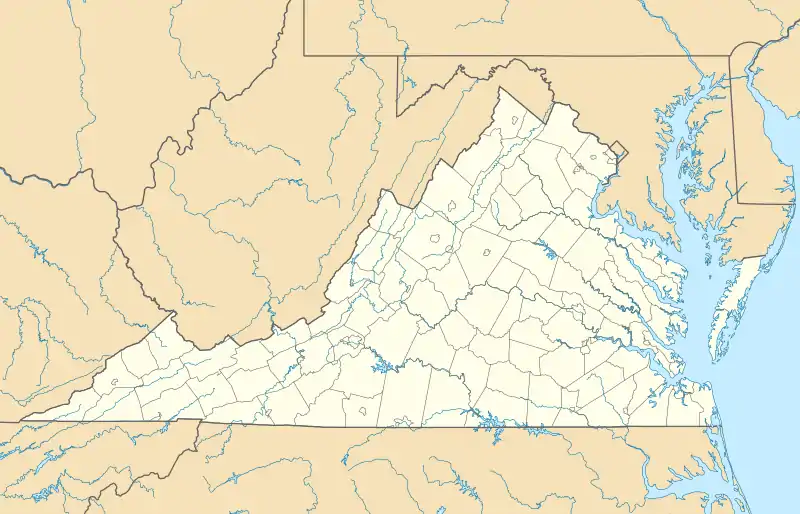
| Fairfax County, Virginia in the United States | |||||||
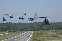 VH-60A Black Hawk and UH-72 Lakota helicopters of the 12th Aviation Battalion lift off from Davison AAF during June 2014 | |||||||
 | |||||||
 Davison  Davison | |||||||
| Coordinates | 38°42′54″N 077°10′52″W | ||||||
| Type | Army Airfield | ||||||
| Site information | |||||||
| Owner | Department of Defense | ||||||
| Operator | US Army | ||||||
| Controlled by | Military District of Washington | ||||||
| Condition | Operational | ||||||
| Website | Official website | ||||||
| Site history | |||||||
| Built | 1952 | ||||||
| In use | 1952 – present | ||||||
| Garrison information | |||||||
| Garrison | The Army Aviation Brigade | ||||||
| Airfield information | |||||||
| Identifiers | ICAO: KDAA, FAA LID: DAA | ||||||
| Elevation | 22.4 metres (73 ft) AMSL | ||||||
| |||||||
| |||||||
| Source: Federal Aviation Administration[1] | |||||||
The airfield is located 15 miles (24 km) southwest of Washington, D.C. It was named for noted World War II aviation engineer Brig. Gen. Donald Angus Davison.[3]
The airfield provided support for Army One from 1957 to 1976 for presidents Dwight Eisenhower, John F. Kennedy, Lyndon Johnson, Richard Nixon, and Gerald Ford. Its role of support for the presidential helicopter ended in 1976 when responsibility for the helicopter was transferred entirely to the United States Marine Corps.[3] The 12th Aviation Battalion (part of The Army Aviation Brigade, TAAB) now operates Davison AAF and the Pentagon helicopter pad.. The battalions 18 UH-60 Blackhawks including 4 VH-60 models ("Gold Tops") is responsible for priority regional transport for US Army and Pentagon senior leadership.[4]
The Civil Air Patrol National Capitol Wing uses a small tower for use during exercises and flights, and bases their 4 Cessna 172 and 182's there.
Facilities
Davison AAF has one runway designated 14/32 with an asphalt surface measuring 5,618 by 74 feet (1,712 by 23 m).[2]
References
- "Airport Data – (DAA) Davison AAF". Federal Aviation Administration. 31 December 2020. Retrieved 11 January 2021.
- FAA Airport Form 5010 for DAA PDF, effective 2009-07-02.
- Davison Army Airfield at GlobalSecurity.org
- "The Army Aviation Brigade".
External links
- Aerial photo as of 10 April 2002 from USGS The National Map
- FAA Terminal Procedures for DAA, effective December 31, 2020
- Resources for this U.S. military airport:
- FAA airport information for DAA
- AirNav airport information for KDAA
- ASN accident history for DAA
- NOAA/NWS latest weather observations
- SkyVector aeronautical chart for KDAA