Dedoplistsqaro Municipality
Dedoplistskaro or Dedoplistsqaro (Georgian: დედოფლისწყაროს მუნიციპალიტეტი, Queen's spring") is a municipality of Georgia, in the region of Kakheti. Its main town is Dedoplistsqaro.
Dedoplistsqaro Municipality | |
|---|---|
 | |
 Flag  Seal | |
 Location of the municipality within Georgia | |
| Country | |
| Region | Kakheti |
| Capital | Dedoplistsqaro |
| Government | |
| • Body | Municipal Assembly |
| • Mayor | Nikoloz Janiashvili [1] |
| Area | |
| • Total | 2,529 km2 (976 sq mi) |
| Population (2014) | |
| • Total | 21 221 |
| • Density | 8.4/km2 (22/sq mi) |
| Population by ethnicity[2] | |
| • Georgians | 91.5 % |
| • Armenians | 4.3 % |
| • Russians | 1.8 % |
| • Azerbaijanis | 1.4 % |
| • Greeks | 0.3 % |
| Time zone | UTC+4 (Georgian Standard Time) |
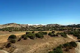
Dedoplistskaro municipality is bordered on the west and north to Signagi Municipality, to the east and south To Azerbaijan. Dedoplistskaro municipality is the largest administrative unit of Kakheti. The area of the municipality is 2531 km2. A large part of the territory of Dedoplistskaro municipality is occupied by the Iori plateau, the Iori plateau goes to the extreme south-eastern part of the Eldri plain. The administrative center of Dedoplistskaro Municipality is the town of Dedoplistskaro, located on the Shirak plain, at an altitude of 800 m above sea level. As of 2014, the population of Dedoplistskaro is 21,221 people, of which 5,940 live in the city of Dedoplistskaro and 15,281 in rural areas.
History
From ancient times the territory of present-day Dedoplistskaro municipality was part of the historical province of Georgia "Kambechovani". it was sometimes part of Kakheti and sometimes of Hereti. The main city of Kambechovan was Khornabuji, which was first mentioned in the sources in 5th century AD. At the beginning of the twentieth century, Dedoplistskaro, as an administrative-territorial unit, was part of Sighnaghi Mazra.
The name "Dedoplistskaro" has been known in historical sources since the 11th century, when King David the Builder established a military post here. According to the legend, the origin of "Dedoplistskaro" is connected with the name of Queen Tamar. According to this legend, Queen Tamar visited Kambechovan with David Soslan and lived in Khornabuji for two weeks. At the top of the mountain there was spring waters. In the same year, the water was brought through clay pipes near the Khornabuji fortress and was renamed “Dedoplistskaro” (Queen’s water), and later the name was extended to a village built there. In 1803, Russian troops established a military base on the site. They changed the name to “Tsarsky Kolodtsi”. Later, the Soviet authorities renamed the place Tsiteltskaro (red water). In 1991, the city and the entire district were restored to its historic name.
See also
References
External links
- Districts of Georgia, Statoids.com