Lanchkhuti Municipality
Lanchkhuti (Georgian: ლანჩხუთის მუნიციპალიტეტი, Lančxutis municip’alit’et’i) is a district of Georgia, in the region of Guria. Its main town is Lanchkhuti.
Lanchkhuti Municipality | |
|---|---|
 Oqona monastery | |
 Flag  Seal | |
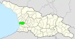 Location of the municipality within Georgia | |
| Country | |
| Region | Guria |
| Capital | Lanchkhuti |
| Government | |
| • Mayor | Alexander Sarishvili [1] |
| Area | |
| • Total | 533 km2 (206 sq mi) |
| Population (2002) | |
| • Total | 31,486 |
| Time zone | UTC+4 (Georgian Standard Time) |
| Website | lanchkhuti |
Lanchkhuti municipality is located in western Georgia, northwest of the Guria Mountains, bordered on the west by an 18 km (11 mi) Black Sea coast. The municipality occupies 15,000 hectares (37,000 acres) of the Kolkheti National Park, the purpose of which is to protect the flora and fauna in the Kolkheti lowlands, as well as to preserve nature intact. The villages of the mountainous zone are located 400 to 500 m (1,300 to 1,600 ft). At altitude above sea level, the villages of the lowland zone are mainly bordered by Kolkheti National Park. Most of the municipality is a subtropical zone.
Lanchkhuti is 300 km (190 mi) away from Tbilisi, 85 km (53 mi) away from Batumi, 42 km (26 mi) away from Poti. There are two lakes in the municipality and five rivers with a total length of 75 km (47 mi), the municipality is known for many minerals, including: limestone deposits, clay clay, peat, Shukhuti rock-rich ore deposit, Supsa sand-gravel deposit. The total land fund of the municipality as of January 1, 2006 is 49860.9 ha, the largest part of which - 76% - is still owned by the state.[2]
Gallery
 Nadarbazevi lake
 Aketis Matskhovari
 Sameba Jikheti monastery church
 Church in upper Aketi
 Museum of Egnate Ninoshvili
See also
- Districts of Georgia (country)
External links
- Districts of Georgia, Statoids.com