Dent, Minnesota
Dent is a city in Otter Tail County, Minnesota, United States. The population was 192 at the 2010 census.[5]
Dent | |
|---|---|
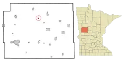 Location of Dent, Minnesota | |
| Coordinates: 46°33′16″N 95°43′6″W | |
| Country | United States |
| State | Minnesota |
| County | Otter Tail |
| Area | |
| • Total | 0.37 sq mi (0.97 km2) |
| • Land | 0.37 sq mi (0.96 km2) |
| • Water | 0.00 sq mi (0.01 km2) |
| Elevation | 1,375 ft (419 m) |
| Population | |
| • Total | 192 |
| • Estimate (2019)[3] | 186 |
| • Density | 502.70/sq mi (193.94/km2) |
| Time zone | UTC-6 (Central (CST)) |
| • Summer (DST) | UTC-5 (CDT) |
| ZIP code | 56528 |
| Area code(s) | 218 |
| FIPS code | 27-15724 |
| GNIS feature ID | 0642771[4] |
History
A post office called Dent has been in operation since 1900.[6] Dent was platted in 1903, and was incorporated on September 6, 1904.[7] The origin of the name "Dent" is obscure,[8] although some say the name came from Henry Dent, who was a railroad official.
Geography
According to the United States Census Bureau, the city has a total area of 0.38 square miles (0.98 km2), all land.[9]
The topography of the area is mainly flat, with several ponds and lakes surrounding the outskirts of the downtown. Minnesota State Highway 108 serves as a main route in the community.
Demographics
| Historical population | |||
|---|---|---|---|
| Census | Pop. | %± | |
| 1910 | 244 | — | |
| 1920 | 221 | −9.4% | |
| 1930 | 224 | 1.4% | |
| 1940 | 204 | −8.9% | |
| 1950 | 187 | −8.3% | |
| 1960 | 176 | −5.9% | |
| 1970 | 156 | −11.4% | |
| 1980 | 167 | 7.1% | |
| 1990 | 177 | 6.0% | |
| 2000 | 192 | 8.5% | |
| 2010 | 192 | 0.0% | |
| 2019 (est.) | 186 | [3] | −3.1% |
| U.S. Decennial Census[10] 2013 Estimate[11] | |||
2010 census
As of the census[2] of 2010, there were 192 people, 78 households, and 53 families living in the city. The population density was 505.3 inhabitants per square mile (195.1/km2). There were 88 housing units at an average density of 231.6 per square mile (89.4/km2). The racial makeup of the city was 95.3% White, 1.0% Native American, and 3.6% from two or more races. Hispanic or Latino of any race were 1.0% of the population.
There were 78 households, out of which 29.5% had children under the age of 18 living with them, 52.6% were married couples living together, 10.3% had a female householder with no husband present, 5.1% had a male householder with no wife present, and 32.1% were non-families. 26.9% of all households were made up of individuals, and 7.6% had someone living alone who was 65 years of age or older. The average household size was 2.46 and the average family size was 2.92.
The median age in the city was 38.3 years. 25.5% of residents were under the age of 18; 8.3% were between the ages of 18 and 24; 22.4% were from 25 to 44; 29.2% were from 45 to 64; and 14.6% were 65 years of age or older. The gender makeup of the city was 45.8% male and 54.2% female.
2000 census
As of the 2000 census, there were 194 people, 77 households, and 49 families living in the city. The population density was 501.0 people per square mile (195.1/km2). There were 80 housing units at an average density of 208.7 per square mile (81.3/km2). The racial makeup of the city was 100.00% White.
There were 77 households, out of which 33.8% had children under the age of 18 living with them, 57.1% were married couples living together, 3.9% had a female householder with no husband present, and 35.1% were non-families. 32.5% of all households were made up of individuals, and 14.3% had someone living alone who was 65 years of age or older. The average household size was 2.49 and the average family size was 3.18.
In the city, the population was spread out, with 28.6% under the age of 18, 5.7% from 18 to 24, 30.2% from 25 to 44, 20.3% from 45 to 64, and 15.1% who were 65 years of age or older. The median age was 37 years. For every 100 females, there were 93.9 males. For every 100 females age 18 and over, there were 104.5 males.
The median income for a household in the city was $30,938, and the median income for a family was $34,167. Males had a median income of $27,321 versus $15,417 for females. The per capita income for the city was $12,024. About 3.7% of families and 12.9% of the population were below the poverty line, including 14.1% of those under the age of eighteen and 20.7% of those 65 or over.
References
- "2019 U.S. Gazetteer Files". United States Census Bureau. Retrieved July 26, 2020.
- "U.S. Census website". United States Census Bureau. Retrieved 2012-11-13.
- "Population and Housing Unit Estimates". United States Census Bureau. May 24, 2020. Retrieved May 27, 2020.
- "US Board on Geographic Names". United States Geological Survey. 2007-10-25. Retrieved 2008-01-31.
- "2010 Census Redistricting Data (Public Law 94-171) Summary File". American FactFinder. U.S. Census Bureau, 2010 Census. Retrieved 23 April 2011.
- "Otter Tail County". Jim Forte Postal History. Archived from the original on 2 March 2016. Retrieved 28 July 2015.
- Upham, Warren (1920). Minnesota Geographic Names: Their Origin and Historic Significance. Minnesota Historical Society. p. 393.
- Moyer, Armond; Moyer, Winifred (1958). The origins of unusual place-names. Keystone Pub. Associates. p. 141.
- "US Gazetteer files 2010". United States Census Bureau. Archived from the original on 2012-01-25. Retrieved 2012-11-13.
- United States Census Bureau. "Census of Population and Housing". Retrieved September 10, 2013.
- "Annual Estimates of the Resident Population: April 1, 2010 to July 1, 2013". Archived from the original on May 22, 2014. Retrieved June 9, 2014.
Municipalities and communities of Otter Tail County, Minnesota, United States | ||
|---|---|---|
| Cities | 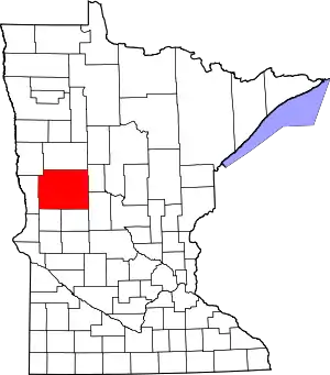 Map of Minnesota highlighting Otter Tail County | |
| Townships |
| |
| Unincorporated communities | ||
| Indian reservation | ||
| Ghost towns | ||
| Footnotes | ‡This populated place also has portions in an adjacent county or counties | |
| ||