Erhard, Minnesota
Erhard is a city in Otter Tail County, Minnesota, United States. The population was 148 at the 2010 census.[5]
Erhard | |
|---|---|
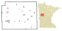 Location of Erhard, Minnesota | |
| Coordinates: 46°29′6″N 96°5′51″W | |
| Country | United States |
| State | Minnesota |
| County | Otter Tail |
| Area | |
| • Total | 0.57 sq mi (1.48 km2) |
| • Land | 0.55 sq mi (1.44 km2) |
| • Water | 0.01 sq mi (0.04 km2) |
| Elevation | 1,283 ft (391 m) |
| Population | |
| • Total | 148 |
| • Estimate (2019)[3] | 146 |
| • Density | 263.54/sq mi (101.72/km2) |
| Time zone | UTC-6 (Central (CST)) |
| • Summer (DST) | UTC-5 (CDT) |
| ZIP code | 56534 |
| Area code(s) | 218 |
| FIPS code | 27-19556 |
| GNIS feature ID | 0643391[4] |
| Website | https://www.co.otter-tail.mn.us/366/Erhard |
Geography
According to the United States Census Bureau, the city has a total area of 0.56 square miles (1.45 km2), of which 0.54 square miles (1.40 km2) is land and 0.02 square miles (0.05 km2) is water.[7]
Demographics
| Historical population | |||
|---|---|---|---|
| Census | Pop. | %± | |
| 1950 | 145 | — | |
| 1960 | 150 | 3.4% | |
| 1970 | 148 | −1.3% | |
| 1980 | 194 | 31.1% | |
| 1990 | 181 | −6.7% | |
| 2000 | 150 | −17.1% | |
| 2010 | 148 | −1.3% | |
| 2019 (est.) | 146 | [3] | −1.4% |
| U.S. Decennial Census[8] 2013 Estimate[9] | |||
2010 census
As of the census[2] of 2010, there were 148 people, 65 households, and 43 families living in the city. The population density was 274.1 inhabitants per square mile (105.8/km2). There were 70 housing units at an average density of 129.6 per square mile (50.0/km2). The racial makeup of the city was 98.0% White and 2.0% Native American.
There were 65 households, of which 24.6% had children under the age of 18 living with them, 52.3% were married couples living together, 12.3% had a female householder with no husband present, 1.5% had a male householder with no wife present, and 33.8% were non-families. 29.2% of all households were made up of individuals, and 12.3% had someone living alone who was 65 years of age or older. The average household size was 2.28 and the average family size was 2.67.
The median age in the city was 48 years. 23.6% of residents were under the age of 18; 6.2% were between the ages of 18 and 24; 15.6% were from 25 to 44; 35.1% were from 45 to 64; and 19.6% were 65 years of age or older. The gender makeup of the city was 48.6% male and 51.4% female.
2000 census
As of the census of 2000, there were 150 people, 71 households, and 39 families living in the city. The population density was 276.4 people per square mile (107.3/km2). There were 73 housing units at an average density of 134.5 per square mile (52.2/km2). The racial makeup of the city was 98.00% White and 2.00% Native American.
There were 71 households, out of which 19.7% had children under the age of 18 living with them, 49.3% were married couples living together, 4.2% had a female householder with no husband present, and 43.7% were non-families. 38.0% of all households were made up of individuals, and 11.3% had someone living alone who was 65 years of age or older. The average household size was 2.11 and the average family size was 2.78.
In the city, the population was spread out, with 18.0% under the age of 18, 4.7% from 18 to 24, 27.3% from 25 to 44, 34.0% from 45 to 64, and 16.0% who were 65 years of age or older. The median age was 44 years. For every 100 females, there were 100.0 males. For every 100 females age 18 and over, there were 105.0 males.
The median income for a household in the city was $35,417, and the median income for a family was $37,250. Males had a median income of $20,000 versus $20,750 for females. The per capita income for the city was $16,189. There were 7.0% of families and 11.5% of the population living below the poverty line, including 23.8% of under eighteens and 12.5% of those over 64.
References
- "2019 U.S. Gazetteer Files". United States Census Bureau. Retrieved July 26, 2020.
- "U.S. Census website". United States Census Bureau. Retrieved 2012-11-13.
- "Population and Housing Unit Estimates". United States Census Bureau. May 24, 2020. Retrieved May 27, 2020.
- "US Board on Geographic Names". United States Geological Survey. 2007-10-25. Retrieved 2008-01-31.
- "2010 Census Redistricting Data (Public Law 94-171) Summary File". American FactFinder. U.S. Census Bureau, 2010 Census. Retrieved 23 April 2011.
- Upham, Warren (1920). Minnesota Geographic Names: Their Origin and Historic Significance. Minnesota Historical Society. p. 394.
- "US Gazetteer files 2010". United States Census Bureau. Archived from the original on 2012-01-25. Retrieved 2012-11-13.
- United States Census Bureau. "Census of Population and Housing". Retrieved February 12, 2014.
- "Annual Estimates of the Resident Population: April 1, 2010 to July 1, 2013". Archived from the original on May 22, 2014. Retrieved June 9, 2014.
Municipalities and communities of Otter Tail County, Minnesota, United States | ||
|---|---|---|
| Cities | 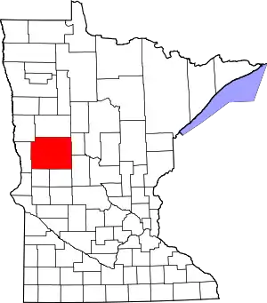 Map of Minnesota highlighting Otter Tail County | |
| Townships |
| |
| Unincorporated communities | ||
| Indian reservation | ||
| Ghost towns | ||
| Footnotes | ‡This populated place also has portions in an adjacent county or counties | |
| ||