Durgapur railway station
Durgapur is a model railway station on the Bardhaman–Asansol section. It is located in Paschim Bardhaman district in the Indian state of West Bengal. It serves Durgapur, the third most populous city in West Bengal, and the surrounding industrial areas.[6] It was ranked the third-cleanest railway station in India in 2019.
Durgapur railway station | |
|---|---|
| Indian Railways station | |
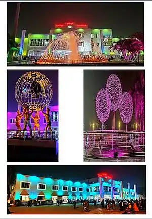 Durgapur railway station | |
| Location | Durgapur, Bardhaman, West Bengal India |
| Coordinates | 23°29′43″N 87°19′03″E |
| Elevation | 71 metres (233 ft) |
| Owned by | Indian Railways |
| Operated by | Eastern Railway |
| Line(s) | Bardhaman–Asansol section Howrah–Delhi main line Howrah–Gaya–Delhi line Howrah–Allahabad–Mumbai line |
| Platforms | 5 |
| Bus stands | Durgapur Station Bus Stand |
| Construction | |
| Structure type | Standard (on ground station) |
| Parking | Yes |
| Bicycle facilities | Yes |
| Other information | |
| Status | Functioning |
| Station code | DGR |
| Division(s) | Asansol |
| History | |
| Opened | 1855 |
| Rebuilt | 2010(expanded),2019(renovated) |
| Electrified | 1965–66 |
| Previous names | East Indian Railway Company |
| Location | |
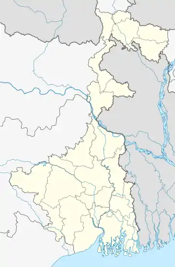 Durgapur railway station Location in West Bengal  Durgapur railway station Location in India | |
Bardhaman–Asansol section | ||||||||||||||||||||||||||||||||||||||||||||||||||||||||||||||||||||||||||||||||||||||||||||||||||||||||||||||||||||||||||||||||||||||||||||||||||||||||||||||||||||||||||||||||||||||||||||||||||||||||||||||||||||||||||||||||||||||||||||||||||||||||||||||||||||||||||||||||||||||||||||||||||||||||||||||||||||||||||||||||||||||||||||||||||||||||||||||||||||||||||||||||||||||||||||||||||||||||||
|---|---|---|---|---|---|---|---|---|---|---|---|---|---|---|---|---|---|---|---|---|---|---|---|---|---|---|---|---|---|---|---|---|---|---|---|---|---|---|---|---|---|---|---|---|---|---|---|---|---|---|---|---|---|---|---|---|---|---|---|---|---|---|---|---|---|---|---|---|---|---|---|---|---|---|---|---|---|---|---|---|---|---|---|---|---|---|---|---|---|---|---|---|---|---|---|---|---|---|---|---|---|---|---|---|---|---|---|---|---|---|---|---|---|---|---|---|---|---|---|---|---|---|---|---|---|---|---|---|---|---|---|---|---|---|---|---|---|---|---|---|---|---|---|---|---|---|---|---|---|---|---|---|---|---|---|---|---|---|---|---|---|---|---|---|---|---|---|---|---|---|---|---|---|---|---|---|---|---|---|---|---|---|---|---|---|---|---|---|---|---|---|---|---|---|---|---|---|---|---|---|---|---|---|---|---|---|---|---|---|---|---|---|---|---|---|---|---|---|---|---|---|---|---|---|---|---|---|---|---|---|---|---|---|---|---|---|---|---|---|---|---|---|---|---|---|---|---|---|---|---|---|---|---|---|---|---|---|---|---|---|---|---|---|---|---|---|---|---|---|---|---|---|---|---|---|---|---|---|---|---|---|---|---|---|---|---|---|---|---|---|---|---|---|---|---|---|---|---|---|---|---|---|---|---|---|---|---|---|---|---|---|---|---|---|---|---|---|---|---|---|---|---|---|---|---|---|---|---|---|---|---|---|---|---|---|---|---|---|---|---|---|---|---|---|---|---|---|---|---|---|---|---|---|---|---|---|---|---|---|---|---|---|---|---|---|---|---|---|---|---|---|---|---|---|---|---|---|---|---|---|---|---|---|---|---|---|---|---|---|---|---|---|---|---|
| ||||||||||||||||||||||||||||||||||||||||||||||||||||||||||||||||||||||||||||||||||||||||||||||||||||||||||||||||||||||||||||||||||||||||||||||||||||||||||||||||||||||||||||||||||||||||||||||||||||||||||||||||||||||||||||||||||||||||||||||||||||||||||||||||||||||||||||||||||||||||||||||||||||||||||||||||||||||||||||||||||||||||||||||||||||||||||||||||||||||||||||||||||||||||||||||||||||||||||
| Sources: | ||||||||||||||||||||||||||||||||||||||||||||||||||||||||||||||||||||||||||||||||||||||||||||||||||||||||||||||||||||||||||||||||||||||||||||||||||||||||||||||||||||||||||||||||||||||||||||||||||||||||||||||||||||||||||||||||||||||||||||||||||||||||||||||||||||||||||||||||||||||||||||||||||||||||||||||||||||||||||||||||||||||||||||||||||||||||||||||||||||||||||||||||||||||||||||||||||||||||||
Overview
Mining-Industry Zone
"The entire belt between Durgapur (171 km [via Main Line] and 158 km [via Chord Line] from Howrah), and all the way up to Dhanbad and beyond is industrialized. Apart from factories, there are many coalmines, some closed now, and some with fires burning deep in the mineshafts. The mining area extends for a large area, mostly to the south of the tracks. Quite a portion of the track passes through cuttings, where the surrounding area is higher than the track level, resulting in the profusion of characteristic small masonry bridges crossing the tracks." This description is from "Gomoh loco shed and CLW trip record" by Samit Roychoudhury.[7]
History
The first passenger train in eastern India run from Howrah to Hooghly on 15 August 1854. The track was extended to Raniganj by 1855.[8]
Electrification
The Mankar–Waria sector was electrified in 1965–66.[9]
Gallery
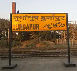 Durgapur railway station nameplate
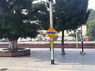 Durgapur station platform
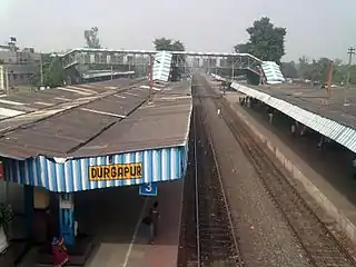 Durgapur railway station, Durgapur, WB
References
- "Bardhaman-Asansol MEMU 63505". India Rail Info.
- "Asansol Division System Map". Eastern Railway. Archived from the original on 26 April 2016.
- "South Eastern Railway Pink Book 2017-18" (PDF). Indian Railways Pink Book.
- "Asansol Division Railway Map". Eastern Railway.
- "Adra Division Railway Map". South Eastern Railway.
- "Urban Agglomerations/Cities having population 1 lakh and above" (PDF). Provisional Population Totals, Census of India 2011. Retrieved 16 April 2013.
- "Gomoh loco shed and CLW trip record". Indian Railway Reports. IRFCA. Missing or empty
|url=(help) - "IR History Part I 1832–1869". IRFCA. Retrieved 13 April 2013.
- "History of Electrification". IRFCA. Retrieved 16 April 2013.
External links
- Trains at Durgapur
 Durgapur travel guide from Wikivoyage
| Preceding station | Indian Railways | Following station | ||
|---|---|---|---|---|
Rajbandh | Eastern Railway zone | Waria |