Edwards, Colorado
Edwards is an unincorporated town, a post office, and a census-designated place (CDP) located in and governed by Eagle County, Colorado, United States. Edwards is the principal town of the Edwards, CO Micropolitan Statistical Area. The Edwards post office has the ZIP Code 81632.[3] At the United States Census 2010, the population of the Edwards CDP was 10,266, while the population of the 81632 ZIP Code Tabulation Area was 10,267.[4] The Edwards Metropolitan District provides services.
Edwards, Colorado | |
|---|---|
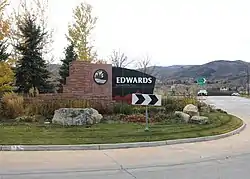 Roundabout in Edwards near Interstate 70. | |
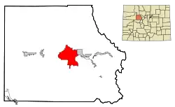 Location of the Edwards CDP in Eagle County, Colorado. | |
 Edwards Location of the Edwards CDP in the United States. | |
| Coordinates: 39°37′17″N 106°37′06″W | |
| Country | |
| State | |
| County | Eagle County |
| Government | |
| • Type | unincorporated town |
| Area | |
| • Total | 26.789 sq mi (69.382 km2) |
| • Land | 26.636 sq mi (68.988 km2) |
| • Water | 0.152 sq mi (0.394 km2) |
| Elevation | 7,552 ft (2,302 m) |
| Population (2010) | |
| • Total | 10,266 |
| • Density | 385/sq mi (149/km2) |
| Time zone | UTC-7 (MST) |
| • Summer (DST) | UTC-6 (MDT) |
| ZIP Code[3] | 81632 |
| Area code(s) | 970 |
| GNIS feature[1] | Edwards CDP |
History
The Edwards Post Office has been in operation since 1883.[5] The community was named after Melvin Edwards, a local postal official.[6]
Geography
Edwards is in the valley of the Eagle River and extends southwards up the valleys of Lake Creek and Squaw Creek, at the north end of the Sawatch Range. It is bordered to the west by the town of Avon. U.S. Route 6 runs through the center of Edwards on the south side of the Eagle River, while Interstate 70 runs through the CDP north of the river, with access from Exit 163. Via I-70, it is 14 miles (23 km) east to Vail, 110 miles (180 km) east to Denver, 17 miles (27 km) west to Eagle, and 47 miles (76 km) west to Glenwood Springs.
The Edwards CDP has an area of 17,145 acres (69.382 km2), including 97 acres (0.394 km2) of water.[2]
Demographics
The United States Census Bureau initially defined the Edwards CDP for the United States Census 2000.
| Year | Pop. | ±% |
|---|---|---|
| 2000 | 8,257 | — |
| 2010 | 10,266 | +24.3% |
| 2020 | — | |
| Source: United States Census Bureau | ||
Ski resorts
Edwards is in a favorable location for skiers and riders. Beaver Creek Resort is 4 miles (6 km) to the east while Vail is 14.5 miles (23.3 km) to the east.
See also
- Outline of Colorado
- State of Colorado
- Colorado cities and towns
- Colorado counties
- Colorado metropolitan areas
References
- "U.S. Board on Geographic Names: Domestic Names". United States Geological Survey. Retrieved December 21, 2020.
- "State of Colorado Census Designated Places - BAS20 - Data as of January 1, 2020". United States Census Bureau. Retrieved December 21, 2020.
- "Look Up a ZIP Code". United States Postal Service. Retrieved December 21, 2020.
- "2010: DEC Summary File 1". United States Census Bureau. Retrieved December 21, 2020.
- "Post offices". Jim Forte Postal History. Archived from the original on 6 March 2016. Retrieved 25 June 2016.
- Dawson, John Frank. Place names in Colorado: why 700 communities were so named, 150 of Spanish or Indian origin. Denver, CO: The J. Frank Dawson Publishing Co. p. 19.
External links
- Edwards @ Colorado.com
- Edwards @ UncoverColorado.com
- Edwards Metropolitan District website
- Eagle County website
Municipalities and communities of Eagle County, Colorado, United States | ||
|---|---|---|
| Towns | 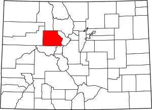 Map of Colorado highlighting Eagle County | |
| CDPs | ||
| Unincorporated communities |
| |
| Ghost towns | ||
| Footnotes | ‡This populated place also has portions in an adjacent county or counties | |
| ||