El Jebel, Colorado
El Jebel is an unincorporated community and a census-designated place (CDP) located in and governed by Eagle County, Colorado, United States. The CDP is a part of the Edwards, CO Micropolitan Statistical Area. The population of the El Jebel CDP was 3,801 at the United States Census 2010.[4] The Carbondale Post Office (ZIP Code 81623) serves El Jebel postal addresses.[3]
El Jebel, Colorado | |
|---|---|
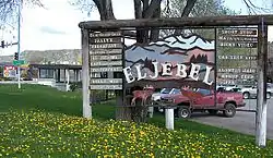 El Jebel sign. | |
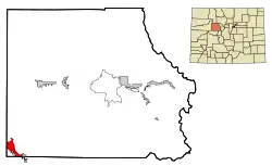 Location of the El Jebel CDP in Eagle County, Colorado. | |
 El Jebel Location of the El Jebel CDP in the United States. | |
| Coordinates: 39°24′18″N 107°05′31″W[1] | |
| Country | |
| State | |
| County | Eagle County |
| Government | |
| • Type | unincorporated community |
| Area | |
| • Total | 5.359 sq mi (13.880 km2) |
| • Land | 5.305 sq mi (13.739 km2) |
| • Water | 0.054 sq mi (0.141 km2) |
| Elevation | 6,617 ft (2,017 m) |
| Population (2010) | |
| • Total | 3,801 |
| • Density | 716/sq mi (277/km2) |
| Time zone | UTC-7 (MST) |
| • Summer (DST) | UTC-6 (MDT) |
| ZIP Code[3] | 81623 |
| Area code(s) | 970 |
| GNIS feature[2] | El Jebel CDP |
History
El Jebel grew rapidly in the last two decades of the 20th century with the population increase in the valley downstream from Aspen. It consists largely of a group of commercial establishments just off State Highway 82, approximately 3 miles (5 km) northwest of Basalt, as well as several housing subdivisions nearby.
"El Jebel" means "the mountain" in Arabic.
Geography
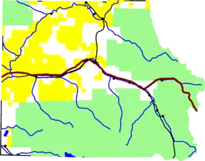 El Jebel is in the south-western corner of Eagle County, on State Highway 82. |
El Jebel is located in the Roaring Fork Valley, between Carbondale and Basalt, along the north side of State Highway 82.
The El Jebel CDP has an area of 3,430 acres (13.880 km2), including 35 acres (0.141 km2) of water.[1]
Climate
This climate type is dominated by the winter season, a long, bitterly cold period with short, clear days, relatively little precipitation mostly in the form of snow, and low humidity. According to the Köppen Climate Classification system, El Jebel has a subarctic climate, abbreviated "Dfc" on climate maps.[5]
| Climate data for El Jebel, Colorado | |||||||||||||
|---|---|---|---|---|---|---|---|---|---|---|---|---|---|
| Month | Jan | Feb | Mar | Apr | May | Jun | Jul | Aug | Sep | Oct | Nov | Dec | Year |
| Average high °C (°F) | 1 (33) |
4 (39) |
9 (48) |
14 (58) |
21 (69) |
26 (78) |
30 (86) |
28 (83) |
24 (75) |
17 (63) |
8 (47) |
1 (34) |
16 (60) |
| Average low °C (°F) | −9 (15) |
−7 (20) |
−3 (27) |
2 (35) |
6 (43) |
10 (50) |
14 (58) |
13 (56) |
9 (48) |
3 (38) |
−3 (27) |
−8 (18) |
2 (36) |
| Average precipitation mm (inches) | 43 (1.7) |
38 (1.5) |
43 (1.7) |
53 (2.1) |
43 (1.7) |
30 (1.2) |
30 (1.2) |
43 (1.7) |
43 (1.7) |
46 (1.8) |
41 (1.6) |
41 (1.6) |
500 (19.5) |
| Source: Weatherbase [6] | |||||||||||||
Demographics
The United States Census Bureau initially defined the El Jebel CDP for the 1990 United States Census.
| Year | Pop. | ±% |
|---|---|---|
| 1990 | 2,605 | — |
| 2000 | 4,488 | +72.3% |
| 2010 | 3,801 | −15.3% |
| 2020 | — | |
| Source: United States Census Bureau | ||
See also
- Outline of Colorado
- State of Colorado
- Colorado cities and towns
- Colorado counties
- Colorado metropolitan areas
References
- "State of Colorado Census Designated Places - BAS20 - Data as of January 1, 2020". United States Census Bureau. Retrieved December 21, 2020.
- "U.S. Board on Geographic Names: Domestic Names". United States Geological Survey. Retrieved December 21, 2020.
- "Look Up a ZIP Code". United States Postal Service. Retrieved December 21, 2020.
- "2010: DEC Summary File 1". United States Census Bureau. Retrieved December 21, 2020.
- Climate Summary for El Jebel, Colorado
- "Weatherbase.com". Weatherbase. 2013. Retrieved on October 2, 2013.
External links
| Major cities |  | |
|---|---|---|
| Other communities | ||
| Near valley | ||
| Ski resorts | ||
| Bodies of water | ||
Municipalities and communities of Eagle County, Colorado, United States | ||
|---|---|---|
| Towns | 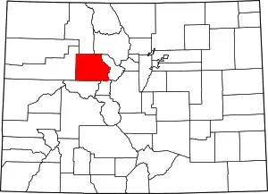 Map of Colorado highlighting Eagle County | |
| CDPs | ||
| Unincorporated communities |
| |
| Ghost towns | ||
| Footnotes | ‡This populated place also has portions in an adjacent county or counties | |
| ||