Avon, Colorado
The Town of Avon is a Home Rule Municipality in Eagle County, Colorado, United States. The town population was 6,447 at the 2010 United States Census. Avon is the gateway to the Beaver Creek Resort which lies about two miles (3 km) south of the town. It was the previous site of Vail Resorts before the company moved its physical headquarters to Broomfield, CO. in 2006. The town also is the home of Liberty Skis, an independent ski manufacturing company.
Avon, Colorado | |
|---|---|
Home Rule Municipality[1] | |
| Town of Avon[1] | |
 Nottingham Lake in Avon. | |
| Nickname(s): The home of Bob the Bridge. | |
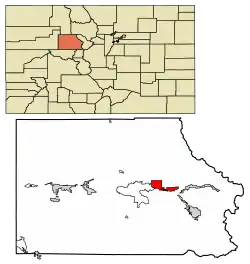 Location of the Town of Avon in Eagle County, Colorado. | |
 Avon Location of the Town of Avon in the United States. | |
| Coordinates: 39°38′30″N 106°30′57″W[2] | |
| Country | |
| State | |
| County | Eagle County[3] |
| Town | Avon[1] |
| Incorporated (town) | August, 1978[4] |
| Government | |
| • Type | Home Rule Municipality[1] |
| • Mayor | Jennie Fancher |
| Area | |
| • Total | 21.82 km2 (8.42 sq mi) |
| • Land | 21.62 km2 (8.35 sq mi) |
| • Water | 0.19 km2 (0.07 sq mi) |
| Elevation | 2,265 m (7,431 ft) |
| Population (2010) | |
| • Total | 6,447 |
| • Estimate (2019)[7] | 6,511 |
| • Density | 301.09/km2 (779.85/sq mi) |
| Time zone | UTC−7 (MST) |
| • Summer (DST) | UTC−6 (MDT) |
| ZIP Code | 81620[8] |
| Area code(s) | 970 |
| FIPS code | 08-04110 |
| GNIS feature ID | 0204667 |
| Website | Town of Avon |
The town first consisted of a rail station opened in 1889. Originally spelled "Avin", the name was later changed to "Avon".[6] Avon was incorporated in August 1978.[4][6]
Geography
Avon is located at 39°38′18″N 106°31′18″W (39.638254, -106.521797),[9] along Interstate 70, U.S. Highway 6, and the Eagle River.
According to the United States Census Bureau, the town has a total area of 8.0 square miles (21 km2), of which, 8.0 square miles (21 km2) of it is land and 0.04 square miles (0.10 km2) of it (0.25%) is water. The town rests at 7,430 feet (2265 m) above sea level.
Demographics
As of the census[10] of 2000, there were 5,561 people, 1,890 households, and 971 families residing in the town. The population density was 695.9 people per square mile (268.7/km2). There were 2,557 housing units at an average density of 320.0 per square mile (123.6/km2). The racial makeup of the town was 72.52% White, 0.79% African American, 0.68% Native American, 0.99% Asian, 0.05% Pacific Islander, 21.79% from other races, and 3.16% from two or more races. Hispanic or Latino of any race were 39.96% of the population.
There were 1,890 households, out of which 27.0% had children under the age of 18 living with them, 39.4% were married couples living together, 5.9% had a female householder with no husband present, and 48.6% were non-families. 21.3% of all households were made up of individuals, and 1.1% had someone living alone who was 65 years of age or older. The average household size was 2.81 and the average family size was 3.23.
In the town, the population was spread out, with 20.6% under the age of 18, 17.5% from 18 to 24, 47.1% from 25 to 44, 13.3% from 45 to 64, and 1.4% who were 65 years of age or older. The median age was 29 years. For every 100 females, there were 141.5 males. For every 100 females age 18 and over, there were 144.0 males.
The median income for a household in the town was $56,921, and the median income for a family was $52,339. Males had a median income of $33,053 versus $30,703 for females. The per capita income for the town was $30,115. About 7.1% of families and 13.9% of the population were below the poverty line, including 13.1% of those under age 18 and none of those age 65 or over.
| Historical population | |||
|---|---|---|---|
| Census | Pop. | %± | |
| 1980 | 640 | — | |
| 1990 | 1,798 | 180.9% | |
| 2000 | 5,561 | 209.3% | |
| 2010 | 6,447 | 15.9% | |
| 2019 (est.) | 6,511 | [7] | 1.0% |
| U.S. Decennial Census[11] | |||
Neighborhoods
Avon includes a number of neighborhoods including Wildridge, Eagle-Vail, Wildwood, Mountain Star.
Transportation
Town of Avon offers a free public transportation system, which comprises four bus routes. ECO Transit provides service within Eagle County, with routes linking Avon with Vail, Minturn, Leadville, Edwards, Eagle, Gypsum and Dotsero. Fares range from $3 to $5 per trip.
Currently, Avon is not home to an active airport, most passengers going to Avon use Eagle County Airport, located 27 miles (43 km) west, or Denver International Airport, located 130 miles (210 km) east. There had previously been a STOLport (Short Take-Off and Landing) facility in Avon. This was located between Chapel Place and Traer Creek Plaza; the outline of this airport can still seen on aerial and satellite photography (a road was overlaid on parts of the old runway).[12]
Avon is served by Eagle County Airport, which is in Gypsum.
Major highways
 Interstate 70 runs east-west through the middle of Avon. to the east, it connects the town to Vail and Denver. To the west, it connects Avon to Gypsum, Grand Junction and finally ends at the intersection of Interstate 15, in Utah.
 US 6 begins in Bishop, California and ends in Provincetown, Massachusetts, serving 12 other states. As in Colorado it runs mostly parallel to Interstates 70 and 76, it can be used as an alternate route from Avon to Edwards, Eagle and Gypsum.
A local four-lane access road spans the Eagle River on a 150-foot (46 m) bridge, constructed in 1992, that was officially christened "Bob" as the result of a local contest to choose a name for it. Avon received national attention for the humorous name and made "Bob the Bridge" the theme for several local festivals.[13][14]
Economy
Top employers
According to Avon's 2014 Comprehensive Annual Financial Report,[15] the top employers in the city are:
| # | Employer | # of Employees |
|---|---|---|
| 1 | The Westin Riverfront Resort & Spa | 270 |
| 2 | Walmart | 260 |
| 3 | The Home Depot | 222 |
| 4 | Maya | 150 |
| 5 | City Market | 125 |
| 6 | Eagle River Water & Sanitation District | 99 |
| 7 | Town of Avon | 79 |
| 8 | Sheraton Mountain Vista | 79 |
| 9 | Christie Lodge | 79 |
| 10 | Montana's Smokehouse | 25 |
Sister cities
 Lech am Arlberg, Austria
See also
- Outline of Colorado
- State of Colorado
- Colorado cities and towns
- Colorado municipalities
- Colorado counties
- Colorado metropolitan areas
- Colorado cities and towns
- Beaver Creek Resort
References
- "Active Colorado Municipalities". State of Colorado, Colorado Department of Local Affairs, Division of Local Government. Retrieved January 31, 2021.
- "2014 U.S. Gazetteer Files: Places". United States Census Bureau. July 1, 2014. Retrieved January 5, 2015.
- "Colorado Counties". State of Colorado, Colorado Department of Local Affairs, Division of Local Government. Retrieved January 31, 2021.
- "Colorado Municipal Incorporations". State of Colorado, Department of Personnel & Administration, Colorado State Archives. 2004-12-01. Archived from the original on 27 September 2007. Retrieved 2007-08-18.
- "2019 U.S. Gazetteer Files". United States Census Bureau. Retrieved July 1, 2020.
- "Geographic Names Information System Feature Detail Report". USGS. Retrieved 2007-08-19.
- "Population and Housing Unit Estimates". United States Census Bureau. May 24, 2020. Retrieved May 27, 2020.
- "ZIP Code Lookup". United States Postal Service. August 19, 2007. Archived from the original (JavaScript/HTML) on 18 August 2007. Retrieved August 19, 2007.
- "US Gazetteer files: 2010, 2000, and 1990". United States Census Bureau. 2011-02-12. Retrieved 2011-04-23.
- "U.S. Census website". United States Census Bureau. Retrieved 2008-01-31.
- "Census of Population and Housing". Census.gov. Retrieved June 4, 2015.
- http://www.airfields-freeman.com/CO/Airfields_CO_NW.htm
- A Bridge Named Bob by Ed Quillen, published October 30, 1991 in the Denver Post
- Bob the Bridge, Town of Avon website, archived June 8, 2007
- City of Capitola CAFR
External links
| Wikimedia Commons has media related to Avon, Colorado. |
- Town of Avon website
- CDOT map of the Town of Avon
- Vail Valley Partnership - The Chamber and Tourism Bureau
Municipalities and communities of Eagle County, Colorado, United States | ||
|---|---|---|
| Towns | 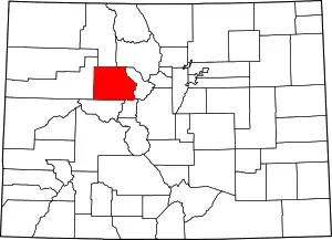 Map of Colorado highlighting Eagle County | |
| CDPs | ||
| Unincorporated communities |
| |
| Ghost towns | ||
| Footnotes | ‡This populated place also has portions in an adjacent county or counties | |
| ||

| Authority control |
|---|