Fuyu County, Heilongjiang
Fuyu (Chinese: 富裕; pinyin: Fùyù) is a county of western Heilongjiang province, People's Republic of China, under the administration of Qiqihar City, the downtown of which is 65 kilometres (40 mi) to the southwest. Various economic crops and the milk are produced in the fertile land. The county has an area of 4,335 square kilometres (1,674 sq mi), and a population of 300,000 inhabitants.
Fuyu County
富裕县 | |
|---|---|
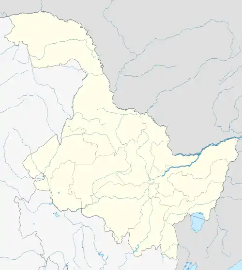 Fuyu Location in Heilongjiang | |
| Coordinates: 47°48′N 124°28′E | |
| Country | People's Republic of China |
| Province | Heilongjiang |
| Prefecture-level city | Qiqihar |
| Time zone | UTC+8 (China Standard) |
Sanjiazi (三家子; Romanized Manchu: Ilan Boo) village in this county is one of the few villages whose elderly inhabitants are considered to being the last native speakers of Manchu.[1]
Dawujia in Aihui District of Heihe Prefecture is another village where a few Manchu speakers can be found.
The Fuyu Kyrgyz language is spoken in Fuyu county.
Administrative division
Towns:
- Fuyu Town (富裕镇), Fulu (富路镇), Fuhai (富海镇), Erdaowan (二道湾镇), Long'anqiao (龙安桥镇)
Townships:
- Taha Manchu and Daur Ethnic Township (塔哈满族达斡尔族乡), Fanrong Township (繁荣乡), Youyi Daur, Manchu, and Kirghiz Ethnic Township (友谊达斡尔族满族柯尔克孜族乡), Shaowen Township (绍文乡), Zhonghou Township (忠厚乡)
Climate
Fuyu has a cold, monsoon-influenced, humid continental climate (Köppen Dwa), with four distinct seasons. It has long, bitterly cold, dry winters and very warm, rainy summers.
| Climate data for Fuyu County, Heilongjiang (1971−2000) | |||||||||||||
|---|---|---|---|---|---|---|---|---|---|---|---|---|---|
| Month | Jan | Feb | Mar | Apr | May | Jun | Jul | Aug | Sep | Oct | Nov | Dec | Year |
| Record high °C (°F) | 0.8 (33.4) |
7.9 (46.2) |
21.8 (71.2) |
28.9 (84.0) |
35.3 (95.5) |
38.3 (100.9) |
38.1 (100.6) |
35.5 (95.9) |
31.5 (88.7) |
26.4 (79.5) |
12.6 (54.7) |
4.9 (40.8) |
38.3 (100.9) |
| Average high °C (°F) | −14.3 (6.3) |
−8.3 (17.1) |
1.4 (34.5) |
12.3 (54.1) |
20.6 (69.1) |
25.8 (78.4) |
27.6 (81.7) |
25.8 (78.4) |
19.7 (67.5) |
10.2 (50.4) |
−2.2 (28.0) |
−11.7 (10.9) |
8.9 (48.0) |
| Daily mean °C (°F) | −20.7 (−5.3) |
−15.5 (4.1) |
−5.2 (22.6) |
5.6 (42.1) |
13.9 (57.0) |
19.9 (67.8) |
22.4 (72.3) |
20.4 (68.7) |
13.5 (56.3) |
4.0 (39.2) |
−8.0 (17.6) |
−17.5 (0.5) |
2.7 (36.9) |
| Average low °C (°F) | −26 (−15) |
−21.6 (−6.9) |
−11.7 (10.9) |
−1.1 (30.0) |
6.7 (44.1) |
13.7 (56.7) |
17.4 (63.3) |
15.4 (59.7) |
7.9 (46.2) |
−1.5 (29.3) |
−12.9 (8.8) |
−22.3 (−8.1) |
−3 (27) |
| Record low °C (°F) | −40.3 (−40.5) |
−36.5 (−33.7) |
−31.2 (−24.2) |
−15.8 (3.6) |
−7.5 (18.5) |
2.7 (36.9) |
9.2 (48.6) |
5.1 (41.2) |
−8.2 (17.2) |
−18.4 (−1.1) |
−28.5 (−19.3) |
−37.5 (−35.5) |
−40.3 (−40.5) |
| Average precipitation mm (inches) | 2.0 (0.08) |
1.7 (0.07) |
4.8 (0.19) |
18.7 (0.74) |
31.9 (1.26) |
67.6 (2.66) |
126.6 (4.98) |
101.0 (3.98) |
58.8 (2.31) |
20.8 (0.82) |
4.9 (0.19) |
3.5 (0.14) |
442.3 (17.42) |
| Average precipitation days (≥ 0.1 mm) | 4.2 | 3.5 | 3.7 | 5.8 | 7.7 | 12.2 | 13.8 | 11.7 | 9.6 | 5.9 | 4.6 | 5.5 | 88.2 |
| Source: Weather China | |||||||||||||
References
- "A Sanjiazi trip report". Archived from the original on 2010-03-15. Retrieved 2010-04-19.