Mohe City
Mohe (Chinese: 漠河; pinyin: Mòhé) is a county-level city in Daxing'anling Prefecture, Heilongjiang province. It is the Northernmost Chinese city.
Mohe
漠河市 | |
|---|---|
 | |
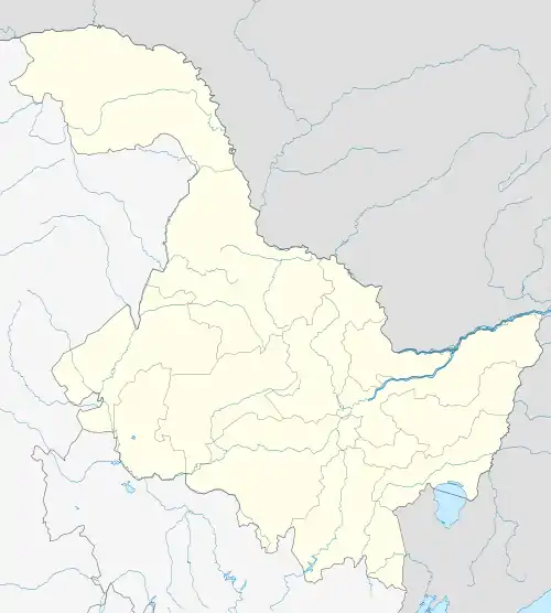
.png.webp) Location of Mohe City jurisdiction (pink) in Daxing'anling Prefecture (yellow) and Heilongjiang | |
 Mohe Location of the city center in Heilongjiang 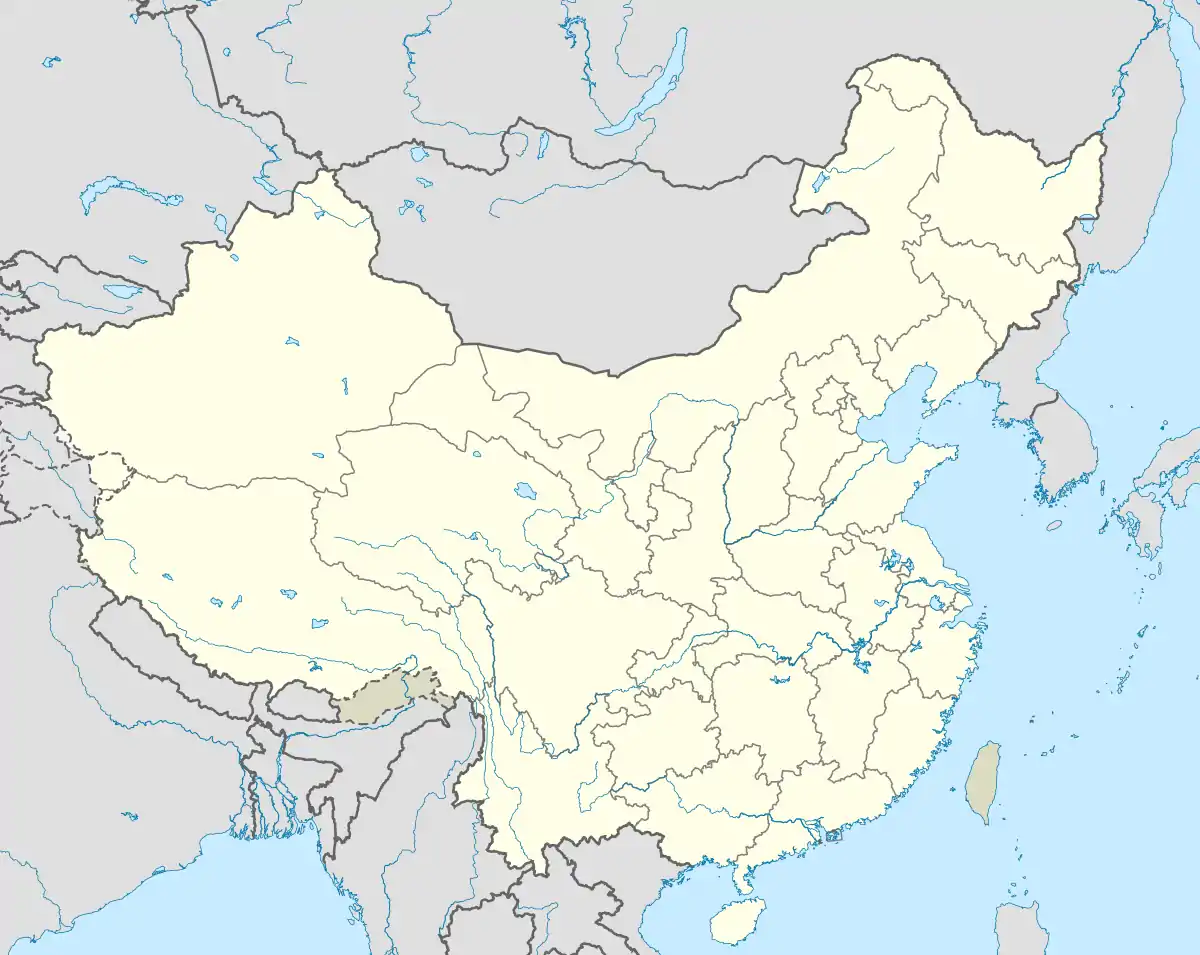 Mohe Mohe (China) | |
| Coordinates: 52°58′19″N 122°32′20″E | |
| Country | People's Republic of China |
| Province | Heilongjiang |
| Prefecture | Daxing'anling |
| County seat | Xilinji (西林吉镇) |
| Area | |
| • Total | 18,233 km2 (7,040 sq mi) |
| Elevation | 435 m (1,427 ft) |
| Population | |
| • Total | 83,465 |
| • Density | 4.6/km2 (12/sq mi) |
| Time zone | UTC+8 (China Standard) |
| Postal code | 165300 |
| Website | www |
| Mohe City | |||||||||||
|---|---|---|---|---|---|---|---|---|---|---|---|
| Chinese | 漠河 | ||||||||||
| Literal meaning | "Desert River" | ||||||||||
| |||||||||||
Climate
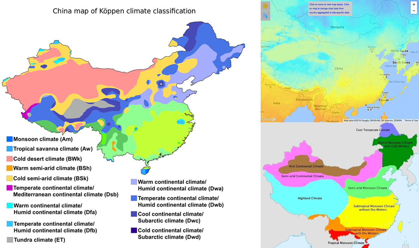
Mohe, by virtue of its far northern location, is one of the few locations in China with a subarctic climate (Köppen Dwc),[1]) with long, severe winters, and short, warm summers.[2] Winter begins in early to mid-October and lasts until late April, and temperatures then are normally the coldest nationwide. Average temperatures stay below freezing for a total of nearly seven months of the year, and the frost-free period is just short of 90 days; in addition, the diurnal temperature variation is large, averaging 17.2 °C (31.0 °F) annually. The monthly 24-hour average temperature ranges from −28.2 °C (−18.8 °F) in January to 18.3 °C (64.9 °F) in July, with an annual mean of −3.90 °C (25.0 °F), so that the city is only a little south of the line of continuous permafrost. Extreme temperatures have ranged from −52.3 °C (−62 °F)[3] to 39.3 °C (103 °F).[4]
| Climate data for Mohe (1981−2010 normals, extremes 1971−2010) | |||||||||||||
|---|---|---|---|---|---|---|---|---|---|---|---|---|---|
| Month | Jan | Feb | Mar | Apr | May | Jun | Jul | Aug | Sep | Oct | Nov | Dec | Year |
| Record high °C (°F) | −4.6 (23.7) |
5.5 (41.9) |
16.2 (61.2) |
28.4 (83.1) |
35.1 (95.2) |
39.3 (102.7) |
38.0 (100.4) |
35.5 (95.9) |
31.7 (89.1) |
25.1 (77.2) |
10.2 (50.4) |
−3.2 (26.2) |
39.3 (102.7) |
| Average high °C (°F) | −18.4 (−1.1) |
−11.4 (11.5) |
−2.6 (27.3) |
8.5 (47.3) |
17.7 (63.9) |
24.7 (76.5) |
26.0 (78.8) |
23.9 (75.0) |
16.8 (62.2) |
5.4 (41.7) |
−9.1 (15.6) |
−19.0 (−2.2) |
5.2 (41.4) |
| Daily mean °C (°F) | −28.2 (−18.8) |
−23.8 (−10.8) |
−13.1 (8.4) |
0.5 (32.9) |
9.2 (48.6) |
15.7 (60.3) |
18.3 (64.9) |
15.2 (59.4) |
7.4 (45.3) |
−2.7 (27.1) |
−17.9 (−0.2) |
−27.4 (−17.3) |
−3.9 (25.0) |
| Average low °C (°F) | −35.3 (−31.5) |
−32.8 (−27.0) |
−23.0 (−9.4) |
−7.8 (18.0) |
−0.3 (31.5) |
5.9 (42.6) |
10.6 (51.1) |
7.6 (45.7) |
−0.2 (31.6) |
−9.8 (14.4) |
−24.9 (−12.8) |
−33.6 (−28.5) |
−12.0 (10.5) |
| Record low °C (°F) | −49.6 (−57.3) |
−52.3 (−62.1) |
−42.7 (−44.9) |
−32.6 (−26.7) |
−13.1 (8.4) |
−5.3 (22.5) |
−1.4 (29.5) |
−3.0 (26.6) |
−12.2 (10.0) |
−28.7 (−19.7) |
−41.9 (−43.4) |
−48.5 (−55.3) |
−52.3 (−62.1) |
| Average precipitation mm (inches) | 7.4 (0.29) |
4.3 (0.17) |
6.1 (0.24) |
20.2 (0.80) |
35.5 (1.40) |
71.6 (2.82) |
97.0 (3.82) |
107.1 (4.22) |
55.3 (2.18) |
25.0 (0.98) |
13.8 (0.54) |
8.8 (0.35) |
452.1 (17.81) |
| Average precipitation days (≥ 0.1 mm) | 7.6 | 5.7 | 4.6 | 7.7 | 9.3 | 14.9 | 16.2 | 16.2 | 11.6 | 5.6 | 8.7 | 9.3 | 117.4 |
| Average relative humidity (%) | 71 | 67 | 63 | 56 | 56 | 70 | 79 | 81 | 75 | 70 | 73 | 72 | 69 |
| Source: China Meteorological Administration,[5] Weather China (precipitation days 1971−2000, all-time record low[4] | |||||||||||||
Geography
Mohe is located in the far northwest of Heilongjiang at latitude 52° 10'−53° 33' N and 121° 07'−124° 20' E. It forms a border with Russia's Amur Oblast and Zabaykalsky Krai, where the Amur River flows for 245 kilometres (152 mi). A village, the northernmost Chinese settlement, at the latitude of 53° 29' N known as the Beiji Village (北极村, literally "Northernmost") lies in this city, on the Amur River. On extremely rare occasions, the aurora borealis can be seen.[6]
Mohe spans 150 kilometres (93 mi) from north to south and has a total area of 18,233 square kilometres (7,040 sq mi), occupying 21.6% of the prefecture's (Daxing'anling) area and 3.9% of the provincial (Heilongjiang) area. This creates a population density of only 4.64 persons/km2 (12.0 persons/sqmi).
Transportation

Mohe railway station, opened in 1972, is the northernmost railway station in China. It has regular passenger service to Harbin, Qiqihar and Shenyang.[7]
Mohe Gulian Airport, opened 2008, is the nation's northernmost airport.
See also
Sources
- "The 6 climate zones of China". ClimateList. Retrieved 2018-12-19.
- Krishna, K. R. (2015-01-28). Agricultural Prairies: Natural Resources and Crop Productivity. CRC Press. ISBN 9781482258066.
- "Climate". en.chinaculture.org. Retrieved 2018-12-19.
- Extreme Temperatures Around the World - world highest lowest temperatures. Accessed 2010-11-02
- 中国气象数据网 - WeatherBk Data (in Chinese). China Meteorological Administration. Retrieved 2020-04-15.
- "A Visit to China's "Arctic Village"". ChinaCulture.org. January 7, 2013.
- Mohe train schedule (in Chinese)
External links
- Mohe People's Government website (in Chinese)
Heilongjiang topics | |
|---|---|
| General | |
| Geography | |
| Education | |
| Visitor attractions | |
| |
