Sunwu County
Sunwu County (simplified Chinese: 孙吴县; traditional Chinese: 孫吳縣; pinyin: Sūnwú Xiàn) is a county under the administration of Heihe City in the north of Heilongjiang province, China, situated on the bank of Amur River, which demarcates the Sino-Russian border. The length of border line within Sunwu county is 36 km (22 mi).
Sunwu County
孙吴县 | |
|---|---|
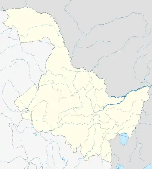
 Sunwu Location in Heilongjiang | |
| Coordinates: 49°26′N 127°20′E | |
| Country | People's Republic of China |
| Province | Heilongjiang |
| Prefecture-level city | Heihe |
| Township-level divisions | 1 subdistrict 2 towns 9 townships |
| County seat | Sunwuchengqu Subdistrict (孙吴城区街道) |
| Area | |
| • Total | 4,448 km2 (1,717 sq mi) |
| Elevation | 226 m (741 ft) |
| Population (2005) | |
| • Total | 104,717 |
| • Density | 24/km2 (61/sq mi) |
| Time zone | UTC+8 (China Standard) |
| Postal code | 164200 |
| Area code(s) | 0456 |
Sunwu County is surrounded by Lesser Khingan Mountains, and its forest coverage is 45%. The urbanization level is 40%.
Geography and climate

Sunwu County has a monsoon-influenced humid continental climate (Köppen Dwb) with very warm, humid summers and severely cold, extremely dry winters. The monthly 24-hour average temperature ranges from −23.3 °C (−9.9 °F) in January to 20.4 °C (68.7 °F), while the annual mean is +0.18 °C (32.3 °F). More than three-fourths of the annual precipitation occurs from June to September. With monthly percent possible sunshine ranging from 52% in July to 73% in February, the area receives 2,576 hours of bright sunshine annually.
| Climate data for Sunwu County (1981–2010 normals) | |||||||||||||
|---|---|---|---|---|---|---|---|---|---|---|---|---|---|
| Month | Jan | Feb | Mar | Apr | May | Jun | Jul | Aug | Sep | Oct | Nov | Dec | Year |
| Average high °C (°F) | −15.1 (4.8) |
−9.3 (15.3) |
−1.0 (30.2) |
10.4 (50.7) |
18.9 (66.0) |
24.7 (76.5) |
26.3 (79.3) |
24.3 (75.7) |
18.5 (65.3) |
8.8 (47.8) |
−4.7 (23.5) |
−14.0 (6.8) |
7.3 (45.2) |
| Daily mean °C (°F) | −23.3 (−9.9) |
−18.5 (−1.3) |
−8.5 (16.7) |
3.7 (38.7) |
11.6 (52.9) |
17.8 (64.0) |
20.4 (68.7) |
18.3 (64.9) |
11.2 (52.2) |
2.0 (35.6) |
−11.3 (11.7) |
−21.2 (−6.2) |
0.2 (32.3) |
| Average low °C (°F) | −29.2 (−20.6) |
−25.8 (−14.4) |
−15.9 (3.4) |
−3.2 (26.2) |
3.5 (38.3) |
10.3 (50.5) |
14.5 (58.1) |
12.6 (54.7) |
4.6 (40.3) |
−4.1 (24.6) |
−16.9 (1.6) |
−26.7 (−16.1) |
−6.4 (20.6) |
| Average precipitation mm (inches) | 5.9 (0.23) |
4.2 (0.17) |
8.9 (0.35) |
24.9 (0.98) |
42.9 (1.69) |
85.4 (3.36) |
140.9 (5.55) |
123.5 (4.86) |
63.0 (2.48) |
24.8 (0.98) |
10.5 (0.41) |
8.2 (0.32) |
543.1 (21.38) |
| Average precipitation days (≥ 0.1 mm) | 7.3 | 4.5 | 5.3 | 8.4 | 11.0 | 13.9 | 15.4 | 14.3 | 12.5 | 7.9 | 7.1 | 7.8 | 115.4 |
| Average relative humidity (%) | 73 | 70 | 63 | 57 | 57 | 70 | 80 | 82 | 74 | 64 | 70 | 75 | 70 |
| Mean monthly sunshine hours | 170.3 | 206.3 | 246.2 | 223.1 | 258.3 | 263.3 | 252.9 | 238.4 | 210.9 | 194.8 | 163.8 | 147.6 | 2,575.9 |
| Percent possible sunshine | 64 | 73 | 67 | 54 | 55 | 55 | 52 | 54 | 56 | 58 | 60 | 58 | 58 |
| Source: China Meteorological Administration (precipitation days and sunshine 1971–2000)[1][2] | |||||||||||||
Administrative divisions
There is one subdistrict, two towns and nine townships in the county:[3]
The only subdistrict is Sunwuchengqu Subdistrict (孙吴城区街道)
Towns:
Townships:
- Xixing Township (西兴乡), Yanjiang Manchu Township (沿江满族乡), Yaotun Township (腰屯乡), Woniuhe Township (卧牛河乡), Qunshan Township (群山乡), Fendou Township (奋斗乡), Hongqi Township (红旗乡), Zhengyangshan Township (正阳山乡), Qingxi Township (清溪乡)
Transport
- China National Highway 202
- Beihei Railway
References
- 中国气象数据网 - WeatherBk Data (in Chinese). China Meteorological Administration. Retrieved 2020-04-15.
- 中国地面国际交换站气候标准值月值数据集(1971-2000年). China Meteorological Administration. Archived from the original on 2013-09-21. Retrieved 2010-05-25.
- 2011年统计用区划代码和城乡划分代码:孙吴县 (in Chinese). National Bureau of Statistics of the People's Republic of China. Retrieved 2013-02-16.