Garibaldi, Oregon
Garibaldi (/ˌɡærɪˈbɔːldi/ GARR-ib-AWL-dee) is a city in Tillamook County, in the U.S. state of Oregon. The population was 779 at the 2010 census.
Garibaldi, Oregon | |
|---|---|
 Garibaldi and Tillamook Bay | |
| Motto(s): "Oregon's Authentic Fishing Village" | |
 Location in Oregon | |
| Coordinates: 45°33′37″N 123°54′41″W | |
| Country | United States |
| State | Oregon |
| County | Tillamook |
| Incorporated | 1946 |
| Government | |
| • Mayor | Judy Riggs |
| Area | |
| • Total | 1.37 sq mi (3.54 km2) |
| • Land | 0.99 sq mi (2.55 km2) |
| • Water | 0.38 sq mi (0.99 km2) |
| Elevation | 22 ft (6.7 m) |
| Population | |
| • Total | 779 |
| • Estimate (2019)[3] | 822 |
| • Density | 833.67/sq mi (321.74/km2) |
| Time zone | UTC-8 (Pacific) |
| • Summer (DST) | UTC-7 (Pacific) |
| ZIP code | 97118 |
| Area code(s) | 503 |
| FIPS code | 41-28000[4] |
| GNIS feature ID | 1121062[5] |
| Website | www.ci.garibaldi.or.us |
History
Daniel Bayley was the first significant property owner on this part of Tillamook Bay, having first settled here after the Civil War. Bayley was one of the first white settlers who arrived in the Tillamook Bay's northern end area.[6] Bayley built a hotel and general store on what is now known as Bay Lane. In 1867, Bayley subdivided the Bayley Park Addition and was officially granted title to the property May 15, 1869 by President Ulysses S. Grant. In 1870, he was appointed by President Grant as the area's first postmaster, and given the duty of naming the postmark. This same year, Giuseppe Garibaldi helped unify Italy after a military career devoted to establishing democracy around the world and Bayley felt so inclined to name the post office after his hero.[7]
Garibaldi's first school (Hobson School) was built in 1896. In 1907 the school was moved close to where it now stands between Cypress and Driftwood under the big "G". In 1926, the new high school opened so Garibaldi students no longer had to attend secondary school in Bay City. In 1954, north Tillamook County high schools were consolidated as Neah-Kah-Nie High School north of Rockaway Beach. Garibaldi High School became a grade school.
The Whitney mill was opened in 1921. The tall smoke stack, today all that remains, was constructed by the Hammond Company in 1927–28.
Garibaldi was incorporated as a City in 1946.[6] During the 1950s the city's population increased to over 1500 with the construction of two large mills, The Oceanside Lumber Company and Oregon-Washington Plywood Corporation. The Oregon-Washington Mill closed in the late 1970s.[8] Weyerhaeuser hard wood mill at the Port of Garibaldi was acquired in 2011 by a New York based company and has been operating as Northwest Hardwoods, Inc. since the acquisition.[9]
Geography
According to the United States Census Bureau, the city has a total area of 1.37 square miles (3.55 km2), of which, 0.99 square miles (2.56 km2) is land and 0.38 square miles (0.98 km2) is water.[10]

Demographics
| Historical population | |||
|---|---|---|---|
| Census | Pop. | %± | |
| 1930 | 213 | — | |
| 1950 | 1,249 | — | |
| 1960 | 1,163 | −6.9% | |
| 1970 | 1,083 | −6.9% | |
| 1980 | 999 | −7.8% | |
| 1990 | 877 | −12.2% | |
| 2000 | 899 | 2.5% | |
| 2010 | 779 | −13.3% | |
| 2019 (est.) | 822 | [3] | 5.5% |
| 1930 population[11] U.S. Decennial Census[12] | |||
2010 census
As of the census[2] of 2010, there were 779 people, 384 households, and 222 families living in the city. The population density was 786.9 inhabitants per square mile (303.8/km2). There were 524 housing units at an average density of 529.3 per square mile (204.4/km2). The racial makeup of the city was 94.7% White, 0.1% African American, 0.8% Native American, 0.9% Asian, 0.1% from other races, and 3.3% from two or more races. Hispanic or Latino of any race were 3.5% of the population.
There were 384 households, of which 15.4% had children under the age of 18 living with them, 47.4% were married couples living together, 8.1% had a female householder with no husband present, 2.3% had a male householder with no wife present, and 42.2% were non-families. 33.9% of all households were made up of individuals, and 13.3% had someone living alone who was 65 years of age or older. The average household size was 1.99 and the average family size was 2.45.
The median age in the city was 55.1 years. 12.5% of residents were under the age of 18; 5.1% were between the ages of 18 and 24; 13% were from 25 to 44; 41.4% were from 45 to 64; and 28.1% were 65 years of age or older. The gender makeup of the city was 50.6% male and 49.4% female.
2000 census
As of the census[4] of 2000, there were 899 people, 436 households, and 251 families living in the city. The population density was 928.4 people per square mile (357.8/km2). There were 584 housing units at an average density of 603.1 per square mile (232.5/km2). The racial makeup of the city was 94.77% White, 1.78% Native American, 0.67% Asian, 0.11% Pacific Islander, 0.22% from other races, and 2.45% from two or more races. Hispanic or Latino of any race were 1.33% of the population.
There were 436 households, out of which 16.5% had children under the age of 18 living with them, 47.5% were married couples living together, 6.4% had a female householder with no husband present, and 42.4% were non-families. 34.2% of all households were made up of individuals, and 17.4% had someone living alone who was 65 years of age or older. The average household size was 2.04 and the average family size was 2.55.
In the city, the population was spread out, with 16.2% under the age of 18, 6.1% from 18 to 24, 21.4% from 25 to 44, 31.3% from 45 to 64, and 25.0% who were 65 years of age or older. The median age was 49 years. For every 100 females, there were 99.8 males. For every 100 females age 18 and over, there were 103.5 males.
The median income for a household in the city was $28,945, and the median income for a family was $37,266. Males had a median income of $30,938 versus $23,359 for females. The per capita income for the city was $18,075. About 6.9% of families and 11.6% of the population were below the poverty line, including 10.5% of those under age 18 and 7.4% of those age 65 or over.
Historical population
The population was 200 in 1915.[6]
References
- "2019 U.S. Gazetteer Files". United States Census Bureau. Retrieved July 28, 2020.
- "U.S. Census website". United States Census Bureau. Retrieved 2012-12-21.
- "Population and Housing Unit Estimates". United States Census Bureau. May 24, 2020. Retrieved May 27, 2020.
- "U.S. Census website". United States Census Bureau. Retrieved 2008-01-31.
- "US Board on Geographic Names". United States Geological Survey. 2007-10-25. Retrieved 2008-01-31.
- Engeman, Richard H. (2009-09-01). The Oregon Companion: An Historical Gazetteer of the Useful, the Curious, and the Arcane. Timber Press. p. 150. ISBN 978-1-60469-147-4.
- McArthur, Lewis A.; McArthur, Lewis L. (2003). Oregon Geographic Names (Seventh ed.). OHS Press. p. 392. ISBN 0875952771. Retrieved 2014-10-10.
- "ARCHAEOLOGICAL SURVEY FOR THE PORT OF GARIBALDI WHARF REDEVELOPMENT PROJECT,TILLAMOOK COUNTY, OREGON" (PDF). Port of Garibaldi. Archaeological Investigations Northwest, Inc. September 2012. Retrieved October 11, 2020.
- Herald, LeeAnn Neal For the Headlight. "Garibaldi sawmill part of sale to New York company". Tillamook Headlight-Herald. Retrieved 2020-10-11.
- "US Gazetteer files 2010". United States Census Bureau. Archived from the original on 2012-07-02. Retrieved 2012-12-21.
- "Oregon Secretary of State: Seaside to Bay City". Oregon. 1940. Retrieved 28 October 2018.
- "Census of Population and Housing". Census.gov. Retrieved June 4, 2015.
External links
| Wikimedia Commons has media related to Garibaldi, Oregon. |
Municipalities and communities of Tillamook County, Oregon, United States | ||
|---|---|---|
| Cities | 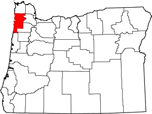 Tillamook County map | |
| CDPs | ||
| Unincorporated communities | ||
| ||
