Idiotville, Oregon
Idiotville is a ghost town in Tillamook County, Oregon, United States, near the mouth of Idiot Creek on the Wilson River, on the route of Oregon Route 6.[1] Idiotville's elevation is 1,200 feet (400 m).[1]
Idiotville | |
|---|---|
Ghost town | |
 Idiotville Location within the state of Oregon | |
| Coordinates: 45°37′10″N 123°25′5″W | |
| Country | United States |
| State | Oregon |
| County | Tillamook |
| Elevation | 1,200 ft (400 m) |
| Time zone | UTC−08:00 (Pacific (PST)) |
| • Summer (DST) | UTC−07:00 (PDT) |
| GNIS feature ID | 1163489[1] |
Background
It is in the Tillamook State Forest, along the Tillamook-Washington county line, approximately 50 miles (80 km) west northwest of Portland. Nothing remains at the site.
The nearby stream was named Idiot Creek after the community and was added to the official United States Board on Geographic Names list in 1977. About a half mile (800 m) up Idiot Creek was a logging camp called Ryan's Camp, which was part of the salvage operations following the Tillamook Burn. Since the spot was so remote, it was said that only an idiot would work there, so the camp was popularly known as Idiotville. The name was eventually applied to the stream.[2] Idiotville has been noted for its unusual name.[3]
See also
References
- "Idiotville (historical)". Geographic Names Information System. United States Geological Survey. Retrieved 2009-01-05.
- McArthur, Lewis A.; McArthur, Lewis L. (2003) [1928]. Oregon Geographic Names (7th ed.). Portland, Oregon: Oregon Historical Society Press. ISBN 978-0875952772.
- Petras, Kathryn; Petras, Ross (18 December 2007). Unusually Stupid Americans: A Compendium of All-American Stupidity. Random House Publishing Group. p. 246. ISBN 978-0-307-41761-9.
Municipalities and communities of Tillamook County, Oregon, United States | ||
|---|---|---|
| Cities | 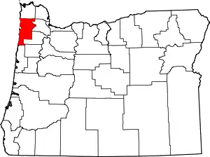 Tillamook County map | |
| CDPs | ||
| Unincorporated communities | ||
| ||