Neahkahnie Beach, Oregon
Neahkahnie Beach (or Neahkahnie) is a census-designated place and unincorporated community in Tillamook County, Oregon, United States.[1][2] It is located west of U.S. Route 101, comprising approximately 370 residences north of the city of Manzanita, at the foot of Neahkahnie Mountain.[3] For statistical purposes, the United States Census Bureau has defined Neahkahnie as a census-designated place (CDP).[4] The census definition of the area may not precisely correspond to local understanding of the area with the same name.
Neahkahnie Beach, Oregon | |
|---|---|
.jpg.webp) | |
 Neahkahnie Beach, Oregon  Neahkahnie Beach, Oregon | |
| Coordinates: 45.729°N 123.941°W | |
| Country | United States |
| State | Oregon |
| County | Tillamook |
| Elevation | 85 ft (26 m) |
| Time zone | UTC-8 (Pacific (PST)) |
| • Summer (DST) | UTC-7 (PDT) |
| ZIP code | 97131 |
| Area code(s) | 503 and 971 |
References
- "Neahkahnie Beach". Geographic Names Information System. United States Geological Survey. November 28, 1980. Retrieved March 4, 2012.
- "Neahkahnie". Geographic Names Information System. United States Geological Survey. December 16, 2010. Retrieved March 4, 2012.
- Oregon Atlas & Gazetteer (7th ed.). Yarmouth, Maine: DeLorme. 2008. p. 20. ISBN 0-89933-347-8.
- "Neahkahnie Census Designated Place". Geographic Names Information System. United States Geological Survey. April 14, 2010. Retrieved March 4, 2012.
Municipalities and communities of Tillamook County, Oregon, United States | ||
|---|---|---|
| Cities | 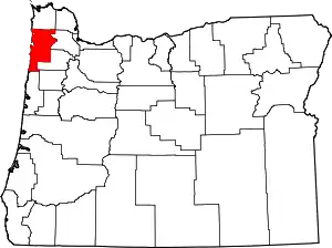 Tillamook County map | |
| CDPs | ||
| Unincorporated communities | ||
| ||
This article is issued from Wikipedia. The text is licensed under Creative Commons - Attribution - Sharealike. Additional terms may apply for the media files.