Hobsonville, Oregon
Hobsonville is an unincorporated community in Tillamook County, Oregon, United States.[1] Although it is considered a ghost town, it is still classified as a populated place by the United States Geological Survey (USGS). Hobsonville is on the east shore of Tillamook Bay, about 2 miles south of Garibaldi via U.S. Route 101 or about a mile from Garibaldi across Miami Cove.[2][3]
Hobsonville | |
|---|---|
 Hobsonville Location within the state of Oregon  Hobsonville Hobsonville (the United States) | |
| Coordinates: 45°32′56″N 123°54′07″W | |
| Country | United States |
| State | Oregon |
| County | Tillamook |
| Elevation | 131 ft (40 m) |
| Time zone | UTC-8 (Pacific (PST)) |
| • Summer (DST) | UTC-7 (PDT) |
| GNIS feature ID | 1121860[1] |
| Coordinates and elevation from Geographic Names Information System[1] | |
The community was named after pioneer John Hobson, who was one of the founders of the local salmon cannery.[4] Hobsonville once had an economy based on lumber and the salmon cannery–the Tillamook Packing Company–which began operating in 1884.[5][6] Hobsonville also had a hotel and a creamery, and was a stop on the Tillamook Bay and Pacific Railway and Navigation Co. Railroad.[5] Hobsonville post office ran from 1883 to 1913.[4] According to Oregon: End of the Trail, nearby Hobsonville Point that extends into Tillamook Bay was named Talapus Cradle by the local Native Americans because of its resemblance to a cradleboard.[7][8] The point was also once known as Driscoll Point.[9]
By 1930, Hobsonville was the home of several elderly Tillamook and Nehalem women, who talked with May Edel, an assistant to anthropologist Franz Boas.[10] By 1940 the townsite was overgrown by alder trees but several buildings and the unoccupied hotel building remained.[7] Shortly before 1940 the remains of the Smith lumber mill were washed into the bay.[7][9]
References
- "Hobsonville". Geographic Names Information System. United States Geological Survey. November 28, 1980. Retrieved December 16, 2016.
- Oregon Atlas & Gazetteer (7th ed.). Yarmouth, Maine: DeLorme. 2008. p. 20. ISBN 0-89933-347-8.
- Albright, Gary. "Tillamook Bay". The Oregon Encyclopedia. Retrieved October 11, 2014.
- McArthur, Lewis A.; McArthur, Lewis L. (2003) [1928]. Oregon Geographic Names (7th ed.). Portland, Oregon: Oregon Historical Society Press. p. 471. ISBN 978-0875952772.
- Friedman, Ralph (1990). In Search of Western Oregon. Caldwell, Idaho: The Caxton Printers, Ltd. p. 31. ISBN 0-87004-332-3.
- "Astoria and Vicinity". The Daily Morning Astorian. Astoria, Oregon. August 15, 1884. Retrieved October 11, 2014.
- Writers' Program of the Work Projects Administration in the State of Oregon (1940). Oregon: End of the Trail. American Guide Series. Portland, Oregon: Binfords & Mort. p. 370. OCLC 4874569.
- Talapus is Chinook Jargon for the trickster Coyote.
- "Garibaldi and the Old Mill History". The Old Mill. Archived from the original on October 8, 2014. Retrieved October 11, 2014.
- Neal, LeeAnn (October 8, 2008). "Cultural geographer to relate Nehalem tales". The Oregonian. Retrieved October 11, 2014.
External links
- Historic image of Hobsonville from Tillamook County Library
- Images of Hobsonville from Flickr
Municipalities and communities of Tillamook County, Oregon, United States | ||
|---|---|---|
| Cities | 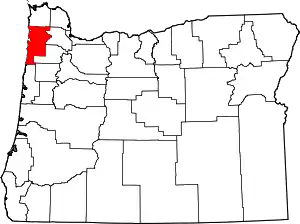 Tillamook County map | |
| CDPs | ||
| Unincorporated communities | ||
| ||