Geography of Brunei
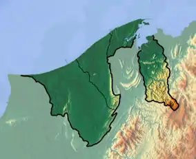
Brunei is a country in Southeast Asia, bordering the South China Sea and East Malaysia. Its geographical coordinates are 4°30′N 114°40′E. The country is small with a total size of 5,765 km2 (2,226 sq mi). It is similar in size to the UK's Norfolk and slightly smaller than the US state of Delaware. It is close to vital sea lanes through the South China Sea linking the Indian and Pacific Oceans. The country has two parts physically separated by Malaysia, making it almost an enclave within Malaysia.
 | |
| Continent | Southeast Asia |
|---|---|
| Region | Asia |
| Coordinates | 4°30′N 114°40′E |
| Area | Ranked 163th |
| • Total | 5,765 km2 (2,226 sq mi) |
| • Land | 91.33% |
| • Water | 8.67% |
| Coastline | 266 km (165 mi) |
| Borders | None |
| Highest point | Bukit Pagon 1,850 metres (6,070 ft) |
| Lowest point | South China Sea 0 metres (0 ft) |
| Longest river | Belait River 32 km (20 mi) |
| Largest lake | Tasek Merimbun 7,800 ha (19,000 acres) |
| Exclusive economic zone | 10,090 km2 (3,900 sq mi) |
Brunei shares a 266 km (165 mi) border with Malaysia and has a 161 km (100 mi) coastline.
Physical Geography
The terrain is a flat coastal plain that rises to mountainous in the east and hilly lowlands in the west. While earthquakes are quite rare, Brunei is located along the Pacific Ring of Fire.
Climate
The climate in Brunei is tropical equatorial and humid subtropical at higher altitudes with heavy rainfall. The municipality of Bandar Seri Begawan's climate is tropical equatorial with two seasons. Dry season is extremely hot (24 to 36 °C or 75.2 to 96.8 °F). Wet or rainy season is generally warm and wet (20 to 28 °C or 68.0 to 82.4 °F). Most of the country is a flat coastal plain with mountains in the east and hilly lowland in the west. The lowest point is at sea level and the highest is Bukit Pagon (1,850 m or 6,070 ft). Brunei also experiences typhoons and flooding.
Climatic regions
- Brunei-Muara District and Bandar Seri Begawan are humid tropical on the coast and lower altitude north and Humid subtropical in central Brunei-Muara District. (20 to 36 °C or 68 to 97 °F)
- Tutong District is tropical, hot in the north and warm in the south. (22 to 32 °C or 71.6 to 89.6 °F)
- Belait District is tropical, hot in the north and slightly warm in the south. (25 to 37 °C or 77.0 to 98.6 °F)
- Temburong District is humid subtropical in the higher altitude south and humid tropical on the coast and lower altitude north. (18 to 29 °C or 64 to 84 °F)
Statistics
Area:
- Total: 5,765 km2 (2,226 sq mi)
- Land: 5,265 km2 (2,033 sq mi)
- Water: 500 km2 (190 sq mi)
Maritime claims:
territorial sea:
12 nmi (13.8 mi; 22.2 km)
exclusive economic zone:
10,090 km2 (3,900 sq mi) and 200 nmi (230.2 mi; 370.4 km) or to median line
Elevation extremes:
lowest point:
South China Sea 0 m
highest point:
Bukit Pagon 1,850 m
Natural resources: petroleum, natural gas, timber
Land use:
arable land:
0.76%
permanent crops:
1.14%
other:
98.10% (2012)
Irrigated land: 10 km2 (3.9 sq mi) (2003)
Total renewable water resources: 8.5 km3 (2.0 cu mi)
Freshwater withdrawal (domestic/industrial/agricultural)
total:
0.09 km3/yr (97%/0%/3%)
per capital:
301.6 m3/yr (2009)
Environment – current issues: seasonal smoke/haze resulting from forest fires in Indonesia
Environment – international agreements:
party to:
Biodiversity, Climate Change, Endangered Species, Hazardous Wastes, Law of the Sea, Ozone Layer Protection, Ship Pollution
See also
References
![]() This article incorporates public domain material from the CIA World Factbook website https://www.cia.gov/the-world-factbook/.
This article incorporates public domain material from the CIA World Factbook website https://www.cia.gov/the-world-factbook/.
Brunei articles | |||||
|---|---|---|---|---|---|
| History |  | ||||
| Geography |
| ||||
| Politics |
| ||||
| Economy | |||||
| Society |
| ||||
| |||||
| Sovereign states |
|
|---|---|
| States with limited recognition |
|
| Dependencies and other territories |
|
| |