Geography of Palau
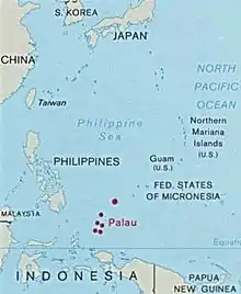
The Republic of Palau consists of eight principal islands and more than 250 smaller ones lying roughly 500 miles southeast of the Philippines, in Oceania. The islands of Palau constitute the westernmost part of the Caroline Islands chain. The country includes the World War II battleground of Peleliu and world-famous rock islands.[1] The total land area is 459 km2 (177 sq mi). It has the 42nd largest Exclusive Economic Zone of 603,978 km2 (233,197 sq mi).
 | |
| Continent | Pacific Ocean |
|---|---|
| Region | Oceania |
| Coordinates | 7°30′N 134°30′E |
| Area | Ranked 179th |
| • Total | 459 km2 (177 sq mi) |
| • Land | 99% |
| • Water | 1% |
| Coastline | 1,519 km (944 mi) |
| Borders | None |
| Highest point | Mount Ngerchelchuus 242 metres (794 ft) |
| Lowest point | Pacific Ocean 0 m |
| Exclusive economic zone | 603,978 km2 (233,197 sq mi) |
Statistics
The area of Palau is slightly more than 2.5 times the size of the US city of Washington, DC.[1]
Maritime claims:
territorial sea:
3 nautical miles
exclusive economic zone:
603,978 km2 (233,197 sq mi) (200 nmi)
Elevation extremes:
lowest point:
Pacific Ocean 0 m
highest point:
Mount Ngerchelchauus 242 meters (794 ft) (on Babeldaob)
Land use:
arable land:
2.17%
permanent crops:
4.35%
other:
93.48% (2011)
Environment - international agreements:
party to:
Biodiversity, Climate Change, Climate Change-Kyoto Protocol, Desertification, Law of the Sea
[1]
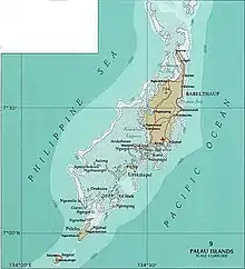
Terrain varies geologically from the high, mountainous main island of Babeldaob to low, coral islands usually fringed by large barrier reefs. Natural resources consist of forests, minerals (especially gold), marine products, and deep-seabed minerals. Current environmental issues include inadequate facilities for disposal of solid waste; threats to the marine ecosystem from sand and coral dredging, illegal fishing practices, and overfishing.[1]
Climate
Climate is tropical; hot and humid. The country has a Köppen Climate Classification of Af (Tropical Rainforest Climate).[2] The wet season lasts from May to November and typhoons can occur from June to December.
Relief
The relief of the country varies from the hilly main island of Babeldaob to the low, coral islands, usually bordered by large barrier reefs. Average altitude - no data available; the lowest point is the water level of the Pacific Ocean (0 m); The highest point is Mount Ngerchelchuus (242 m).
 Relief of Palau
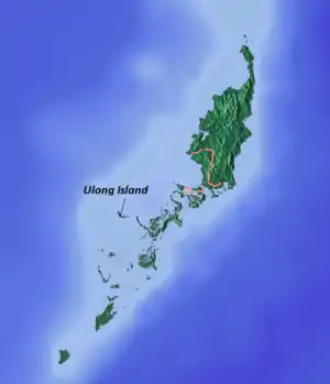 Ulong Island, Palau
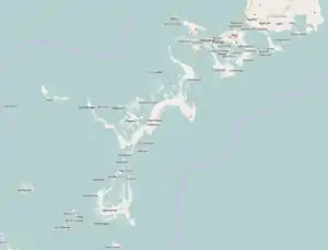
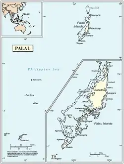 Palau geography map
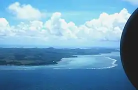 Aerial view of Babeldaob
Islands
- Palau Islands
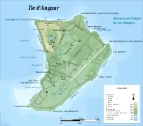 Angaur Island
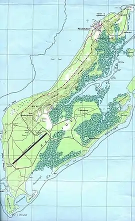 Peleliu
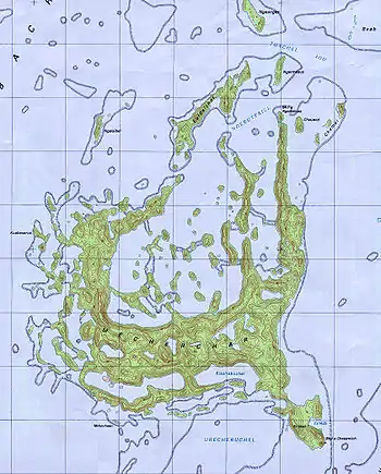
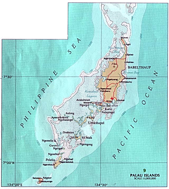
 Map including most of the islands of Palau (DMA, 1991)
Extreme points
This is a list of the extreme points of Palau, the points that are farther north, south, east or west than any other location.
- Northernmost point – Ngaruangel Reef, Kayangel state*
- Easternmost point – Kayangel islet, Kayangel state
- Southernmost point – Round Rock, Helen Reef, Hatohobei state
- Westernmost point - Tobi Island, Hatohobei state
- *Note: if submerged reefs are included then Velasco reef is Palau's northernmost point
External links
References
- "Australia - Oceania :: Palau — The World Factbook - Central Intelligence Agency". www.cia.gov. Retrieved 2019-03-27.
- "Koror, Palau Köppen Climate Classification (Weatherbase)". Weatherbase. Retrieved 2019-03-28.
![]() This article incorporates public domain material from the CIA World Factbook website https://www.cia.gov/the-world-factbook/.
This article incorporates public domain material from the CIA World Factbook website https://www.cia.gov/the-world-factbook/.