Trust Territory of the Pacific Islands
The Trust Territory of the Pacific Islands (TTPI) was a United Nations trust territory in Micronesia administered by the United States from 1947 to 1994.
Trust Territory of the Pacific Islands | |||||||||||||||
|---|---|---|---|---|---|---|---|---|---|---|---|---|---|---|---|
| 1947–1994 | |||||||||||||||
 Seal
| |||||||||||||||
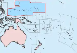 Location of the Trust Territory of the Pacific Islands in the Pacific | |||||||||||||||
| Status | United Nations Trust Territory under the administration of the United States | ||||||||||||||
| Capital | Saipan | ||||||||||||||
| Common languages | English (official) Micronesian languages | ||||||||||||||
| Government | Trust Territory | ||||||||||||||
| Chief of State | |||||||||||||||
• 1947–1953 (first) | Harry S. Truman | ||||||||||||||
• 1993–1994 (last) | Bill Clintona | ||||||||||||||
| High Commissioner | |||||||||||||||
• 1947–1948 (first) | Louis E. Denfeld | ||||||||||||||
• 1981–1987 (last) | Janet J. McCoyb | ||||||||||||||
| Legislature | Congress | ||||||||||||||
| Historical era | Cold War | ||||||||||||||
• Trusteeship | July 18, 1947 | ||||||||||||||
• Termination of administration (Marshall Islands) | October 21, 1986 | ||||||||||||||
• Termination of administration (Micronesia) | November 3, 1986 | ||||||||||||||
| October 1, 1994 | |||||||||||||||
| Area | |||||||||||||||
| 1980 | 1,779 km2 (687 sq mi) | ||||||||||||||
| Population | |||||||||||||||
• 1980 | 132,929 | ||||||||||||||
| Currency | United States dollar | ||||||||||||||
| |||||||||||||||
| |||||||||||||||
History
Spain initially claimed the islands that later comprised the territory of the Trust Territory of the Pacific Islands (TTPI).[1] Subsequently, Germany established competing claims over the islands.[1] The competing claims were eventually resolved in favor of Germany when Spain, following its loss of several possessions to the United States during the Spanish–American War, ceded its claims over the islands to Germany pursuant to the German–Spanish Treaty (1899).[1] Germany, in turn, continued to retain possession until the islands were captured by Japan during World War I.[1] The League of Nations formally placed the islands in the former South Seas Mandate, a mandate that authorized Japanese administration of the islands.[1] The islands then remained under Japanese control until captured by the United States in 1944 during World War II.[1]
The TTPI entered UN trusteeship pursuant to Security Council Resolution 21 on July 18, 1947, and was designated a "strategic area" in its 1947 trusteeship agreement. Article 83 of the UN Charter provided that, as such, its formal status as a UN trust territory could be terminated only by the Security Council, and not by the General Assembly as with other trust territories. The United States Navy controlled the TTPI from a headquarters in Guam until 1951, when the United States Department of the Interior took over control, administering the territory from a base in Saipan.[2]
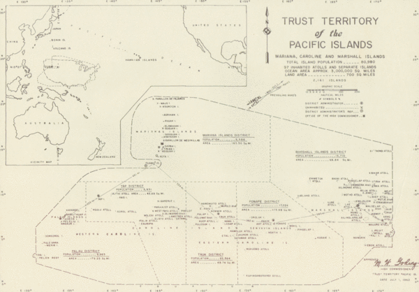
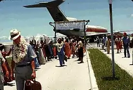
The Territory contained 100,000 people scattered over a water area the size of continental United States. It was subdivided into six districts, and represented a variety of cultures, with nine spoken languages. The Ponapeans and Kusaieans, Marshallese and Palauans, Trukese, Yapese and Chamorros had little in common, except they were in the same general area of the Pacific Ocean.[3]
The large distances between people, lack of an economy, language and cultural barriers, all worked against the union. The six district centers became upscale slums, containing deteriorated Japanese-built roads, with electricity, modern music and distractions, which led to alienated youth and elders. The remainder of the islands maintained their traditional way of life and infrastructure.[3]
A Congress of Micronesia first levied an income tax in 1971. It affected mainly foreigners working at military bases in the region.[4]
On October 21, 1986, the U.S. ended its administration of the Marshall Islands District.[5] The termination of U.S. administration of the Chuuk, Yap, Kosrae, Pohnpei, and the Mariana Islands districts of the TTPI soon followed on November 3, 1986.[6][7] The Security Council formally ended the trusteeship for the Chuuk, Yap, Kosrae, Pohnpei, Mariana Islands, and Marshall Islands districts on December 22, 1990 pursuant to Security Council Resolution 683.[8] On May 25, 1994, the Council ended the trusteeship for the Palau District pursuant to Security Council Resolution 956, after which the U.S. and Palau agreed to establish the latter's independence on October 1.[9][10]
Geography
In 1969, the 100 occupied islands comprised 700 square miles (1,800 km2) over an area of 3,000,000 square miles (7,800,000 km2) of sea. The latter area was comparable in size to the continental United States.[11] The water area is about 5% of the Pacific Ocean.
Demographics
The population of the islands was 200,000 in the latter part of the 19th century. The population decreased to 100,000 by 1969 due to emigration, war, and disease. At that time, the population inhabited less than 100 out of 2,141 of the Marshall, Mariana, and Caroline Islands.[11]
Education
In 1947 the Mariana Islands' Teacher Training School (MITTS), a normal school serving all areas of the Trust Territory, opened in Guam.[12] It moved to Chuuk in 1948,[13] to be more central in the Trust Territory,[12] and was renamed Pacific Islands' Teacher Training School (PITTS).[13] It transitioned from being a normal school to a comprehensive secondary school, so it was renamed the Pacific Islands Central School (PICS). The school moved to Pohnpei in 1959.[12] At the time it was a three-year institution housing students who graduated from intermediate schools.[14] The school, later known as Pohnpei Island Central School (PICS),[15] is now Bailey Olter High School.[16]
Palau Intermediate School, established in 1946, became Palau High School in 1962 as it added senior high grades.[17] From the late 1960s to the middle of the 1970s, several public high schools were built and/or received additions in the Trust Territory. They included Jaluit High School, Kosrae High School, Marshall Islands High School in Majuro, Palau High, PICS, and Truk High School (now Chuuk High School). The Micronesian Occupational College in Koror, Palau was also built.[18] It later merged with the Kolonia-based Community College of Micronesia, which began operations in 1969, into the College of Micronesia-FSM in 1976.[19]
Current status
The former area is now (2021) divided into four jurisdictions:
Sovereign states in free association with the United States
The following sovereign states have become freely associated with the United States under the Compact of Free Association (COFA).
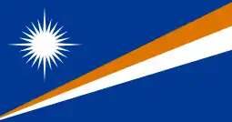 Republic of the Marshall Islands – established 1979, COFA effective October 21, 1986
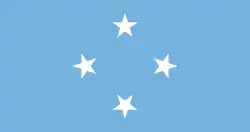 Federated States of Micronesia – established 1979, COFA effective November 3, 1986
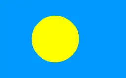 Republic of Palau – established 1981, COFA effective October 1, 1994
Commonwealth in political union with the United States
 Commonwealth of the Northern Mariana Islands – new constitution partially effective January 1, 1978, and fully effective November 4, 1986.[20]
See also
References
- Encyclopædia Britannica: Trust Territory of the Pacific Islands
- "Trust Territory of the Pacific Archives Photos – University of Hawaii". University of Hawaii at Manoa Hamilton Library.
- Kluge, P. F. (December 1971). "Micronesia: America's Troubled Island Ward". Readers Digest from the Beacon Magazine of Hawaii. Pleasantville, NY. p. 161.
- Glenn B. Martineau (September 1976). "Micronesia's Simplified Income Tax System". American Bar Association Journal. p. 1176–1178.
- "Marshall Islands (07/00)". U.S. Department of State. Archived from the original on April 27, 2019. Retrieved 2019-04-27.
- "Background Notes: Micronesia 6/96". United States Department of State. Retrieved 2019-04-27.
- Reagan, Ronald. "Proclamation 5564 of November 3,1986" (PDF). Government Publishing Office.
- "Resolution 683 (1990)" (PDF). United Nations Security Council. December 22, 1990.
- "[USC04] 48 USC 1931: Approval of Compact of Free Association: Article VII". United States House. Retrieved 2019-04-27.
- "Trusteeship Council formally suspends operation: Palau admitted to UN". UN Chronicle. March 1995.
- "Remembering an adopted cousin". Time. New York City. May 23, 1969. p. 28.
- Wuerch, William L. and Dirk Anthony Ballendorf. Historical Dictionary of Guam and Micronesia, 1994. ISBN 0810828588, 9780810828582. p.91.
- Goetzfridt, Nicholas J. and Karen M. Peacock. Micronesian Histories: An Analytical Bibliography and Guide to Interpretations'. p. 190.
- Bureau of International Organization Affairs, Office of United Nations Political Affairs, 1961. p. 137. "The Pacific Islands Central School is the only public senior secondary school of the Territory. Students selected for further training following graduation from the district intermediate schools may go to the Pacific Islands Central School for 3 additional years of education."
- "TITLE: Pohnpei Island Central School : (papers, articles, etc.)."
- "Higher Education in the Federated States of Micronesia." Embassy of the Federated States of Micronesia Washington DC. Retrieved on February 23, 2018. "Bailey Olter High School (former PICS) P.O. Box 250 Kolonia, Pohnpei FM 96941"
- "About." Palau High School. Retrieved on February 22, 2018.
- Compact of Free Association in the Micronesian States of Palau, the Federated States of Micronesia and the Marshall Islands: Environmental Impact Statement. United States Department of State, 1984. p. 36. "From the late 1960s to mid-1970s the major high school complexes throughout the Trust Territory were constructed: notably,[...]additions to the Ponape High School[...]"
- Thomas, R. Murray. "The U.S. Trust Territory of the Pacific Islands (Micronesia)" (Chapter 3). In: Thomas, R. Murray and T. Neville Postlethwaite (editors). Schooling in the Pacific Islands: Colonies in Transition . Elsevier, January 26, 2016. ISBN 1483148556, 9781483148557. Start: 67. CITED: p. 91.
- "Northern Mariana Islands". CIA World Factbook. Central Intelligence Agency. March 27, 2014. Retrieved April 5, 2014.
External links
![]() Media related to Trust Territory of the Pacific Islands at Wikimedia Commons
Media related to Trust Territory of the Pacific Islands at Wikimedia Commons
- Photos from the records of the Trust Territory Government
- 1967 Trust Territory of the Pacific Islands Census Geography
- United States Code: CHAPTER 14 – TRUST TERRITORY OF THE PACIFIC ISLANDS
- PACIFIC ISLANDS REPORT, Pacific Islands Development Program/East-West Center
- Compact of Free Association between the United States and the Federated States of Micronesia As Amended (2003) (pdf, archived from the original on 2003-10-05)
Marshall Islands articles | |||||||
|---|---|---|---|---|---|---|---|
| History | |||||||
| Geography |
| ||||||
| Politics |
| ||||||
| Economy | |||||||
| Culture |
| ||||||
| |||||||
| |
| |
| |
| |
|