Thar Desert
The Thar Desert, also known as the Great Indian Desert, is a large arid region in the north western part of the Indian subcontinent that covers an area of 200,000 km2 (77,000 sq mi) and forms a natural boundary between India and Pakistan. It is the world's 17th largest desert, and the world's 9th largest hot subtropical desert.
| Thar Desert Great Indian Desert | |
|---|---|
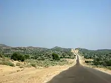
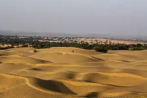 Thar Desert in Rajasthan, India | |
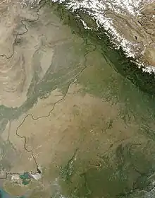
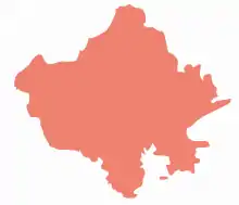
 Map of the Thar Desert ecoregion | |
| Ecology | |
| Realm | Indomalayan |
| Biome | deserts and xeric shrublands |
| Borders | Northwestern thorn scrub forests and Rann of Kutch seasonal salt marsh |
| Geography | |
| Area | 238,254 km2 (91,990 sq mi) |
| Countries | India and Pakistan |
| states of India & provinces of Pakistan | Rajasthan, Gujarat, Haryana, Punjab (India), Punjab and Sindh (Pakistan) |
| Coordinates | 27°N 71°E |
| Conservation | |
| Conservation status | vulnerable |
| Protected | 41,833 km² (18%)[1] |
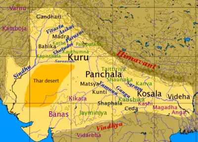
About 85% of the Thar Desert is located within India and the remaining 15% in Pakistan.[2] In India, it covers about 170,000 km2 (66,000 sq mi), and the remaining 30,000 km2 (12,000 sq mi) of the desert is within Pakistan. The Thar Desert forms approximately 5% (c. 4.56%) of the total geographic area of India. More than 60% of the desert lies in the Indian state of Rajasthan, and it extends into the states of Gujarat, Punjab and Haryana, and the Pakistani province of Sindh.[3] Within Pakistan's Punjab province, the Thar continues as the Cholistan Desert. The desert comprises a very dry part, the Marusthali region in the west, and a semidesert region in the east with fewer sand dunes and slightly more precipitation.[4]
Geography

The Thar Desert extends between the Aravalli Hills in the north-east and stretches to other states like punjab and haryana the Great Rann of Kutch along the coast and the alluvial plains of the Indus River in the west and north-west. Most of the desert area is covered by huge shifting sand dunes that receive sediments from the alluvial plains and the coast. The sand is highly mobile due to strong winds occurring before the onset of the monsoon. The Luni River is the only river integrated into the desert.[5] Rainfall is limited to 100–500 mm (4–20 in) per year, mostly falling from July to September.[2]
Salt water lakes within the Thar Desert include the Sambhar, Kuchaman, Didwana, Pachpadra and Phalodi in Rajasthan and Kharaghoda in Gujarat. These lakes receive and collect rain water during monsoon and evaporate during the dry season. The salt is derived by the weathering of rocks in the region.[6]
Lithic tools belonging to the prehistoric Aterian culture of the Maghreb have been discovered in Middle Paleolithic deposits in the Thar Desert.[7]
Desertification control

The soil of the Thar Desert remains dry for much of the year and is prone to wind erosion. High velocity winds blow soil from the desert, depositing some on neighboring fertile lands, and causing shifting sand dunes within the desert. Sand dunes are stabilised by erecting micro-windbreak barriers with scrub material and subsequent afforestation of the treated dunes with seedlings of shrubs such as phog, senna, castor oil plant and trees such as gum acacia, Prosopis juliflora and lebbek tree. The 649 km (403 mi) long Indira Gandhi Canal brings fresh water to the Thar Desert.[2] It was conceived to halt spreading of the desert to fertile areas.
There are few local tree species suitable for planting in the desert, which are slow growing. Therefore, exotic tree species were introduced for plantation. Many species of Eucalyptus, Acacia, Cassia and other genera from Israel, Australia, US, Russia, Zimbabwe, Chile, Peru and Sudan have been tried in Thar Desert. Acacia tortilis has proved to be the most promising species for desert afforestation and the jojoba is another promising species of economic value found suitable for planting in these areas.[2]
Protected areas
There are several protected areas in the Thar Desert.
- In India:
- the Desert National Park covers 3,162 km2 (1,221 sq mi) and represents the Thar Desert ecosystem;[8] it includes 44 villages.[9] Its diverse fauna includes the great Indian bustard (Chirotis nigricaps), blackbuck, chinkara, fox, Bengal fox, wolf, and caracal. Seashells and massive fossilized tree trunks in this park record the geological history of the desert;
- the Tal Chhapar Sanctuary covers 7 km2 (2.7 sq mi) and is an Important Bird Area.[9] It is located in the Churu District, 210 km (130 mi) from Jaipur, in the Shekhawati region. This sanctuary is home to a large population of blackbuck, fox and caracal and birds such as partridge and sand grouse;
- the Sundha Mata Conservation Reserve covers 117.49 km2 (45.36 sq mi) and is located in the Jalore District.[10]
- In Pakistan:
- the Nara Desert Wildlife Sanctuary covers 6,300 km2 (2,400 sq mi);[11] and is located in is located in Mirpurkhas District.[12] It contains the largest population of the endangered mugger crocodile in Pakistan.[12]
- the Rann of Kutch Wildlife Sanctuary located in Badin District is an Important Bird Area and Ramsar Site with 30 species of mammals, 112 bird species, 20 reptile, and 22 important plant species.[13]
- the Lal Suhanra Biosphere Reserve and National Park is a UNESCO declared Biosphere Reserve,[14] which covers 65,791 hectares (254.02 sq mi) the Cholistan region of the Greater Thar Desert.[15]
Biodiversity
Fauna
Stretches of sand in the desert are interspersed by hillocks and sandy and gravel plains. Due to the diversified habitat and ecosystem, the vegetation, human culture and animal life in this arid region is very rich in contrast to the other deserts of the world. About 23 species of lizard and 25 species of snakes are found here and several of them are endemic to the region.
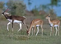
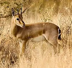
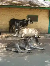
Some wildlife species, which are fast vanishing in other parts of India, are found in the desert in large numbers such as the blackbuck (Antilope cervicapra), chinkara (Gazella bennettii) and Indian wild ass (Equus hemionus khur) in the Rann of Kutch. They have evolved excellent survival strategies, their size is smaller than other similar animals living in different conditions, and they are mainly nocturnal. There are certain other factors responsible for the survival of these animals in the desert. Due to the lack of water in this region, transformation of the grasslands into cropland has been very slow. The protection provided to them by a local community, the Bishnois, is also a factor. Other mammals of the Thar Desert include a subspecies of red fox (Vulpes vulpes pusilla) and the caracal.

The region is a haven for 141 species of migratory and resident birds of the desert. One can see eagles, harriers, falcons, buzzards, kestrel and vultures. There are short-toed eagles (Circaetus gallicus), tawny eagles (Aquila rapax), greater spotted eagles (Aquila clanga), laggar falcons (Falco jugger) and kestrels. There are also a number of reptiles.
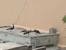
The Indian peafowl is a resident breeder in the Thar region. The peacock is designated as the national bird of India and the provincial bird of the Punjab (Pakistan). It can be seen sitting on khejri or pipal trees in villages or Deblina.
Flora
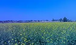
.jpg.webp)
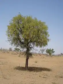
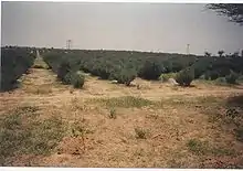
The natural vegetation of this dry area is classed as Northwestern thorn scrub forest occurring in small clumps scattered more or less openly.[17][18] Density and size of patches increase from west to east following the increase in rainfall. The natural vegetation of the Thar Desert is composed of the following tree, shrub and herb species:[19]
- trees and shrubs: Acacia jacquemontii, Balanites roxburghii, Ziziphus zizyphus, Ziziphus nummularia, Calotropis procera, Suaeda fruticosa, Crotalaria burhia, Aerva javanica, Clerodendrum multiflorum, Leptadenia pyrotechnica, Lycium barbarum, Grewia tenax, Commiphora mukul, Euphorbia neriifolia, Cordia sinensis, Maytenus emarginata, Capparis decidua, Mimosa hamata
- herbs and grasses: Ochthochloa compressa, Dactyloctenium scindicum, Cenchrus biflorus, Cenchrus setigerus, Lasiurus scindicus, Cynodon dactylon, Panicum turgidum, Panicum antidotale, Dichanthium annulatum, Sporobolus marginatus, Saccharum spontaneum, Cenchrus ciliaris, Desmostachya bipinnata, Eragrostis species, Ergamopagan species, Phragmites species, Tribulus terrestris, Typha species, Sorghum halepense, Citrullus colocynthis
The endemic floral species include Calligonum polygonoides, Prosopis cineraria, Acacia nilotica, Tamarix aphylla, Cenchrus biflorus.[20]
People

The Thar Desert is the most widely populated desert in the world, with a population density of 83 people per km2.[9] In India, the inhabitants comprise Hindus, Jains, Sikhs and Muslims. In Pakistan, inhabitants also include both Muslims and Hindus.[21]
About 40% of the total population of Rajasthan live in the Thar Desert.[22] The main occupation of the people is agriculture and animal husbandry. A colourful culture rich in tradition prevails in this desert. The people have a great passion for folk music and folk poetry.
Jodhpur, the largest city in the region, lies in the scrub forest zone. Bikaner and Jaisalmer are located in the desert proper. A large irrigation and power project has reclaimed areas of the northern and western desert for agriculture. The small population is mostly pastoral, and hide and wool industries are prominent.
The desert's part in Pakistan also has a rich multifaceted culture, heritage, traditions, folk tales, dances and music due to its inhabitants who belong to different religions, sects and castes.
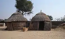
Water and housing in the desert

Water scarcity plays an important role in shaping life in all parts of the Thar. Small, intermittent ponds, whether natural (tobas) or man-made (johads), are often the only source of water for animals and humans in the true desert areas. The lack of a constant water supply causes much of the local population to live as nomads. Most human settlements are found near the two seasonal streams of the Karon-Jhar hills. Potable groundwater is also rare in the Thar Desert. Supplies are often sour due to dissolved minerals, and are only available deep underground. Wells that successfully bear sweet water attract nearby settlement, but are difficult to dig, possibly claiming the lives of the well-diggers.

According to 1980 housing census in Pakistan, there were 241,326 housing units of one or two very small rooms. The degree of crowding was six persons per housing unit and three persons per room. For most of the housing units (approximately 76 per cent), the main construction material of outer walls is unbaked bricks whereas wood is used in 10 percent and baked bricks or stones with mud bonding in 8 percent housing units. A large number of families still live in jhugis or huts which are housing units formed with straws and thin wood-sticks. These jhugis are susceptible to damage from the occasional high winds. But the poverty leaves no other option to these jhugiwalas (people living in jhugis).
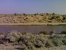
The river Luni is the only natural water source that drains inside a lake in the desert. It originates in the Pushkar valley of the Aravalli Range, near Ajmer and ends in the marshy lands of Rann of Kutch in Gujarat, after travelling a distance of 530 km. The Luni flows through part of Ajmer, Barmer, Jalor, Jodhpur, Nagaur, Pali, and Sirohi districts and Mithavirana Vav Radhanpur region of Banaskantha North Gujarat. Its major tributaries are the Sukri, Mithri, Bandi, Khari, Jawai, Guhiya and Sagi from the left, and the Jojari River from the right.
The Ghaggar is another intermittent river in India, flowing during the monsoon rains. It originates in the Shivalik Hills of Himachal Pradesh and flows through Punjab and Haryana to Rajasthan; just southwest of Sirsa, Haryana and by the side of talwara jheel in Rajasthan. This seasonal river feeds two irrigation canals that extend into Rajasthan. It terminates in Hanumangarh district.[22]
The Rajasthan Canal system is the major irrigation scheme of the Thar Desert and is conceived to reclaim it and also to check spreading of the desert to fertile areas. It is world's largest irrigation which is being extended in an attempt to make the desert arable.[23] It runs south-southwest in Punjab and Haryana but mainly in Rajasthan for a total of 650 kilometers and ends near Jaisalmer, in Rajasthan. After the construction of the Indira Gandhi Canal, irrigation facilities were available over an area of 6770 km2 in Jaisalmer district and 37 km2 in Barmer district. Irrigation had already been provided in an area of 3670 km2 in Jaisalmer district. The canal has transformed the barren deserts of this district into fertile fields. Crops of mustard, cotton, and wheat now flourish in this semi-arid western region replacing the sand there previously.
Besides providing water for agriculture, the canal will supply drinking water to hundreds of people in far-flung areas. As the second stage of work on the canal progresses rapidly, there is hope that it will enhance the living standards of the people of the state.
Recreation
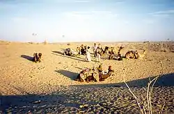
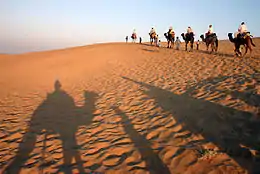
The Thar Desert provides recreational value in terms of desert festivals organized every year. Rajasthan desert festivals are celebrated with great zest and zeal. This festival is held once a year during winters. Dressed in brilliantly hued costumes, the people of the desert dance and sing haunting ballads of valor, romance and tragedy. The fair has snake charmers, puppeteers, acrobats and folk performers. Camels, of course, play a starring role in this festival, where the rich and colorful folk culture of Rajasthan can be seen.
Camels are an integral part of the desert life and the camel events during the Desert Festival confirm this fact. Special efforts go into dressing the animal for entering the competition of the best-dressed camel. Other interesting competitions on the fringes are the moustache and turban tying competitions, which not only demonstrate tradition but also inspire its preservation. Both the turban and the moustache have been centuries old symbols of honor in Rajasthan.
Evenings are meant for the main shows of music and dance. Continuing till late into the night, the number of spectators swells up each night and the grand finale, on the night of a full moon, takes place by sand dunes.
Agriculture
The Thar is one of the most heavily populated desert areas in the world with the main occupations of its inhabitants being agriculture and animal husbandry. Agriculture is not a dependable proposition in this area because after the rainy season, at least one third of crops fail. Animal husbandry, trees and grasses, intercropped with vegetables or fruit trees, is the most viable model for arid, drought-prone regions. The region faces frequent droughts. Overgrazing due to high animal populations, wind and water erosion, mining and other industries have resulted in serious land degradation.
Agricultural production is mainly from kharif crops, which are grown in the summer season and seeded in June and July. These are then harvested in September and October and include bajra, pulses such as guar, jowar (Sorghum vulgare), maize (zea mays), sesame and groundnuts. Over the past few decades the development of irrigation features including canals and tube wells have changed the crop pattern with desert districts in Rajasthan now producing rabi crops including wheat, mustard and cumin seed along with cash crops.[22]
The Thar region of Rajasthan is a major opium production and consumption area. The Indira Gandhi Canal irrigates northwestern Rajasthan while the Government of India has started a centrally sponsored Desert Development Program based on watershed management with the objective of preventing the spread of desert and improving the living conditions of people in the desert.[22]
Livestock
In the last 15–20 years, the Rajasthan desert has seen many changes, including a manifold increase of both the human and animal population. Animal husbandry has become popular due to the difficult farming conditions. At present, there are ten times more animals per person in Rajasthan than the national average, and overgrazing is also a factor affecting climatic and drought conditions.
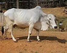
A large number of farmers in the Thar Desert depend on animal husbandry for their livelihood. Cows, buffalo, sheep, goats, camels, and oxen consists of major cattle population. Barmer district has the highest cattle population out of which sheep and goats are in majority. Some of the best breeds of bullocks such as Kankrej (Sanchori) and Nagauri are from the desert region.
Thar region of Rajasthan is the biggest wool-producing area in India. Chokla, Marwari, Jaisalmeri, Magra, Malpuri, Sonadi, Nali and Pungal breeds of sheep are found in the region. Of the total wool production in India, 40-50% comes from Rajasthan. The sheep-wool from Rajasthan is considered to be the best in the world for the carpet making industry. The wool of the Chokla breed of sheep is considered to be of high quality. Breeding centres have been developed for Karakul and Merino sheep at Suratgarh, Jaitsar and Bikaner. Some important mills for making woolen thread established in the desert are: Jodhpur Woolen Mill, Jodhpur; Rajasthan Woolen Mill, Bikaner and India Woolen Mill, Bikaner. Bikaner is the biggest mandi (market place) of wool in Asia.[22]
The live stock depends for grazing on common lands in villages. During famine years the nomadic Rebari people move with large herds of sheep and camel to the forested areas of south Rajasthan or nearby states like Madhya Pradesh for grazing their cattle.
The importance of animal husbandry can be understood from the organization of large number of cattle fairs in the region. Cattle fairs are normally named after the folk-deities. Some of major cattle fairs held are Ramdevji cattle fair at Manasar in Nagaur district, Tejaji cattle fair at Parbatsar in Nagaur district, Baldeo cattle fair at Merta city in Nagaur district, Mallinath cattle fair at Tilwara in Barmer district. Livestock is very important to the Thar Desert people.
Agroforestry

Forestry has an important part to play in the amelioration of the conditions in semi-arid and arid lands. If properly planned, forestry can make an important contribution to the general welfare of the people living in desert areas. The living standard of the people in the desert is low. They can not afford other fuels like gas and kerosene. Firewood is their main fuel, of the total consumption of wood about 75 percent is firewood. The forest cover in the desert is low. Rajasthan has a forest area of 31150 km2. which is about 9% of the geographical area. The forest area is mainly in southern districts of Rajasthan like Udaipur and Chittorgarh. The minimum forest area is in Churu district at only 80 km2. Thus the forest is insufficient to fulfill the needs of firewood and grazing in desert districts. This diverts the much needed cattle dung from the field to the hearth. This in turn results into a decrease in agricultural production. Agroforestry model is best suited to the people of desert.
The scientists of the Central Arid Zone Research Institute (CAZRI), have successfully developed and improved dozens of traditional and non-traditional crops and fruits, such as Ber trees (like plums) that produce much larger fruits than before and can thrive with minimal rainfall. These trees have become a profitable option for farmers. One example from a case study of horticulture showed that in a situation of budding in 35 plants of Ber and Guar (Gola, Seb and Mundia variety developed by CAZRI), using only one hectare of land, yielded 10,000 kg. of Ber and 250 kg. of Guar, which translates into double or even triple the profit.[24]
Arid Forest Research Institute, (AFRI) situated at Jodhpur is another national level institute in the region. It is one of the institutes of the Indian Council of Forestry Research and Education (ICFRE) working under the Indian Ministry of Environment & Forests. The objective of the institute is to carry out scientific research in forestry in order to provide technologies that increase the vegetative cover and to conserve the biodiversity in the hot arid and semi arid region of Rajasthan, Gujarat and Dadara and Nagar Haveli union territory.
The most important tree species in terms of providing a livelihood in Thar Desert communities is Prosopis cineraria.
Prosopis cineraria provides wood of construction grade. It is used for house-building, chiefly as rafters, posts scantlings, doors and windows, and for well construction water pipes, the upright posts of Persian wheels, agricultural implements and shafts, spokes, fellows and cart yokes. It can also be used for small turning work and tool-handles. Container manufacturing is another important wood-based industry, which depends heavily on desert-grown trees.
Prosopis cineraria is much valued as a fodder tree. The trees are heavily lopped, particularly during the winter months when no other green fodder is available in the dry tracts. There is a popular saying that death will not visit a man, even at the time of a famine, if he has a Prosopis cineraria, a goat and a camel, since the three together are some what said to sustain a man even under the most trying condition. The forage yield per tree varies a great deal. On an average, the yield of green forage from a full grown tree is expected to be about 60 kg with complete lopping having only the central leading shoot, 30 kg when the lower two-thirds of the crown is lopped and 20 kg when the lower one-third of the crown is lopped. The leaves are of high nutritive value. Feeding of the leaves during winter when no other green fodder is generally available in rain-fed areas is thus profitable. The pods have a sweetish pulp and are also used as fodder for livestock.
Prosopis cineraria is most important top feed species providing nutritious and highly palatable green as well as dry fodder, which is readily eaten by camels, cattle, sheep and goats, constituting a major feed requirement of desert livestock. Locally it is called Loong. Pods are locally called sangar or sangri. The dried pods locally called kho-kha are eaten. Dried pods also form rich animal feed, which is liked by all livestock. Green pods also form rich animal feed, which is liked by drying the young boiled pods. They are also used as famine food and known even to prehistoric man. Even the bark, having an astringent bitter taste, was reportedly eaten during the severe famine of 1899 and 1939. Pod yield is nearly 1.4 quintals of pods/ha with a variation of 10.7% in dry locations.
Prosopis cineraria wood is reported to contain high calorific value and provide high quality fuel wood. The lopped branches are good as fencing material. Its roots also encourage nitrogen fixation, which produces higher crop yields.

Tecomella undulata is one more tree species, locally known as rohida, which is found in the Thar Desert regions of northwest and western India. It is another important medium-sized tree of great use in agroforestry, that produces quality timber and is the main source of timber amongst the indigenous tree species of desert regions. The trade name of the tree species is desert teak or Marwar teak.
Tecomella undulata is mainly used as a source of timber. Its wood is strong, tough and durable. It takes a fine finish. Heartwood contains quinoid. The wood is excellent for firewood and charcoal. Cattle and goats eat leaves of the tree. Camels, goats and sheep consume flowers and pods.
Tecomella undulata plays an important role in the desert ecology. It acts as a soil-binding tree by spreading a network of lateral roots on the top surface of the soil. It also acts as a windbreak and helps in stabilizing shifting sand dunes. It is considered as the home of birds and provides shelter for other desert wildlife. Shade of tree crown is shelter for the cattle, goats and sheep during summer days.
Tecomella undulata has medicinal properties as well. The bark obtained from the stem is used as a remedy for syphilis. It is also used in curing urinary disorders, enlargement of spleen, gonorrhoea, leucoderma and liver diseases. Seeds are used against abscess.
Ecotourism

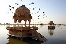
Desert safaris on camels have become increasingly popular around Jaisalmer. Domestic and international tourists frequent the desert seeking adventure on camels for anything from a day to several days. This ecotourism industry ranges from cheaper backpacker treks to plush Arabian night style campsites replete with banquets and cultural performances. During the treks tourists are able to view the fragile and beautiful ecosystem of the Thar Desert. This form of tourism provides income to many operators and camel owners in Jaisalmer as well as employment for many camel trekkers in the desert villages nearby. People from various parts of the world come to see the Pushkar ka Mela (Pushkar Fair) and oases.
Industry
Rajasthan is pre-eminent in quarrying and mining in India. The Taj Mahal was built with white marble mined from Makrana in Nagaur district. The state is the second largest source of cement in India. It has rich salt deposits at Sambhar. Jodhpur sandstone is mostly used in monuments, important buildings, and residential buildings. This stone is termed "chittar patthar". Jodhpur also has mines of red stone locally known as ghatu patthar used in construction. Sandstone is found in Jodhpur and Naguar districts. Jalore is biggest centre of granite processing units.[22]
Lignite coal deposits are there at places Giral, Kapuradi, Jalipa, Bhadka in Barmer district; Plana, Gudha, Bithnok, Barsinghpur, Mandla Charan, Raneri Hadla in Bikaner district and Kasnau, Merta, Lunsar etc., in Nagaur district. A lignite based thermal power plant has been established at Giral in Barmer district. Jindal group is working on 1080 Megawatt power project in private sector at Bhadaresh village in Barmer district. "Neyeli Lignite Barsinghpur Project" is in progress to establish two thermal power units of capacity 125 megawatts each at Barsinghpur in Bikaner district. Reliance Energy is working on establishing power generation through an underground gasification technique in Barmer district with an outlay of about 30 billion rupees.[22]
There is a large amount of good quality petroleum in Jaisalmer and Barmer districts. The main places with deposits of petroleum are Baghewal, Kalrewal, and Tawariwal in Jaisalmer district and Gudha Malani area in Barmer district. Barmer district has started petroleum production on commercial scale.[22] Barmer district is in the news due to its large oil basin. The British exploration company Cairn Energy started production of oil on a large scale. Mangala, Bhagyam and Aishwariya are the major oil fields in the district. This is India's biggest oil discovery in 22 years. This promises to transform the local economy, which has long suffered from the harshness of the desert.
The Government of India initiated departmental exploration for oil in 1955 and 1956 in the Jaisalmer area,[25] Oil India Limited discovered natural gas in 1988 in the Jaisalmer basin.[26] Also known for their fine leather messenger bags made from wild camels native to the area.
The Thar Desert seems an ideal place for generation of electricity from wind power. According to an estimate Rajasthan state has got a potential of 5500 megawatt wind power generation as such it is in the priority of the state govt. Rajasthan State Power Corporation has established its first wind power-based power plant at Amarsagar in Jaisalmer district. Some leading companies in the field are working on establishing wind mills in Barmer, Jaisalmer and Bikaner districts. Solar energy also has a great potential in this region as most of the days during a year are cloud free. A solar energy based plant has been established at Bhaleri in Churu district to convert hard water into drinking water.[22]
Salt water lakes
There are a number of salt water lakes in the Thar Desert. These are Sambhar, Pachpadra, Tal Chhapar, Falaudi and Lunkaransar where sodium chloride salt is produced from salt water. The Didwana lake produces sodium sulphate salt. Ancient archaeological evidences of habitations have been recovered from Sambhar and Didwana lakes which shows their antiquity and historical importance.[22]
History
The Desert National Park in Jaisalmer district has a collection of animal fossils and plants 180 million years old.
Jaisalmer State had its foundations in what remains of the Empire ruled by the Bhati dynasty. Early Bhati rulers ruled over large empire stretching from Ghazni[27] in modern-day Afghanistan to Sialkot, Lahore and Rawalpindi in modern-day Pakistan[28] to Bhatinda and Hanumangarh in Modern day India.[29] The empire crumbled over time because of continuous invasions from the central Asia. According to Satish Chandra, the Hindu Shahis of Afghanistan made an alliance with the Bhatti rulers of Multhan, because they wanted to end the slave raids made by the Turkic ruler of Ghazni, however the alliance was defeated by Alp Tigin in 977 CE. Bhati dominions continued to be shifted towards the South as they ruled Multan, then finally got pushed into Cholistan and Jaisalmer where Rawal Devaraja built Dera Rawal / Derawar.[30] Jaisalmer was the new capital founded in 1156 by Maharawal Jaisal Singh and the state took its name from the capital. On 11 December 1818 Jaisalmer became a British protectorate in the Rajputana Agency.[31][30]
Traditionally, the main source of income for the kingdom was levies on caravans, but the economy was heavily affected when Bombay emerged as a major port and sea trade replaced the traditional land routes. Maharawals Ranjit Singh and Bairi Sal Singh attempted to turn around the economic decline but the dramatic reduction in trade impoverished the kingdom. A severe drought and the resulting famine from 1895 to 1900, during the reign of Maharawal Salivahan Singh, only made matters worse by causing widespread loss of the livestock that the increasingly agriculturally based kingdom relied upon.
In the years 1965 and 1971, population exchanges took place in the Thar between India and Pakistan. 3,500 Muslims shifted from the Indian section of the Thar to Pakistani Thar whilst thousands of Hindu families also migrated from Pakistani Thar to the Indian section of the Thar.[32][33][34]
Thar in ancient literature
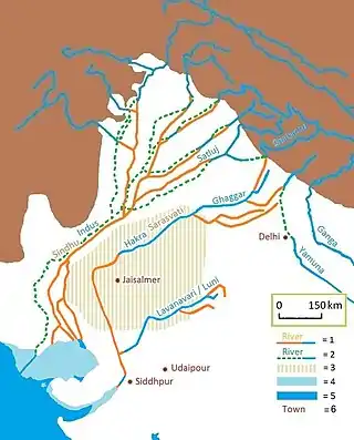
The Sarasvati River is one of the chief Rigvedic rivers mentioned in ancient Hindu texts. The Nadistuti hymn in the Rigveda mentions the Sarasvati between the Yamuna in the east and the Sutlej in the west, and later Vedic texts like Tandya and Jaiminiya Brahmanas as well as the Mahabharata mention that the Sarasvati dried up in a desert.
Most scholars agree that at least some of the references to the Sarasvati in the Rigveda refer to the Ghaggar-Hakra River.
There is also a small present-day Sarasvati River (Sarsuti) that joins the Ghaggar.
The epic Mahabharata mentions the Kamyaka Forest situated on the western boundary of the Kuru Kingdom (Kuru Proper and Kurujangala), on the banks of the Sarasvati River to the west of the Kurukshetra plain, which contained a lake known as Kamyaka. The Kamyaka forest is mentioned as being situated at the head of the Thar Desert,[22] near Lake Trinavindu. The Pandavas, on their way to exile in the woods, left Pramanakoti on the banks of the Ganges and went towards Kurukshetra, travelling in a western direction and crossing the Yamuna and Drishadvati rivers. They finally reached the banks of the Sarasvati River where they saw the forest of Kamyaka, the favourite haunt of ascetics, situated on a level and wild plain on the banks of the Sarasvati abounding in birds and deer. There the Pandavas lived in an ascetic asylum. It took three days for the Pandavas to reach the Kamyaka forest, setting out from Hastinapura, on their chariots.
In the Rigveda there is also mention of a river named Aśvanvatī along with the river Drishadvati.[35] Some scholars consider both the Sarasvati and Aśvanvatī to be the same river.[22]
Human habitations on the banks of Sarasvati and Drishadvati had shifted to the east and south directions prior to the Mahabharata period. At that time the present day Bikaner and Jodhpur areas were known as Kurujangala and Madrajangala provinces.[22]
See also
References
- Eric Dinerstein, David Olson, et al. (2017). An Ecoregion-Based Approach to Protecting Half the Terrestrial Realm, BioScience, Volume 67, Issue 6, June 2017, Pages 534–545; Supplemental material 2 table S1b.
- Sinha, R. K., Bhatia, S., & Vishnoi, R. (1996). "Desertification control and rangeland management in the Thar desert of India". RALA Report No. 200: 115–123.
- Sharma, K. K. and S. P. Mehra (2009). "The Thar of Rajasthan (India): Ecology and Conservation of a Desert Ecosystem". Chapter 1 in: Sivaperuman, C., Baqri, Q. H., Ramaswamy, G., & Naseema, M. (eds.) Faunal ecology and conservation of the Great Indian Desert. Springer, Berlin Heidelberg.
- Sharma, K. K., S. Kulshreshtha, A. R. Rahmani (2013). Faunal Heritage of Rajasthan, India: General Background and Ecology of Vertebrates. Springer Science & Business Media, New York.
- Laity, J. J. (2009). Deserts and Desert Environments. John Wiley & Sons.
- Ramesh, R., Jani, R. A., & Bhushan, R. (1993). "Stable isotopic evidence for the origin of salt lakes in the Thar desert". Journal of Arid Environments 25 (1): 117–123.
- Gwen Robbins Schug, Subhash R. Walimbe (2016). A Companion to South Asia in the Past. John Wiley & Sons. p. 64. ISBN 978-1119055471. Retrieved 6 May 2016.
- Rahmani, A. R. (1989). "The uncertain future of the Desert National Park in Rajasthan, India". Environmental Conservation 16 (03): 237–244.
- Singh, P. (ed.) (2007). "Report of the Task Force on Grasslands and Deserts" Archived 10 December 2011 at the Wayback Machine. Government of India Planning Commission, New Delhi.
- WII (2015). Conservation Reserves Wildlife Institute of India, Dehradun.
- Ghalib, S. A., Khan, A. R., Zehra, M., & Abbas, D. (2008). "Bioecology of Nara Desert Wildlife Sanctuary, Districts Ghotki, Sukkur and Khairpur, Sindh". Pakistan Journal of Zoology 40 (1): 37–43.
- http://www.wildlifeofpakistan.com/sanctuaries.html
- Ghalib, S. A. (Karachi Univ (Pakistan) Dept of Zoology/Wildlife and Fisheries); Khan, M. Z. (Karachi Univ (Pakistan) Dept of Zoology/Wildlife and Fisheries); Hussain, S. A. (Environmental Management Consultants; Zehra, A. (Karachi Univ (Pakistan) Dept of Zoology/Wildlife and Fisheries); Samreen, N. (Karachi Univ (Pakistan) Dept of Zoology/Wildlife and Fisheries); Tabassum, F. (Karachi Univ (Pakistan) Dept of Zoology/Wildlife and Fisheries); Jabeen, T. (Karachi Univ (Pakistan) Dept of Zoology/Wildlife and Fisheries); Khan, A. R. (Halcrow Pakistan (Pvt) Ltd; Sharma, L. (Sindh Wildlife Dept; Bhatti, T. (Sindh Board of Revenue. "Current distribution and status of the mammals, birds and reptiles in Rann of Kutch Wildlife Sanctuary, Sindh". International Journal of Biology and Biotechnology (Pakistan). ISSN 1810-2719.
- "Lal Suhanra". UNESCO. Retrieved 28 December 2016.
- "UNESCO - MAB Biosphere Reserves Directory". www.unesco.org. Retrieved 21 April 2020.
- "Breeds of Livestock - Tharparkar Cattle — Breeds of Livestock, Department of Animal Science". afs.okstate.edu. Retrieved 5 August 2019.
- Champion, H. G. and S. K. Seth. (1968). A revised survey of the forest types of India. Government of India Press
- Negi, S. S. (1996). Biosphere Reserves in India: Landuse, Biodiversity and Conservation. Indus Publishing Company, Delhi.
- Kaul, R. N. (1970). "Afforestation in arid zones". Monographiiae Biologicae (20), The Hague.
- Khan, T. I., & Frost, S. (2001). "Floral biodiversity: a question of survival in the Indian Thar Desert". Environmentalist 21 (3): 231–236.
- Raza, Hassan (5 March 2012). "Mithi: Where a Hindu fasts and a Muslim does not slaughter cows". Dawn.
A Muslim resident of Thar shared his account by saying: "In our village, Hindus and Muslims have been living together for decades and there has not been a single day, when I have seen a religious conflict. No loud speaker is used for Azaan at the time when Hindus are worshiping in their temple, and no bells are rung when it is time for namaz. Nobody eats in public when it is Ramazan and Holi is played by every member of the village." I had always heard stories about interfaith harmony from Sindh but it was so much more amazing to see it firsthand. The love and brotherhood that exists between the Hindus and Muslims of Mithi is a perfect example of pluralism and the tolerant Sufi culture of Sindh.
- Gupta, M. L. (2008). Rajasthan Gyan Kosh. 3rd Edition. Jojo Granthagar, Jodhpur. ISBN 81-86103-05-8
- Guide to Places of the World, The Reader's Digest Association Ltd, London, 1987, p. 540
- "Arid Agriculture: State-of-the-Art Agro-Forestry vs. Deserts on the March" Archived 19 December 2006 at the Wayback Machine. Brook & Gaurav Bhagat 14 August 2003
- "PlanningCommission.NIC.in". Archived from the original on 14 April 2006. Retrieved 16 November 2009.
- OilIndia.NIC.in Archived 30 June 2006 at the Wayback Machine
- "Rajasthan or the Central and Western Rajpoot States, Volume 2, page 197-198". Higginbotham And Co. Madras. 14 August 2018.
- "Imperial Gazetter of India, Volume 21, page 272 - Imperial Gazetteer of India - Digital South Asia Library". Dsal.uchicago.edu. 18 February 2013. Retrieved 22 November 2013.
- "Bhatinda Government: District at A glance- Origin". Bhatinda Government. 14 August 2018. Archived from the original on 10 January 2011. Retrieved 14 August 2018.
- "Provinical Gazetteers Of India: Rajputana". Government of India. 14 August 2018.
- Princely States of India
- Hasan, Arif; Raza, Mansoor (2009). Migration and Small Towns in Pakistan. IIED. pp. 15–16. ISBN 9781843697343.
In the 1965 war, Pakistan captured a large area of the Indian part of the Thar Desert, and in 1971 India captured a large part of the Thar Desert in Pakistan. Many UCs in Pakistani Thar were Hindu majority areas, and Pakistani Thar as a whole was dominated by the Hindu upper caste who controlled most of the productive land and livestock. They also dominated the politics of Thar and strictly enforced caste divisions, making upward social and economic mobility almost impossible for the Hindu lower castes. Their control over the caste system also ensured the maintenance of agriculture-related infrastructure through baigar (forced labour) and the protection of forests and pasture lands. Following the 1965 and 1971 wars, the Hindu upper castes and their retainers fled to India. As a result, the feudal institutions that managed agricultural production and the maintenance of infrastructure collapsed. This has had severe repercussions on the natural environment of Thar. In addition, the lower castes were freed from serfdom and to some extent from discrimination. Many of their members, as a result, have acquired education and are important professionals and NGO leaders. Apart from the migration of Hindus to India, 3,500 Muslim families moved from Indian Thar to Pakistani Thar. They were given 12 acres of land per family (a total of 42,000 acres), thus introducing another factor in the social and political structure of Thar and creating a new interest group.
- Maini, Tridivesh Singh (15 August 2012). "Not just another border". Himal South Asian.
It was not 1947 but the Indo-Pak war of 1971 which proved to be the game changer on this part of the border, since it was then that Hindus from Sindh, worried about persecution in Pakistan, fled to India. The cross-border train service had already been stopped following the 1965 war between India and Pakistan, and resumed only in 2006. Hindu Singh Sodha, a 15-year-old at that time he fled Pakistan in 1971, has set up the Seemant Lok Sangathan, which has been fighting for citizenship rights for all Hindu refugees from Sindh. During the war, Muslims from this region also fled to Pakistan.
- Arisar, Allah Bux (6 October 2015). "Families separated by Pak-India border yearn to see their loved ones". News Lens Pakistan. Retrieved 25 December 2016.
Another woman, Amnat, a resident of Umerkot had a similar story to tell. She was married at the age of 17 and her husband took her to Pakistan. She is presently 60 years old. Her husband passed away 23 years ago. "My father Abdul Karim had also migrated from Rajasthan, India to Umerkot". One of reasons is that his daughter lives in Sindh. Her father narrated to her that at the time of Pak-India wars, Muslims in the border's districts were robbed, killed and harassed by the Indian army, hence he preferred to migrate to a Muslim country like Pakistan to avoid confrontation. She recalled that in the 1965 War between Pakistan and India; Kaprao, Konro, Boath, Vauri, Gahrr jo Tarr, Dedohar, Mate ka Talha, Bijhrar, and a number of other border villages were evacuated. Four persons were killed in the village of Kaprao by the Indian Army based on the allegations that they had been helping the Pakistan Army.
- aśmanvatī rīyate saṃ rabhadhvamut tiṣṭhata pra taratāsakhāyaḥ | atrā jahāma ye asannaśevāḥ śivān vayamuttaremābhi vājān || (RV:10.53.8)
Further reading
- Bhandari M. M. Flora of The Indian Desert, MPS Repros, 39, BGKT Extension, New Pali Road, Jodhpur, India.
- Zaigham, N. A. (2003). "Strategic sustainable development of groundwater in Thar Desert of Pakistan". Water Resources in the South: Present Scenario and Future Prospects, Commission on Science and Technology for Sustainable Development in the South, Islamabad.
- Govt. of India. Ministry of Food & Agriculture booklet (1965)—"Soil conservation in the Rajasthan Desert"—Work of the Desert Afforestation Research station, Jodhpur.
- Gupta, R. K. & Prakash Ishwar (1975). Environmental analysis of the Thar Desert. English Book Depot., Dehra Dun.
- Kaul, R. N. (1967). "Trees or grass lands in the Rajasthan: Old problems and New approaches". Indian Forester, 93: 434–435.
- Burdak, L. R. (1982). "Recent Advances in Desert Afforestation". Dissertation submitted to Shri R. N. Kaul, Director, Forestry Research, F.R.I., Dehra Dun.
- Yashpal, Sahai Baldev, Sood, R.K., and Agarwal, D.P. (1980). "Remote sensing of the 'lost' Saraswati river". Proceedings of the Indian Academy of Sciences (Earth and Planet Science), V. 89, No. 3, pp. 317–331.
- Bakliwal, P. C. and Sharma, S. B. (1980). "On the migration of the river Yamuna". Journal of the Geological Society of India, Vol. 21, Sept. 1980, pp. 461–463.
- Bakliwal, P. C. and Grover, A. K. (1988). "Signature and migration of Sarasvati river in Thar desert, Western India". Record of the Geological Survey of India V 116, Pts. 3–8, pp. 77–86.
- Rajawat, A. S., Sastry, C. V. S. and Narain, A. (1999-a). "Application of pyramidal processing on high resolution IRS-1C data for tracing the migration of the Saraswati river in parts of the Thar desert". in "Vedic Sarasvati, Evolutionary History of a Lost River of Northwestern India", Memoir Geological Society of India, Bangalore, No. 42, pp. 259–272.
- Ramasamy, S. M. (1999). "Neotectonic controls on the migration of Sarasvati river of the Great Indian desert". in "Vedic Sarasvati, Evolutionary History of a Lost River of Northwestern India", Memoir Geological Society of India, Bangalore, No. 42, pp. 153–162.
- Rajesh Kumar, M., Rajawat, A. S. and Singh, T. N. (2005). "Applications of remote sensing for educidate the Palaeochannels in an extended Thar desert, Western Rajasthan", 8th annual International conference, Map India 2005, New Delhi.
External links
| Wikimedia Commons has media related to Thar Desert. |
 Thar Desert travel guide from Wikivoyage
- Rajasthan Tourism
- "Thar Desert". Terrestrial Ecoregions. World Wildlife Fund.
- Dharssi.org.uk, Photos of the Thar Desert
- Avgustin.net, Photos of the Thar Desert in Pakistan side
- MIT.gov, आपणो राजस्थान
| Outline |
|  | |||||||||||||
|---|---|---|---|---|---|---|---|---|---|---|---|---|---|---|---|
| Governance |
| ||||||||||||||
| Divisions and districts |
| ||||||||||||||
| Major cities | |||||||||||||||
| Related templates |
| ||||||||||||||
| History | |
|---|---|
| Government and politics | |
| Culture |
|
| Geography | |
| Education | |
| Sports | |
| Flora & Fauna | |
| Sindhi Media | |
| Sindhi Websites | |
| Sindh Tourism | |
| Authority control |
|---|