Greater Glasgow
Greater Glasgow is an urban settlement in Scotland consisting of all localities which are physically attached to the city of Glasgow, forming with it a single contiguous urban area (or conurbation). It does not relate to municipal government boundaries and its territorial extent is defined by the General Register Office for Scotland, which determines settlements in Scotland for census and statistical purposes. Greater Glasgow had a population of 1,199,629 at the time of the 2001 UK Census[4] making it the largest urban area in Scotland and the fifth-largest in the United Kingdom.[5] However, the population estimate for the Greater Glasgow 'settlement' (a chain of continuously populated postcodes) in mid-2016 was 985,290[6] – the reduced figure explained by the removal of the Motherwell & Wishaw (124,790), Coatbridge & Airdrie (91,020) and Hamilton (83,730) settlement areas east of the city due to small gaps between the populated postcodes. The 'new towns' of Cumbernauld (which had a 2016 settlement population of 50,920) and East Kilbride (75,120) were never included in these figures despite their close ties to Glasgow due to having a clear geographical separation from the city.
Greater Glasgow
| |
|---|---|
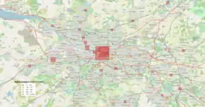
 Satellite image showing the Greater Glasgow Area | |
| Area | 265 km2 (102 sq mi) [1] |
| Population | 985,290 (2016)[2] |
| Language | English, Scots, Gaelic[3] |
| OS grid reference | NS590655 |
| • Edinburgh | 42 mi (68 km) |
| • London | 403 mi (649 km) |
| Country | Scotland |
| Sovereign state | United Kingdom |
| Post town | GLASGOW |
| Postcode district | G1–G84 |
| Post town | PAISLEY |
| Postcode district | PA1–PA19 |
| Post town | MOTHERWELL |
| Postcode district | ML1–ML8 |
| Dialling code | 0141, 01236, 01355, 01360, 01389, 01505, 01698, 01475 |
A more extensive Greater Glasgow concept covers a much larger area, and may include Ayrshire down to Ayr as well as the whole of Lanarkshire down to Lanark, Dunbartonshire, Renfrewshire and Inverclyde. At present the Glasgow City Region consists of the Glasgow City Council, North Lanarkshire, South Lanarkshire, West Dunbartonshire, East Dunbartonshire, Renfrewshire, East Renfrewshire and Inverclyde Local Authorities with a combined population of over 1.7 million. This city-region is described as a metropolitan area by its own strategic planning authority, and is similar to the Glasgow metropolitan area identified by the European Union.
The City of Glasgow grew substantially in population during the late-nineteenth and early-twentieth centuries, becoming in 1912 the eighth city in Europe to reach the one million mark after Rome, London, Paris, Berlin, Vienna, St Petersburg and Moscow. The official population stayed over a million for fifty years.[7] Since the 1960s, successive boundary changes and large-scale relocation to suburban districts and new towns have reduced the population of the City of Glasgow council area to 593,245 at the time of the 2011 UK Census.
Greater Glasgow urban area
Following the local government boundary changes in 1996 and the creation of unitary councils in Scotland, replacing the former regional and district councils, the Greater Glasgow Settlement Area or Urban Area was created for the 2001 Census from groups of neighbouring urban postcodes grouped so that each group of postcode units (known as a locality) contains at least a given number of addresses per unit area, and the group contains at least 500 residents. The localities that make up Greater Glasgow are listed below:
| Locality | Population
(1991 census) |
Population
(2001 census)[4] |
Population
(2016 estimate)[6] |
|---|---|---|---|
| Airdrie[lower-alpha 1] | 12,436 | 36,326 | 37,410 |
| Bargeddie[lower-alpha 1] | 2,325 | 2,790 | 2,960 |
| Barrhead[lower-alpha 1] | 16,703 | 17,443 | 17,610 |
| Bearsden | 27,707 | 27,967 | 28,120 |
| Bellshill[lower-alpha 1] | 20,075 | 20,134 | 20,290 |
| Bishopbriggs | 23,825 | 23,118 | 23,540 |
| Blantyre[lower-alpha 1] | 16,900 | ||
| Bothwell[lower-alpha 1] | 6,380 | ||
| Bowling | 5,500 | 5,500 | 560 |
| Busby | 1,617 | 1,654 | 3,250 |
| Cambuslang | 23,212 | 24,500 | 29,100 |
| Chapelhall | 4,405 | 5,691 | 6,690 |
| Chryston[lower-alpha 1] | 3,000 | ||
| Clarkston | 18,899 | 19,136 | 9,860 |
| Clydebank | 29,171 | 29,858 | 26,320 |
| Coatbridge[lower-alpha 1] | 40,320 | 41,170 | 43,960 |
| Duntocher and Hardgate | 7,882 | 7,301 | 6,880 |
| Elderslie | 5,166 | 5,180 | 5,330 |
| Erskine | 15,166 | 15,347 | 15,510 |
| Faifley | 6,087 | 4,932 | 4,860 |
| Gartcosh[lower-alpha 1] | 2,200 | ||
| Giffnock | 16,190 | 16,178 | 12,300 |
| Glasgow | 658,379 | 629,501 | 612,040 |
| Hamilton[lower-alpha 1] | 44,658 | 53,457 | 54,080 |
| Inchinnan | 1,233 | 1,574 | 1,860 |
| Johnstone | 18,280 | 16,468 | 16,090 |
| Kilbarchan | 3,710 | 3,622 | 3,480 |
| Linwood | 10,183 | 9,058 | 8,600 |
| Milngavie | 11,992 | 12,795 | 12,940 |
| Moodiesburn[lower-alpha 1] | 6,890 | ||
| Motherwell[lower-alpha 1] | 27,426 | 30,301 | 32,590 |
| Muirhead[lower-alpha 1] | 1,380 | ||
| Netherlee | 4,600 | ||
| Newton Mearns | 19,342 | 22,637 | 26,600 |
| Old Kilpatrick | 2,408 | 3,199 | 4,680 |
| Paisley | 73,925 | 74,170 | 77,220 |
| Renfrew | 20,764 | 20,251 | 22,570 |
| Rutherglen | 25,000 | 25,000 | 31,190 |
| Stamperland | 3,640 | ||
| Stepps | 4,942 | 4,802 | 7,450 |
| Thornliebank | 3,980 | 4,051 | 4,070 |
| Uddingston[lower-alpha 1] | 6,370 | ||
| Wishaw[lower-alpha 1] | 26,439 | 28,564 | 30,290 |
- No longer included in Greater Glasgow in 2016 figures.
Transport
In 1973, the Greater Glasgow Passenger Transport Executive was created to take over control of Glasgow Corporation Transport (which included the Glasgow Subway). Following local government reorganisation in 1975, control subsequently passed to Strathclyde Regional Council. The former PTE is now the Strathclyde Partnership for Transport, within Transport Scotland.
The city is served by the only metro system in Scotland, the Glasgow Subway; and by two international airports, Glasgow Prestwick Airport[8] and Glasgow Airport.[9]
Glasgow City Region
The Glasgow City Region[10] is a collection of local authorities clustered around Glasgow.[11] The eight constituent authorities are:
- Glasgow
- East Dunbartonshire
- West Dunbartonshire
- North Lanarkshire
- South Lanarkshire
- East Renfrewshire
- Renfrewshire
- Inverclyde
The population of this area in 2011 was 1,787,515. The city region is not a conurbation as significant parts of the council areas (and the whole of Inverclyde) are separated from Greater Glasgow by open countryside. It uses numerous other terms for itself, including Metropolitan Glasgow,[10] the metropolitan City-Region of Glasgow,[12] Glasgow and the Clyde Valley and Clydeside.
As a collection of individual local authorities the city region has no single municipal government however, following the agreement of a City Deal with the UK Government, the eight constituent authorities formally established a joint Glasgow and Clyde Valley Cabinet on 20 January 2015. This cabinet consists of the leaders of all eight councils, with the leader of Glasgow City Council being Chair of the Cabinet.[13] Prior to 2015 the eight authorities formed only a combined strategic planning authority.[12]
Metropolitan Glasgow
While the Scottish Government makes no official recognition of 'Metropolitan status' in its workings,[14] the term is used by other bodies. The European Union's statistical body Eurostat lists Glasgow as the 32nd most populous metropolitan area, or Larger Urban Zones, in the EU. Although not defining the boundaries of this metropolitan area, Eurostat state it consists "of over 1.7 million inhabitants covering an area of 3,346 km2".,[15] which is similar to the 1.75 million population of the Glasgow City Region and may suggest a correlation between the two. The Glasgow City Region's strategic development authority describes itself as the planning authority for the "Glasgow metropolitan area"[16] and the "metropolitan city-region of Glasgow".[12]
The former local government region of Strathclyde has also been identified as a metropolitan area surrounding the Greater Glasgow conurbation, and covers approximately 2.3 million people, 41% of Scotland's population.[17]
See also
- Central belt
References
- Urban Areas
- "Layout 1" (PDF). Glasgow.gov.uk. Retrieved 14 November 2012.
- "Key Statistics for Settlements and Localities Scotland". General Register Office for Scotland. Archived from the original on 27 September 2007. Retrieved 8 September 2008.
- The UK’s major urban areas Archived 2010-01-07 at the Wayback Machine Office for National Statistics, 2005
- "NRS – Background Information Settlements and Localities" (PDF). National Records of Scotland. Retrieved 29 September 2020.
- Archived 27 April 2009 at the Wayback Machine
- "Glasgow Prestwick Airport. Holidays, parking, flight arrival and departure information". Gpia.co.uk. 6 September 2012. Retrieved 14 November 2012.
- "Welcome to Glasgow Airport | Parking". Glasgow Airport. Retrieved 14 November 2012.
- "Unknown" (PDF). Glasgow.gov.uk. Retrieved 14 November 2012. Cite uses generic title (help)
- "Glasgow and Clyde Valley Structure Plan". Gcvore.gov.uk. Archived from the original on 20 May 2007. Retrieved 8 September 2008.
- "Glasgow and the Clyde Valley Structure Plan Joint Committee | GCVSDPA". Gcvcore.gov.uk. 28 February 2009. Archived from the original on 3 April 2012. Retrieved 14 November 2012.
- "Committee Information - Error". www.glasgow.gov.uk.
- "Parliamentary Business : Scottish Parliament". Scottish.parliament.uk. 14 August 2011. Archived from the original on 5 June 2011. Retrieved 14 November 2012.
- "CityProfiles". Urban Audit. Archived from the original on 17 December 2007. Retrieved 14 November 2012.
- "Glasgow and Clyde Valley Structure Plan Joint Committee". Gcvcore.gov.uk. 7 May 1998. Archived from the original on 20 May 2007. Retrieved 14 November 2012.
- "Minister backs SPT on White Paper". Interchange Issue 7. Strathclyde Partnership for Transport. September 2004. Archived from the original on 13 June 2007. Retrieved 9 July 2007.