Henderson Executive Airport
Henderson Executive Airport (IATA: HSH, ICAO: KHND, FAA LID: HND) is a public airport located in Henderson, Nevada, 13 miles south of Las Vegas, in Clark County, Nevada. The airport is owned by Clark County[1] and operated by the Clark County Department of Aviation. The FAA's National Plan of Integrated Airport Systems for 2009-2013 categorized it as a reliever airport.[2] It was originally Sky Harbor Airport, but was renamed in 1996 when Clark County bought it to be a reliever airport for McCarran International Airport.
Henderson Executive Airport | |||||||||||||||
|---|---|---|---|---|---|---|---|---|---|---|---|---|---|---|---|
 | |||||||||||||||
.jpg.webp) | |||||||||||||||
| Summary | |||||||||||||||
| Airport type | Public | ||||||||||||||
| Owner | Clark County, Nevada | ||||||||||||||
| Operator | Clark County Department of Aviation | ||||||||||||||
| Serves | Las Vegas, Nevada | ||||||||||||||
| Location | Henderson, Nevada | ||||||||||||||
| Elevation AMSL | 2,492 ft / 760 m | ||||||||||||||
| Coordinates | 35°58′22″N 115°08′04″W | ||||||||||||||
| Website | www | ||||||||||||||
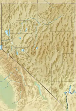
| Map | |||||||||||||||
 HND  HND | |||||||||||||||
| Runways | |||||||||||||||
| |||||||||||||||
| Statistics (Sept 2014 - Sept 2015) | |||||||||||||||
| |||||||||||||||
Most U.S. airports use the same three-letter location identifier for the FAA and IATA, but Henderson Executive Airport is HND to the FAA[1] and HSH to the IATA[3] (which assigned HND to Haneda Airport in Tokyo, Japan[4]). The airport's ICAO identifier is KHND.[3][5]
Facilities
The airport covers 760 acres (310 ha) at an elevation of 2,492 feet (760 m). It has two asphalt runways: 17R/35L is 6,501 by 100 feet (1,982 m × 30 m) and 17L/35R is 5,001 by 75 feet (1,524 m × 23 m).[1]
In the year ending September 30, 2015 the airport had 71,323 aircraft operations, average 195 per day: 86% general aviation, 14% air taxi and <1% military. 252 aircraft were then based at the airport: 81% single-engine, 12% multi-engine, 7% jet and 3% helicopter.[1]
The terminal has car rental, flight school, line service facilities, and the Landings Restaurant.
References
- FAA Airport Form 5010 for HND PDF. Federal Aviation Administration. Effective August 27, 2009.
- National Plan of Integrated Airport Systems (NPIAS): 2009-2013. Federal Aviation Administration. October 1, 2008.
- Great Circle Mapper: HSH/KHND - Las Vegas, Nevada (Henderson Executive Airport)
- Great Circle Mapper: HND/RJTT - Tokyo, Japan (Haneda Airport)
- AirNav: KHND - Henderson Executive Airport
External links
- Henderson Executive Airport, official site
- Aerial photo as of June 1994 from USGS The National Map
- "Diagram of Henderson Executive Airport (HND)" (PDF). Archived from the original (PDF) on 2016-03-04. (32.6 KB) from Nevada DOT
- FAA Airport Diagram for Henderson Executive (HND) (PDF), effective January 28, 2021
- FAA Terminal Procedures for Henderson Executive (HND), effective January 28, 2021
- Businesses based at Henderson Executive:
- Desert Flying Club - Nevada Non-Profit, official site
- Resources for this airport:
- FAA airport information for HND
- AirNav airport information for KHND
- ASN accident history for HSH
- FlightAware airport information and live flight tracker
- NOAA/NWS weather observations: current, past three days
- SkyVector aeronautical chart, Terminal Procedures
- NOAA/NWS current weather conditions