Fengbin
Fengbin Township[2] is a rural township located in Hualien County, Taiwan, bordering Taitung County. The Pacific Ocean lies to the east and the Hai'an Range to the west.
Fengbin Township
豐濱鄉 Toyohama | |
|---|---|
 | |
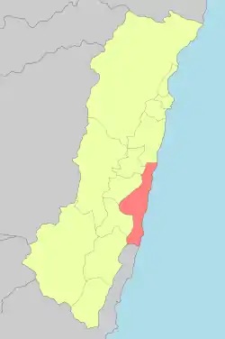 Fengbin Township in Hualien County | |
 Fengbin Township 豐濱鄉 Fengbin Township in Hualien County | |
| Coordinates: 23.591055°N 121.503794°E | |
| Country | Taiwan |
| Province | Taiwan |
| County | Hualien |
| Area | |
| • Total | 162.4 km2 (62.7 sq mi) |
| Population (December 2014) | |
| • Total | 4,706 |
| • Density | 29/km2 (75/sq mi) |
| Website | http://www.feng-bin.gov.tw/bin/home.php |
| Fengbin Township | |
|---|---|
| Chinese name | |
| Chinese | 豐濱鄉 |
| Hanyu Pinyin | Fēngbīn Xiāng |
| Wade–Giles | Feng1-pin1 Hsiang1 |
| Pha̍k-fa-sṳ | Fûng-pîn-hiông |
| Hokkien POJ | Hong-pin-hiong |
| Amis name | |
| Amis | Fakong[1] |
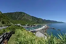
Shitiping Port
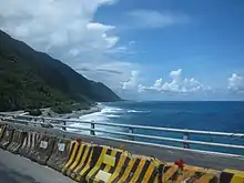
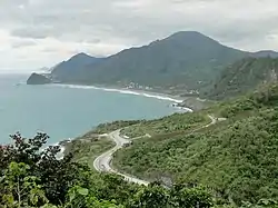
Hualien-Taitung Coastal Highway passing through Fengbin Township
It has the smallest population in Hualien County with around 4,706 inhabitants. The population consists of the indigenous Amis, Kavalan and Sakizaya peoples.
Administrative divisions

Map of Fengbin (labeled as Byōtō) and surrounding area (1944)
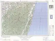
Map including Fenglin (labeled as Mao-kung (Byōtō) 猫公) (1951)
- Jingpu Village
- Gangkou Village
- Fengbin Village
- Xinshe Village
- Jici Village
Tourist attractions
- Taiwan East Coast National Scenic Area
- Xiuguluan River Rafting
- Fengbin Tropic of Cancer Marker
- Jici seaside resort
- Chenghong Bridge Recreation Area
- Shitiping Scenic Area
- Shitiping Port Whale Watching
Transportation
| Wikimedia Commons has media related to Fengbin Township, Hualien. |
References
- Sing ‘Olam. 阿美語簡明詞典(學生版) O Citing no Pangcah. Taipei: 臺灣族群母語推行委員會, 2011. ISBN 9789868693630
- 臺灣地區鄉鎮市區級以上行政區域名稱中英對照表 Glossary of Names for Administrative Divisions. Ministry of the Interior. 26 March Minguo 104 (2015). Retrieved 5 October 2017. (in Chinese)
External links
Cities and townships of Hualien County | ||
|---|---|---|
| Cities | 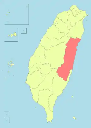 | |
| Urban townships | ||
| Rural townships | ||
| Mountain indigenous townships | ||
| Highland aboriginal Townships and Districts |
|  | ||||||||||||||||||||||||
|---|---|---|---|---|---|---|---|---|---|---|---|---|---|---|---|---|---|---|---|---|---|---|---|---|---|---|
| Plains aboriginal Townships and County-Administered Cities |
| |||||||||||||||||||||||||
Note: On the map, "Mountain Indigenous Areas" are in dark green and "Plains Indigenous Areas" are in light green. | ||||||||||||||||||||||||||
This article is issued from Wikipedia. The text is licensed under Creative Commons - Attribution - Sharealike. Additional terms may apply for the media files.