Huangzhou District
Huangzhou District is an urban district of Huanggang, Hubei province, China.
Huangzhou
黄州区 Hwangchow, Hoang-tcheou | |
|---|---|
 Li Siguang Memorial Museum | |
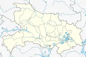 Huangzhou Location in Hubei | |
| Coordinates: 30°26′02″N 114°52′44″E | |
| Country | People's Republic of China |
| Province | Hubei |
| Prefecture-level city | Huanggang |
| Time zone | UTC+8 (China Standard) |
| Website | 黄冈市黄州区人民政府门户网站 (Huanggang City Huangzhou District People's Government Web Portal) (in Simplified Chinese) |
| Huangzhou District | |||||||||
|---|---|---|---|---|---|---|---|---|---|
| Traditional Chinese | 黃州區 | ||||||||
| Simplified Chinese | 黄州区 | ||||||||
| Literal meaning | District of the Yellow Prefectural Seat | ||||||||
| |||||||||
History

In 845 BC Marquis Wen 文侯 Huang Meng 黃孟 (aka Huang Zhang 黃璋) moved the capital of the State of Huang from Yicheng to Huangchuan (present-day Huangchuan, Henan). Huang Xi's descendants ruled State of Huang until 648 BC when it was destroyed by the State of Chu. The Marquis of Huang, Marquis Mu 穆侯 Huang Qisheng 黃企生, fled to the state of Qi. The people of Huang were forced to relocate to Chu. They settled in the region of present-day Hubei province, in a region known as the Jiangxia Prefecture 江夏郡 during the Han dynasty (206 BC-AD 220). There are many places in this region today that were named after Huang e.g. Huanggang, Huangpi, Huangmei, Huangshi, Huang'an (now Hong'an), Huangzhou etc. A large number of the people of Huang were also relocated to regions south of the Yangtze River.
Huangzhou was previously a separate city which administered a prefecture in its own right. Huanggang Middle School and the campuses of Huanggang Normal University are located in Huangzhou.
Geography
Administrative Divisions
Huangzhou District administers:[1][2][3]
| # | Name | Chinese (S) | ||||
|---|---|---|---|---|---|---|
| Districts | ||||||
| 1 | Chibi Subdistrict Red Cliff | 赤壁街道 | ||||
| 2 | Donghu Subdistrict East Lake | 东湖街道 | ||||
| 3 | Yuwang Subdistrict King Yu | 禹王街道 | ||||
| 4 | Nanhu Subdistrict South Lake | 南湖街道 | ||||
| Towns | ||||||
| 5 | Lukou Town Intersection (road) | 路口镇 | ||||
| 6 | Ducheng Town | 堵城镇 | ||||
| 7 | Chencelou Town | 陈策楼镇 | ||||
| Township | ||||||
| 8 | Taodian Township Tao Store | 陶店乡 | ||||
| Other Areas | ||||||
| 9 | Railway Station Economic Development Area | 火车站经济开发区 | ||||
References
- 行政区划 (in Chinese). Huangzhou District People's Government. 28 May 2015. Retrieved 5 January 2018.
2014年,黄州区辖3镇1乡4个街道办事处1 个火车站经济开发区,116个行政村、24个社区。
- 黄冈市乡镇(街道)名录 [Huanggang City Township-level Divisions List] (in Chinese). XZQH.org. 15 August 2014. Retrieved 5 January 2018.
黄州区辖4个街道、3个镇、1个乡:赤壁街道、东湖街道、禹王街道、南湖街道、路口镇、堵城镇、陈策楼镇、陶店乡。区政府驻赤壁街道。
- 中国地质邮政编码簿(2015). 中国邮政集团公司. 2015. p. 594.
| Wikimedia Commons has media related to Huangzhou District. |
| Look up Huangzhou or Huang-chou in Wiktionary, the free dictionary. |