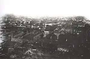
Hanyang District
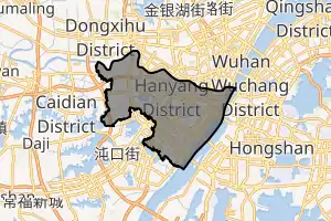
Hanyang District (simplified Chinese: 汉阳区; traditional Chinese: 漢陽區; pinyin: Hànyáng Qū) forms part of the urban core of and is one of 13 urban districts of the prefecture-level city of Wuhan, the capital of Hubei Province, China. Currently, it is a district and stands between the Han River (right/southern bank) and the Yangtze River (left/northwestern bank), where the former drains into the latter. It is connected by bridges with its former sister cities, Hankou and Wuchang. Presently, on the left bank of the Yangtze, it borders the districts of Qiaokou to the north across the Han River, Jianghan to the northeast, Caidian to the southwest, and Dongxihu to the northwest; on the opposite bank it borders Wuchang and Hongshan. Guiyuan Temple is located in Hanyang.
Hanyang
汉阳区 | ||||||||||||||||||||||||||||||||||||
|---|---|---|---|---|---|---|---|---|---|---|---|---|---|---|---|---|---|---|---|---|---|---|---|---|---|---|---|---|---|---|---|---|---|---|---|---|
 | ||||||||||||||||||||||||||||||||||||
| ||||||||||||||||||||||||||||||||||||
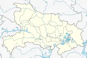 Hanyang Location in Hubei | ||||||||||||||||||||||||||||||||||||
| Coordinates: 30°32′23″N 114°12′43″E[1] | ||||||||||||||||||||||||||||||||||||
| Country | People's Republic of China | |||||||||||||||||||||||||||||||||||
| Province | Hubei | |||||||||||||||||||||||||||||||||||
| Sub-provincial city | Wuhan | |||||||||||||||||||||||||||||||||||
| Township-level (4th) subdivisions | 13 | |||||||||||||||||||||||||||||||||||
| Area | ||||||||||||||||||||||||||||||||||||
| • Total | 108.34 km2 (41.83 sq mi) | |||||||||||||||||||||||||||||||||||
| Population (2010)[3] | ||||||||||||||||||||||||||||||||||||
| • Total | 792,183 | |||||||||||||||||||||||||||||||||||
| • Density | 7,312/km2 (18,940/sq mi) | |||||||||||||||||||||||||||||||||||
| Time zone | UTC+8 (China Standard) | |||||||||||||||||||||||||||||||||||
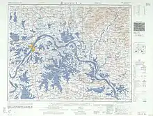
| Wuhan district map |
| |||||||||||||||||||||||||||||||||||
| Website | www | |||||||||||||||||||||||||||||||||||
| Hanyang District | |||||||||
|---|---|---|---|---|---|---|---|---|---|
| Traditional Chinese | 漢陽區 | ||||||||
| Simplified Chinese | 汉阳区 | ||||||||
| |||||||||
The name "Hanyang" means "the Yang side of Han River", referring to the town's historic location on the north ("yang") bank of the Han River mouth. However, the lower Han River changed course to the north side of the town during Ming dynasty's Chenghua-era. The town, now on the south ("yin") side of the river, should have been renamed to "Hanyin" by naming convention, but the name "Hanyang" remained as it was well-established since the Sui dynasty. Administratively, the area forms Hanyang District of the modern Wuhan city, with an area of 108 square kilometers (42 sq mi) and a population of 510,000.[4]
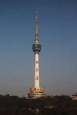
The Hanyang Arsenal is known for its production of the so-called "Hanyang rifle" - an indigenous Asian copy of the German Model 1888 Commission Rifle, which was heavily used in World War II, as well as in the Korean War and Vietnam War.
Geography
Administrative divisions
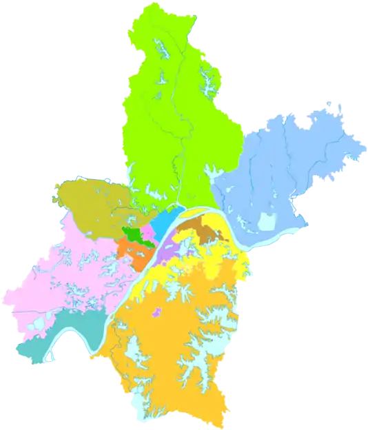
As of 2016, Hanyang District administers eleven subdistricts, one economic development zone and one administrative committee:[5][6]
| # | Name | Chinese (S) | Hanyu Pinyin | English Meaning | Population (2010)[7] | Area (km2)[8] |
|---|---|---|---|---|---|---|
| Subdistricts | ||||||
| 1 | Qingchuan Subdistrict | 晴川街道 | Qíngchuān Jiēdào | Clear Creek | 17,138 | 1.64 |
| 2 | Longyang Subdistrict | 龙阳街道 | Lóngyáng Jiēdào | Longyang | ||
| 3 | Jianqiao Subdistrict | 建桥街道 | Jiànqiáo Jiēdào | Bridge Construction | 46,960 | 1.41 |
| 4 | Yingwu Subdistrict | 鹦鹉街道 | Yīngwǔ Jiēdào | Parrot | 51,945 | 2.52 |
| 5 | Zhoutou Subdistrict | 洲头街道 | Zhōutóu Jiēdào | Islet | 38,888 | 4.05 |
| 6 | Sixin Subdistrict | 四新街道 | Sìxīn Jiēdào | Four New | ||
| 7 | Wulidun Subdistrict | 五里墩街道 | Wǔlǐdūn Jiēdào | Five Li Dun | 87,346 | 5.63 |
| 8 | Qinduankou Subdistrict | 琴断口街道 | Qínduànkǒu Jiēdào | Broken Qin Mouth | 66,908 | 3.39 |
| 9 | Jianghan'erqiao Subdistrict | 江汉二桥街道 | Jiānghàn'èrqiáo Jiēdào | Jianghan Second Bridge | 76,001 | 3.88 |
| 10 | Yongfeng Subdistrict | 永丰街道 | Yǒngfēng Jiēdào | Ever-abundant | 106,482 | 33.70 |
| 11 | Jiangdi Subdistrict | 江堤街道 | Jiāngdī Jiēdào | River Dyke | 24,496 | 16.93 |
| former | Cuiwei Subdistrict | 翠微街道 | Cuìwēi Jiēdào | Green Hills | 44,529 | 1.46 |
| former | Yuehu Subdistrict | 月湖街道 | Yuèhú Jiēdào | Moon Lake | 20,944 | 4.86 |
| Other Areas | ||||||
| 12 | Hanyang Economic Development Area | 汉阳经济开发区 | Hànyáng Jīngjì Fāzhǎn Qū | Hanyang Economic Development Area | ||
| 13 | Sixin Area Administrative Committee | 四新地区管委会 | Sìxīn Dìqū Guǎnwěihuì | Four New | 2,461 | 8.93 |
Education
Colleges and universities:
Primary and secondary schools:
Gallery
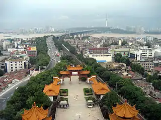 Wuchang (foreground) and Hanyang (background) seen from the Yellow Crane Tower
References
- Google (2014-07-02). "Hanyang" (Map). Google Maps. Google. Retrieved 2014-07-02.
- "Wuhan Statistical Yearbook 2010" (PDF). Wuhan Statistics Bureau. Archived from the original (PDF) on 5 November 2011. Retrieved 31 July 2011.p. 15
- 武汉市2010年第六次全国人口普查主要数据公报. Wuhan Statistics Bureau. 10 May 2011. Archived from the original on 25 October 2011. Retrieved 11 July 2011.
- (in Chinese) Profile of Hanyang Archived 2008-03-28 at the Wayback Machine, Official website of Hanyang District Government, visited on April 19, 2008.
- 人口区划 [Population and Administrative Divisions)] (in Chinese). People's Government of Hanyang District. 6 December 2016. Retrieved 23 December 2017.
2016 年,汉阳区下辖晴川街、龙阳街、建桥街、鹦鹉街、洲头街、四新街、五里墩街、琴断口街、江汉二桥街、永丰街、江堤街等 11 个街道和汉阳经济开发区、四新地区,共有 118 个社区居民委员会。
- 汉阳区历史沿革 [The Historical Development of Hanyang District] (in Chinese). XZQH.org. 7 July 2014. Retrieved 23 December 2017.
2010年第六次人口普查,汉阳区常住总人口584098人,其中:翠微街道44529人,建桥街道46960人,月湖街道20944人,晴川街道17138人,鹦鹉街道51945人,洲头街道38888人,五里墩街道87346人,琴断口街道66908人,江汉二桥街道76001人,永丰街道106482人,江堤街道24496人,四新地区管委会2461人。2011年末,全区总面积111.54平方千米,户籍总人口420529人,其中农业人口10361人。辖11个街道、1个经济开发区、1个管理地区,131个社区、6个行政村。(武汉年鉴2012数据
- (Area numbers taken from the first line of each individual page about the subdistricts.)首页湖北省武汉市汉阳区 (in Chinese). XZQH.org. 7 July 2014. Retrieved 23 December 2017.
External links
| Wikimedia Commons has media related to Hanyang District. |
- (in Chinese) Official website of Hanyang District Government
| Authority control |
|---|