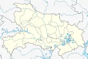
Zhijiang, Hubei
Zhijiang (Chinese: 枝江; pinyin: Zhījiāng) is a county-level city of Yichang City, in the west of Hubei province, People's Republic of China. Until the 1990s Zhijiang was a county. It is located on the left (northern) shore of the Yangtze River, downstream from Yichang center city.
Zhijiang
枝江市 Chihkiang | |
|---|---|
 Zhijiang Transportation Bureau | |
 Zhijiang Location in Hubei | |
| Coordinates: 30°25′34″N 111°45′40″E | |
| Country | People's Republic of China |
| Province | Hubei |
| Prefecture-level city | Yichang |
| Area | |
| • County-level city | 1,310 km2 (510 sq mi) |
| • Urban | 100.00 km2 (38.61 sq mi) |
| Population (2010)[1] | |
| • County-level city | 495,995 |
| • Density | 380/km2 (980/sq mi) |
| • Urban | 201,000 |
| Time zone | UTC+8 (China Standard) |
| Zhijiang | |||||||||
|---|---|---|---|---|---|---|---|---|---|
| Chinese | 枝江 | ||||||||
| Postal | Chihkiang | ||||||||
| |||||||||
Administrative divisions
Eight towns:
Climate
Zhijiang has a humid subtropical climate (Köppen climate classification Cfa) with hot, rainy summers and cool winters. Rainfall occurs throughout the year but is significantly heavier between April and August.
| Climate data for Zhijiang | |||||||||||||
|---|---|---|---|---|---|---|---|---|---|---|---|---|---|
| Month | Jan | Feb | Mar | Apr | May | Jun | Jul | Aug | Sep | Oct | Nov | Dec | Year |
| Record high °C (°F) | 28.7 (83.7) |
29.5 (85.1) |
34.8 (94.6) |
33.5 (92.3) |
35.2 (95.4) |
36.8 (98.2) |
39.1 (102.4) |
39.0 (102.2) |
38.5 (101.3) |
34.0 (93.2) |
29.5 (85.1) |
24.7 (76.5) |
39.1 (102.4) |
| Average high °C (°F) | 8.9 (48.0) |
9.8 (49.6) |
15.1 (59.2) |
21.2 (70.2) |
25.8 (78.4) |
29.1 (84.4) |
32.5 (90.5) |
32.6 (90.7) |
28.4 (83.1) |
22.5 (72.5) |
16.8 (62.2) |
11.4 (52.5) |
21.2 (70.1) |
| Daily mean °C (°F) | 4.8 (40.6) |
6.1 (43.0) |
10.6 (51.1) |
16.4 (61.5) |
21.1 (70.0) |
24.5 (76.1) |
27.4 (81.3) |
27.0 (80.6) |
23.1 (73.6) |
17.6 (63.7) |
12.2 (54.0) |
7.0 (44.6) |
16.5 (61.7) |
| Average low °C (°F) | 1.9 (35.4) |
3.4 (38.1) |
7.4 (45.3) |
12.8 (55.0) |
17.5 (63.5) |
21.0 (69.8) |
23.4 (74.1) |
23.0 (73.4) |
19.2 (66.6) |
14.1 (57.4) |
9.0 (48.2) |
3.8 (38.8) |
13.0 (55.5) |
| Record low °C (°F) | −11.5 (11.3) |
−5.4 (22.3) |
−1.5 (29.3) |
2.1 (35.8) |
7.6 (45.7) |
13.1 (55.6) |
16.5 (61.7) |
15.5 (59.9) |
9.3 (48.7) |
4.0 (39.2) |
−2.4 (27.7) |
−4.9 (23.2) |
−11.5 (11.3) |
| Average precipitation mm (inches) | 39.0 (1.54) |
47.1 (1.85) |
72.2 (2.84) |
164.4 (6.47) |
207.9 (8.19) |
196.0 (7.72) |
118.7 (4.67) |
122.5 (4.82) |
66.3 (2.61) |
104.2 (4.10) |
68.0 (2.68) |
33.8 (1.33) |
1,240.1 (48.82) |
| Average precipitation days | 7.9 | 7.9 | 10.4 | 13.4 | 13.0 | 11.0 | 8.3 | 7.4 | 6.3 | 9.2 | 7.8 | 5.7 | 108.3 |
| Mean monthly sunshine hours | 58.9 | 48.4 | 69.1 | 96.3 | 126.5 | 152.0 | 249.1 | 238.4 | 172.5 | 120.9 | 95.6 | 76.5 | 1,504.2 |
| Source: NOAA (1961-1990) [5] | |||||||||||||
Education
Lü Banglie
In October 2005, Zhijiang was in the news because one of the delegates to its (county-level) People's Congress, Lu Banglie (吕邦列), a village-rights activist, was savagely beaten on October 8, 2005 in the village of Taishi (太石), in Yuwotou town, Panyu District, Guangzhou, Guangdong, by unknown persons. The beating was witnessed by Benjamin Joffe-Walt, correspondent for The Guardian newspaper of the UK, who was himself threatened and believed Lü had been killed.
Since 2004, Lü has been the popularly elected head of Baoyuesi village (宝月寺村; 30°20′31″N 111°41′01″E), in the town of Bailizhou (百里洲镇), situated on a peninsula in the Yangtze River and the only town in Zhijiang not on the river's left bank; there is no road connection between Bailizhou and the city's other towns. He is the first elected village head in the history of the People's Republic of China.
The beating may have been intended to prevent a similar popular election from taking place in Taishi.
External links
| Wikimedia Commons has media related to Zhijiang, Hubei. |
| Look up Zhijiang or Chih-chiang in Wiktionary, the free dictionary. |
- 枝江市历史沿革 [Zhijiang City Historical Development] (in Chinese). XZQH. 14 July 2014. Retrieved 8 October 2018.
1996年,枝江市面积1310平方千米,{...}2010年第六次人口普查,枝江市常住总人口495995人,其中:马家店街道132746人,安福寺镇52784人,白洋镇37444人,顾家店镇26303人,董市镇54730人,仙女镇32174人,问安镇41213人,七星台镇43478人,百里洲镇75123人。
- Ministry of Housing and Urban-Rural Development, ed. (2019). China Urban Construction Statistical Yearbook 2017. Beijing: China Statistics Press. p. 66. Retrieved 11 January 2020.
- 2017年统计用区划代码和城乡划分代码:枝江市 [2017 Statistical Area Numbers and Rural-Urban Area Numbers: Zhijiang City]. National Bureau of Statistics of the People's Republic of China. 2017. Retrieved 8 October 2018.
统计用区划代码 名称 420583001000 马家店街道 420583101000 安福寺镇 420583102000 白洋镇 420583103000 顾家店镇 420583104000 董市镇 420583105000 仙女镇 420583106000 问安镇 420583107000 七星台镇 420583108000 百里洲镇
- 行政区划 [Administrative Divisions] (in Chinese). Zhijiang People's Government. Retrieved 8 October 2018.
Map (west to east):白洋镇, 顾家店, 安福寺镇, 董市镇, 仙女镇, 马家店街道办事处, 百里洲镇, 问安镇, 七星台镇
- "Zhijiang Climate Normals 1961-1990". National Oceanic and Atmospheric Administration. Retrieved December 21, 2012.