Ingleby Barwick
Ingleby Barwick is a town and civil parish in the borough of Stockton-on-Tees. The town is on the south bank of the River Tees within part of ceremonial North Yorkshire, England.
Ingleby Barwick
| |
|---|---|
 Official logo for the community of Ingleby Barwick | |
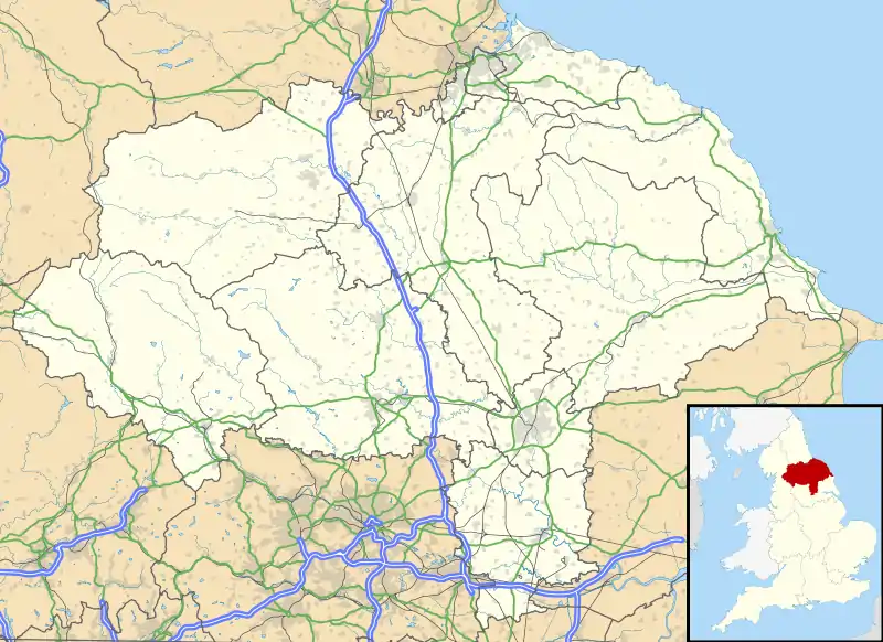 Ingleby Barwick Location within North Yorkshire | |
| Population | 21,045 (2011 census) |
| OS grid reference | NZ445140 |
| Civil parish |
|
| Unitary authority | |
| Ceremonial county | |
| Region | |
| Country | England |
| Sovereign state | United Kingdom |
| Post town | STOCKTON-ON-TEES |
| Postcode district | TS17 |
| Dialling code | 01642 |
| Police | Cleveland |
| Fire | Cleveland |
| Ambulance | North East |
| UK Parliament | |
Large scale development of Ingleby Barwick started in the late 1970s on farm land at the southern perimeter of the old Thornaby Airfield[1] In 2011, the population was 21,045.[2] , with the first development being officially opened on the 30 July 1981 by the mayor of Langbaurgh.[3]
The development gained the status of Town in February 2007 with the passing of a resolution under the Local Government Act 1972 s245(6) at the meeting of the then Parish Council.
Etymology
Ingleby Barwick was originally two settlements that merged. Ingleby is derived from Old Norse Englar+by (English place) named by Danes on accounts of the use of Norse-derived pronunciation of Englar, Ingle as opposed to Anglo, and ‘by’, a homophone to bee. The suffix -by is common locally, seen in Maltby, Thornaby, Coulby Newham settlements, and is used in by-law. Ingleby is a common name that is commonly tagged with other names, notably Ingleby Arncliffe and Ingleby Greenhow which are also in North Yorkshire.[4]
Barwick is of Anglo-Saxon in origin, Bere is Saxon for barley and Wick means farm.[4] This name is pronounced two ways. One way Barwick is pronounce is how the name would have came to be pronounced by locals /ˈbærɪk/ (due a shorter ‘a’ sound to coalesce of ‘r‘and ‘w’), This is similar how in Berwick-upon-Tweed is pronounced. People in settlements around Ingleby Barwick tend to pronounce Barwick this way when they have no ties to any who are not living or have lived in Ingleby Barwick since its expansion.
The second pronunciation is closer to how the individual words evolved in English and how the word is spelt, /bɑːrwɪk/. This pronunciation came about by the way housing developers pronounced it when the place expanded rapidly over decades. This pronunciation is therefore common in Ingleby Barwick itself.[5]
History
Prehistoric and ancient
The settlement of Ingleby Barwick has been occupied for thousands of years. There are traces of human occupation from as far back as the Stone Age. Work at a former farm discovered prolific multi period flintwork and Iron Age field patterns in the town.[6]
A salvage excavation was carried out on the former Windmills Fields of the town, at the end of 1996. Five individual burials were found along with a wooden cist, these finds were accompanied by objects containing stone, jet and copper alloy of high status. This site was considered of European significance as it threw new light on the settlement of the area in the Bronze Age and highlighted a change in tradition of burial traditions and trade networks at this time.[7]
A Roman settlement is also apparent in the town and a Roman Villa, was excavated in part. This has been preserved as a field.[8]
Former Quarry

The former Quarry and farm site is covered be the Ingleby Barwick Golf Academy and north of the housing development. Building work at Quarry farm discovered prolific concentrations of multi period flintwork along the South Bank of the River Tees and traces of Iron Age field patterns were discovered.[6] A Roman Villa circa 200 AD, perhaps the most northerly in UK, was excavated in part. This has been preserved as a grassed area as The Forum field.[8] The "official" report on the excavation was published in 2013 with the title "A Roman Villa at the Edge of Empire" ( ISBN 978-1-902771-90-8 )

Norman era
After the Norman invasion The Manor of Barwick was given to Robert Malet the son of William Malet, King William's great chamberlain. In the 13th century the land was owned by the Priors of Guisborough & Jervaulx until the dissolution of monasteries. The Manor of Barwick was given to Robert Malet the son of William Malet, King William's great chamberlain. Ingleby and Barwick were two separate places. Between the 14th to 17th century, it is not known when Barwick merged with Ingleby as a parish. Between the 14th and 16th centuries landowners in the area included the Percys of Northumberland and the Parrs of Nottingham.
Renaissance
The Middle Ages are considered to have ended with the Renaissance in the mid 15th century. In the 17th century the Manor of Barwick was sold to Sir Thomas Lynch, Governor of Jamaica and then to Sir William Turner of Kirkleatham.
Modern
After 1611, It is not known when the two separate places of Barwick and Ingleby combined there name or if Ingleby develop as a separate settlement or spawned from and then re-merged with Barwick. The land was in the ownership of the Turner's, with them gaining profits from the land used to support a free school and hospital at Kirkleatham.
Ingleby Barwick is listed as being a township in the parish of Stainton in 1887.[9][10] Its population was given as 132. During this time the land was sold off by the Turner estate. From 1894 to 1932, Ingleby Barwick was apart of the Middlesbrough Rural District.
During the wars
During the Second World War Ingleby Barwick stood near to the south-western perimeter of Thornaby Airfield and a number of aircraft crashed where Ingleby Barwick now stands. On 11 June 1940 a Coastal Command Lockheed Hudson crashed at Quarry Farm killing the four crew after the bomb load exploded on crashing.[11] On 28 April 1941 a Bristol Blenheim crashed at Barwick Lane killing all three crew.[11] On 18 December 1941 a Lockheed Hudson stalled soon after take off and crashed into Quarry Farm killing the five crew and four civilians.[11] On 4 September 1942 a Lockheed Hudson crashed at Myton House Farm killing the four crew.[11] The last aircraft accident was a Photo Reconnaissance de Havilland Mosquito which was attempting to land at Thornaby on one engine and crashed into land which is now home to Ingleby Mill School on 11 November 1943 killing both crew members; there is now a stone marking the crash site.[11][12][13]
Existing old town parish features
There are still a number of features that pre-date the 1980s-onward development.
Farms
- Low Farm. One of the buildings is incorporated in the Teal Arms pub.
- Cleveland View on Barwick Lane is another former farm building, belonging originally to Lane House Farm.
- There are original buildings from Ingleby Hill Farm at the end of Heddon Grove, now residential.
- Ingleby Close Farm buildings, which lie on land originally occupied by Betty's Close Farm, now residential, lie between Crosswell Park and Trevine Gardens.
- The original Myton House Farm site is marked by the public house that bears its name. The pub's website says "Formally (sic) a farmhouse..."
- Ingleby Hill Farm, an early 19th–century, Late Georgian, Grade II Listed Farmhouse.[14]
- White House Farm, converted into houses around the late 2000s to early 2010s.
Mills
- Black Mill on Raydale Beck is the remnant of a corn mill built on the original Sober Hall Farm, now residential.
- The Old Mill at the southern end of Barwick Lane is now a bed and breakfast
Routes
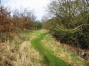
The route of the original Barwick Lane, which gave access to much of the original farmland remains accessible. Its origin remains as a cul-de-sac, to the east of the Fox Covert Inn, High Leven on Low Lane. This then becomes a cycle path, whose route can be navigated through Sober Hall, crossing Sober Hall Avenue, Pennine Way and Blair Avenue, passing west of Barley Fields Primary School and the Myton Road shops before crossing Blair Avenue's northern loop and terminating in name at the Myton Way/The Rings roundabout. Galava Walk is the original end of Barwick Lane leading to Barwick Farm being renamed when houses South of the lane were built.
Another original road route is preserved in the cycle path that runs in a westerly direction starting from the Teal Arms / Ingleby Barwick Post Office complex, this being the approximate former site of Low Farm. This route continues to the west of Myton Way and merged into Barwick Lane, leading eventually to Barwick Farm.
The route of the original road to Betty's Close Farm is preserved in the route of the cycle path that runs from Cleveland View to Roundhill Avenue (and whose route continues along the approach to Ingleby Close Farm buildings).
The route of the original road to White House Farm is preserved in the line of trees behind Rochester Court and Thirwall Drive, continuing in the east-west cycle path from there to Blair Avenue and in the east-west footpath that runs to the south of Harlech Court.[15]
Contemporary
From 1932, the town was in the Stokesley Rural District. In 1969 Yarmside Holdings bought land for housing. Ingleby Barwick was transferred to its current borough (Stockton-on-Tees’s) in 1974. The first houses were built at Lowfields in the late 1970s. Subsequent developments have formed the village-sized town to one of the most populous settlements in the Teesside conurbation and Tees Valley region. Housing developers, throughout the 2010s, included Taylor Wimpey, Persimmon PLC, Avant and Bellway.
The Rings housing development is named after a meandering of the river Tees, to the west of the village. Roads are named after Romano-British street and places to show the villages association with the a roman site.
Houses built when the village was developed were built by Persimmon plc and its subsidiary Charles Church Developments. Taylor Wimpey, a long-term developer of houses in Ingleby Barwick, also contributed through an agreement with Persimmon. Both developers have local-bases, Taylor Wimpey in Preston Farm Industrial Estate and Persimmon in Teesdale Industrial Estate, Thornaby.
In 2016, due to the housing development of The Rings being built, Myton Way was upgraded to dual-carrigeway from the Tesco roundabout to Broom Hill, and the Sandgate roundabout was replaced with traffic signals. Ingleby Way was also dualled from the Tesco roundabout to Barwick Way roundabout. The works started on Monday 29 February 2016 and were completed on Thursday 22 December 2016, apart from some footpath work.[16]
Governance
| Arms of Ingleby Barwick Town Council | |
|---|---|
| Crest | On a Wreath Or and Gules a Teal proper supporting with the dexter wing a Garb Or. |
| Blazon | Or three barrulets wavy Azure over all three Mill-rinds Gules. |
| Motto | Stepping Stones To The Future |
| Granted in October 2000.[17] | |
Ingleby Barwick, as part of the Stockton on Tees unitary authority, has six borough councillors representing the two wards Ingleby Barwick East (which also includes Hilton and Maltby) and Ingleby Barwick West (which also includes High Leven and Low Leven).[18] At 2019 the community is represented by Independent councillors and those from the Conservative party and Ingleby Barwick Independent Society (IBIS). It has a town council with 12 councillors.
Ingleby Barwick was represented in the House of Commons by James Wharton (Conservative), who was elected on 6 May 2010[19] for Stockton South (UK Parliament constituency). Wharton was re-elected with an increased majority on 7 May 2015. In August 2016 he was appointed Parliamentary Under-Secretary of State at the Department for International Development. On 8 May 2017 Dr Paul Williams (Labour) was elected to represent the constituency of Stockton South in the House of Commons. In 2019 Matt Vickers (Conservative) won the seat.
They are currently six councillors of IB that represent the town’s wards.
- The east ward is represented by:
- Ted Strike (Independent)
- Alan Watson (Conservative)
- Sally Ann Watson (Conservative)
- Ingleby Barwick West ward:
- Ken Dixon (Ingleby Barwick Independent Society)
- Kevin Faulks (Ingleby Barwick Independent Society)
- Ross Patterson (Ingleby Barwick Independent Society)[20]
Coat of Arms
Ingleby Barwick Town Council ceremonial Coat of Arms contains: a representation of the three rivers that run around Ingleby Barwick; depictions of mill-rinds which are an historical link to the Turner family, who used to own most of the land which now forms the town, and the Barwick element of the name. The crest shows a Teal bird which refers to a horse named Teal, trained at Middleham by Captain Neville Crump, which won the Grand National in 1952. The Teal Arms in the town is also a reference to the horse.[21]
Demography
| Year | 1881 | 1891 | 1901 | 1911 | 1921 | 1931 | 1951 | 1961 | 2001 | 2011 | |||
|---|---|---|---|---|---|---|---|---|---|---|---|---|---|
| Population | 132 | 115 | 124 | 147 | 118 | 133 | 141 | 113 | 16,280 | 21,045 | |||
| Historical population of Ingleby Barwick Source:[22] | |||||||||||||
2001 Census
| 2001 UK census | Ingleby Barwick | Stockton-On-Tees | England |
|---|---|---|---|
| Total population | 16,280 | 178,408 | 49,138,831 |
| Long term illness | 9.31% | 19.86% | 17.93% |
| Unemployed | 2.35% | 4.98% | 3.35% |
| Aged 75+ | 1.59% | 6.41% | 7.6% |
| Mean age | 31.87 | 37.97 | 38.6 |
| Ethnic white | 95.46% | 96.22% | 86.99% |
| Christian | 81.34% | 81.58% | 71.8% |
| Married or remarried | 64.6% | 53.2% | 50.9% |
The United Kingdom Census 2001 found Ingleby Barwick had 5,862 households and a population of 16,280, of which 8,272 were male and 8,008 female.
The town consists largely of owner-occupied properties and private rental properties making up 98% of the population. Council housing makes up the other 2%.
Ethnic diversity is minimal in Ingleby Barwick. Over 95% of residents class themselves as White British. The population is generally younger than average for Stockton-On-Tees with a mean age of 31.87 highlighting the high proportion of families with children in the town. In 2011 however, 92% of Ingleby Barwick's 21,045 residents were White British, 5.2% Asian and 0.4% Black.
Residents of Ingleby Barwick tend to have attained a higher level of education compared with Stockton-On-Tees and nationally. Over 25% of residents reported attaining a degree or higher level HNC/HND or NVQ compared with only 15% in Stockton as a whole.
The people of Ingleby Barwick enjoy a high employment rate, with 75% reporting themselves as being in full or part-time employment or being self-employed. Of these 76% usually travel to work by car or van, travelling an average distance of 21 km. Only 2.7% get to work on foot suggesting that most of the employment is from outside of Ingleby Barwick. The largest industry of employment was manufacturing accounting for 16.6% of the workforce. 50% of those working were in roles either in professional occupations or in companies at senior managerial levels.[23]
Continued development of the area means the population of the town is expanding dramatically. Estimates put the population of Ingleby Barwick at 21,860 in 2010.[24]
Geography
Ingleby Barwick Villages | ||||||||||
|---|---|---|---|---|---|---|---|---|---|---|
| ||||||||||

The town is divided into seven villages with a central area for shops and community facilities. The villages are not villages in the true sense of the word, but rather seven geographic areas within the town. Each village was originally intended to have its own schools, shops and community facilities.[25]
- Ingleby Barwick Centre
- Lowfields, named after Low Barwick Farm (now the Teal Arms public house)
- Beckfields, named after Bassleton Beck
- Sober Hall, a house before the development
- Round Hill, named after a hill which would have had a view of the fields before the village was built on
- Broom Hill
- The Rings, named after meandering of the River Tees.
- Ingleby Manor, includes Ingleby Manor Secondary School[26][18]
Waterways
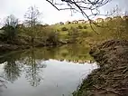
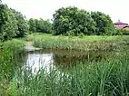
Ingleby Barwick is surrounded by water on three sides.[27] It is bordered by the Leven to the south and west, the Tees to the north and west, and Bassleton Beck to the east. Barwick pond, in the centre of the town, is a small Local Nature Reserve.[28]
Barwick Farm
Barwick Farm is an operating farm in The Rings and formed the basis and main spinal path (Barwick Lane) through Ingleby Barwick.[4]
Sport
TIBS is a football club on Thornaby Road. They are parks multiple play parks throughout the town with The Rings, Broom Hill, Myton and Ingleby Mill having one or more each. A community hub is at the centre of the Beckfields. The Rings a golf course driving range and community centre.[29]
Transport
Road
the Ingleby Barwick Town Centre


2. Queen Elizabeth Way‘s Jubilee Bridge
Ingleby Barwick is only accessible by driving and walking, being well connected to both. Some notable roads running from the town centre (Myton):
- Queen Elizabeth Way:
 A66, starts approximately a half mile distance to the town’s northern side, accessible via Queen Elizabeth Way, running north to south
- Ingleby Way
- Barwick Way:
- B1380 (Low Lane) runs to the South of the town and runs east to Yarm and west to Blue Bell Corner (Acklam, Middlesbrough)
Bus
Arriva North East operate buses in Ingleby Barwick with regular services, day & evening, to Stockton seven days a week & Middlesbrough and Yarm Monday to Saturday.
Rail
Adjacent settlements of Yarm, Eaglescliffe and Thornaby each have railway stations that are about four miles away. Connections to the main line service, at Darlington or York, are further connected to these three stations. Since May 2008, there has been a direct service with Grand Central at Eaglescliffe to and from London King' s Cross, five times a day.
Air
Teesside International Airport with regular daily services to/from Aberdeen and Amsterdam, is about 8 miles away.
Education
Library
The original Library was located within All Saints School. In 2020 the Library was relocated within the IB Leisure Centre.[30] It is open to the public during specified times, seven days a week. Library facilities include computer access, CD/DVD hire, photocopying, reference section, a children's and an adult library. The Library also plays host during elections to a Polling Station.
Primary
Whinstone
Whinstone is in Lowfields and is so named due to Ingleby Barwick formerly having a quarry, now the golf course in The Rings. In December 2017, the school became part of the Vision Academy Learning Trust.[31]
Barley Fields
Barley Fields opened in September 2006 and named due to Barwick, as a name, coming from a still operating farm that formally harvest barley in the large parts of the town and was the initial township.[32]
St Francis of Assisi
St Francis of Assisi is in Broom Hill. The school is affiliated with the Church of England religion and therefore St. Francis church and All Saints Academy in the town. The school is a part of the Dales Academy Trust.[33]
St. Thérèse of Lisieux
St Thérèse is a school religiously affiliated with the Roman Catholic Diocese of Middlesbrough and therefore St. Therese church in the town. The congregation previously used the school hall before the church was built.[34][35]
The school is currently a part of the Nicholas Postgate Catholic Academy Trust.[36]
Myton Park
Myton Park is named after Myton Farm House and is adjacent to All Saints Academy and IB Leisure Centre.[37]
Ingleby Mill
Ingleby Mill is a school named after a mill next to the current site. Barley Fields occupies the former site of Ingleby Mill which is opposite St. Thérèse.[38]
Secondary
All Saints

All Saints Academy, is the oldest secondary school within Ingleby Barwick, located at the centre of the town. The school is affiliated with the Church of England religion and therefore St. Francis church in the town.
The school opened as All Saints Voluntary Aided Church of England Secondary School and initially accommodated 600 pupils. From September 2009 the admission number to year 7 had been increased to 140 pupils.
Previously a voluntary aided school administered by Stockton-on-Tees Borough Council and the Church of England Diocese of York, All Saints CofE School converted to academy status in May 2013 and was renamed All Saints Academy. The school is still administered by the Diocese of York but is now independent of council control.
Ingleby Manor
Ingleby Manor Free School, is the other secondary school within Ingleby Barwick, located to the south of the town. The academy is operated by Delta Academies Trust and has a sixth form.
Ingleby Manor Free School was established in 2014, with an initial intake of approximately 80 year 7 pupils.[39][40] It initially operated from a converted warehouse, before relocating to a new purpose-built site in 2016.[41]
Catchment
They are three schools that cover all or parts of Ingleby Barwick in their catchment areas:
Notable current/former residents
- Ben Houchen, first and current Tees Valley Mayor, was brought up in Ingleby.[42]
Associated with a sport
- Juninho Paulista, lived in Ingleby Barwick during his time at Middlesbrough FC.[29][43]
- Katherine Copeland, a rower who won a gold medal at London 2012 Olympic Games.[44]
- Nathan Thomas (footballer), born in Ingleby Barwick.[45]
- Nathan Wood, born in Ingleby and is a footballer for Middlesbrough FC.[46]
Amenities
The amenities within Ingleby Barwick are largely located around a number of local centres:
Ingleby Barwick Centre
In 1997 the first Bannatyne's health club was built in Ingleby Barwick Centre. There has been supermarket at in the centre with Tesco being the current operator, since 2004, but the store was previously operated by Safeway.[29]
Romano play-park is situated on land between Tesco and Barley Field primary school. The land was previously a field and a smaller park. The building of a play area for children under 14 years had started in January 2009 and opened thereafter opened soon after. The park also has a multi-use sport ground.[47]
The Ingleby Barwick Leisure Centre, located next to All Saints Academy, opened in August 2020. It includes a 25-metre swimming pool, a gym, a customer service point and the local library.[48]
An Anglican Church dedicated to St Francis of Assisi operates services in the town’s centre.[49]
In November 2007 Stockton on Tees Borough Council approved plans to build St. Therese of Lisieux Catholic parish church next to the primary school of the same name, where services will continue to be held until funds can be obtained for the construction of the new church.[50]
In August 2014 the Diocese of Middlesbrough announced that it was soon to proceed with the building of the church. The building of the St Therese of Lisieux church started on 8 June 2015, completion expected "early 2016". Building work was completed in February 2016 and the first mass was celebrated on Saturday 5 March 2016.
The Rings
Sandgate Park is located in The Rings and is notably centred on food-based establishments. it has an Italian restaurant , a bistro-bar, a pizza take-away, bakery (Cooplands) and chicken house.
Sandgate Park also includes a Co-op Food, barbers, hair salon and retail estate agent. Ingleby Barwick Community Hall, and an area of open space are also located a short distance away.
The village is home to one of the Royal Mail Olympic Golden Postboxes. It is in honour of Kat Copeland's rowing gold at the 2012 Summer Games in London. The post box is located at the end of Apsley Way.[51]
Beckfields Centre
Beckfields Centre contains a number of amenities including a small shopping parade, The Beckfields public house, and Ingleby Barwick Community Centre.
Lowfields Centre
Lowfields Centre contains a number of amenities including a small shopping parade, Post Office, Doctors Surgery, Dentist, The Teal Arms public house, Whinstone Primary School, and Lowfields Green Public Open Space.
Traffic and social problems
Congestion and speeding
Ingleby Barwick faces a number of problems, including traffic congestion at peak times. These are particularly a concern around Ingleby Barwick centre, and the exit on to Low Lane. Speeding is also a significant problem within the estate. On 15 July 2011, 9-year old Brandon Maggs died after being hit by a car on Roundhill Avenue. This prompted residents to launch a campaign to reduce speeding on the main estate roads.[52]
Anti-social behaviour

Social problems have long been an issue in Ingleby Barwick, and were mentioned in the 1986 Domesday project. Anti-social behaviour is currently a problem in the estate, particularly around the local supermarket Tesco, other shopping areas, and Romano Park.[47] There have been a few reported incidents of muggings and assaults in the estate between 2005 and date.[53][54][55][56]
In October 2006, then leader of Ingleby Barwick Independent Society (IBIS) Councillor Lee Narroway was assaulted after confronting a gang on the estate.[57] The estate's problems sometimes draw the attention of the council's enforcement team, who attempt to disperse groups of youths causing trouble at the local shops, and occasionally confiscating alcohol.[58]
It was reported in 2008 that 10% of all police call outs to Ingleby Barwick come from the estate's Tesco store, with both staff and customers feeling intimidated by gangs of youths loitering in the vicinity.[59] After the completion of Romano Park in summer 2009 it has become a hot spot for antisocial behaviour, particularly around the multi-use games area.[47][60]
In January 2011 local schools warned parents that groups of over 100 youths, some of whom were armed, were gathering outside the estate's Tesco store engaging in anti-social behaviour and intimidating the public on evenings,[61] and subsequently on August 2015 a man was seriously assaulted by a group of men close to the store.[62]
In January 2016 Cleveland Police issued a dispersal order around the centre of Ingleby Barwick following reports of intimidation, and missiles being thrown at vehicles, with the area being described as a hot spot for anti-social behaviour.[63] In March 2017 police again raised concerns about trouble and intimidation be caused to members of the public around the Ingleby Barwick Tesco store. This included throwing items at vehicles and at people.[64]
References
- "BBC Domesday Reloaded - Ingleby Barwick 1986".
- Ingleby Barwick East and West wards http://ukcensusdata.com/stockton-on-tees-e06000004#sthash.OoQVyliYdbYSLc2s.dpbs
- "Ingleby Barwick: 1970s planning wrangling that saw tiny parish develop into bustling estate". TeessideLive. 3 November 2015. Retrieved 3 November 2020.
- A Dictionary of British Place-Names, A.D. Mills & Adrian Room, Oxford University Press, 2nd Ed 1998
- "How should Ingleby Barwick be pronounced? No controversy about first part, but there is about the second". Teesside Gazette. 27 August 2020.
- Archaeological Services. 1997. Ingleby Barwick Villages 5 and 6. Land near Quarry Farm and Barwick Farm: An Archaeological Evaluation. University of Durham. Unpublished Report.
- Tees Archaeology. Early Bronze Age burials at Windmill Fields,Ingleby Barwick, Stockton on Tees. "Archived copy" (PDF). Archived from the original (PDF) on 5 June 2011. Retrieved 28 November 2009.CS1 maint: archived copy as title (link)
- "Archived copy" (PDF). Archived from the original (PDF) on 16 July 2011. Retrieved 18 November 2010.CS1 maint: archived copy as title (link)
- John Bartholomew, Gazetteer of the British Isles (1887)
- A Vision of Britain through time. Descriptive Gazetteer Entry for Ingleby Barwick
- "www.yorkshire-aircraft.co.uk". www.yorkshire-aircraft.co.uk. Retrieved 22 September 2020.
- Hidden Teesside
- Doris Perley. Ingleby Barwick, the new settlement.
- Historic England. "Ingleby Hill Farmhouse (1139233)". National Heritage List for England. Retrieved 27 August 2020.
- "Explore Georeferenced Maps - Spy viewer". National Library of Scotland. Retrieved 3 November 2020.
- https://www.stockton.gov.uk/majorhighwayprojects
- "INGLEBY BARWICK TOWN COUNCIL (NORTH YORKSHIRE - Stockton-on-Tees)". Robert Young. Retrieved 31 October 2019.
- "Ingleby Barwick East Ward Profile 2019" (PDF).
- "My Blog – My WordPress Blog". Archived from the original on 23 October 2016. Retrieved 22 September 2020.
- "Councillors".
- Grand National Winners and Results – 1886 to 2010 – http://www.aintree.co.uk/index.php?content=ainwinners&p=2
- A Vision of Britain Through Time. http://www.visionofbritain.org.uk/data_cube_page.jsp?data_theme=T_POP&data_cube=N_TOT_POP&u_id=10437544&c_id=10001043&add=N
- Office for National Statistics. Census 2001. Lead Dataset List
- http://www.teesvalleyunlimited.gov.uk/
- Ingleby Barwick Master Plan. Missing or empty
|title=(help); Missing or empty|url=(help) - "Ingleby Barwick West Ward Profile 2019" (PDF).
- "Ingleby Barwick - Coat of arms (crest) of Ingleby Barwick". www.heraldry-wiki.com. Retrieved 2 February 2021.
- "Barwick Pond Local Nature Reserve". www.teesvalleylocalaccessforum.co.uk. Retrieved 2 February 2021.
- "So what's it like to live in Ingleby Barwick in 2017? We went to find out". Teesside Live. 15 July 2017. Retrieved 22 September 2020.
- "Ingleby Barwick library is on the move". Stockton Council. Retrieved 30 January 2021.
- https://www.whinstone.org.uk/. Missing or empty
|title=(help) - http://www.barleyfieldsprimaryschool.org.uk/. Missing or empty
|title=(help) - https://www.stfrancispri.dalesmat.org. Missing or empty
|title=(help) - French spelling “Thérèse” is used for the school where as unaccented “Therese” is used for the church. Saint abbreviations vary between “St.” (with a stop) and “St” (without).
- https://www.middlesbroughdioceseschoolsservice.org.uk/. Missing or empty
|title=(help) - https://www.sttherese.npcat.org.uk. Missing or empty
|title=(help) - https://www. Check
|url=value (help). Missing or empty|title=(help) - https://www.inglebymill.org.uk/. Missing or empty
|title=(help) - "Ingleby Manor Free School & Sixth Form". get-information-schools.service.gov.uk. Department for Education. Retrieved 29 December 2020.
- Blackburn, Mike (10 September 2014). "Excitement in the air as Ingleby Barwick free school prepares to open doors". gazettelive. Retrieved 24 February 2017.
- Lodge, Bethany (8 September 2016). "Take a look around Ingleby Manor Free School's brand new home". gazettelive. Retrieved 24 February 2017.
- Robson, Dave (5 May 2017). "Who is new Tees mayor Ben Houchen?". gazettelive. Retrieved 12 April 2018.
- "Juninho burns with the purest of passions". irishtimes.com. Irish Times. Retrieved 2 October 2020.
- "Teesside gets gold postbox". itv.com. itv. Retrieved 2 October 2020.
- "Nathan Thomas: Hartlepool United sign Mansfield Town winger". BBC.co.uk. BBC Sport. Retrieved 2 October 2020.
- "New Intakes Boost Academy". mfc.co.uk. Middlesbrough F.C. Retrieved 2 October 2020.
- Ingleby Barwick Councillors Comments, Gossip Magazine, 31 July 2009
- "Creating the first public leisure centre for the people of Ingleby Barwick". Retrieved 7 November 2020.
- See "Archived copy". Archived from the original on 28 August 2011. Retrieved 10 April 2011.CS1 maint: archived copy as title (link)
- "Planning Application 07/3296/FUL". Stockton-on-Tees Borough Council. 27 November 2007. Archived from the original on 4 October 2008. Retrieved 4 August 2009.
- http://www.itv.com/news/tyne-tees/story/2012-08-04/teesside-rower-wins-gold/
- "Speed petition after child dies in Ingelby Barwick". BBC News. 21 July 2011. Retrieved 22 September 2020.
- Talk before you make your plans, Evening Gazette, Published 2 May 2006
- Abusive teenager is given an ASBO, Evening Gazette, Published 16 September 2005
- Girl robbed at knifepoint by gang, BBC News Online, Published 5 September 2005
- Mum assaulted in daylight attack near Romano Park, Evening Gazette, Published 28 November 2011
- The Northern Echo, Teesside Edition, 30 October 2006
- Respect unit's hard work, BBC News, Published 27 February 2008
- CCTV needed at Tesco store at Ingleby Barwick? Archived 4 October 2008 at the Wayback Machine, Gazette Live, Published 17 June 2008
- Youths cause problems on housing estate, Gazette Live, Published 28 March 2009
- Warning as gangs gather in Ingleby Barwick, Gazette Live, Published 31 January 2011
- Charges admitted after man injured in Ingleby Barwick Tesco car park attack, Gazette Live, Published 12 January 2016
- 48-hour dispersal order in Ingleby Barwick was 'regrettable but necessary', Gazette Live, Published 15 January 2016
- Youths continue to cause trouble and 'intimidate' public at Ingleby Barwick Tesco, Gazette Live, Published 13 March 2017
External links
| Wikimedia Commons has media related to Ingleby Barwick. |