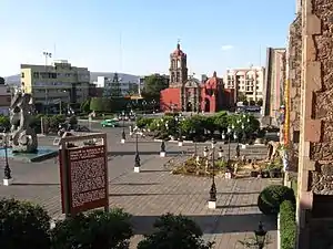
Irapuato
Irapuato is a Mexican city (and municipality) located at the foot of the Arandas Hill (in Spanish: Cerro de Arandas), in the central region of the state of Guanajuato. It lies between the Silao River and the Guanajuato River, a tributary of the Lerma River, at 1,724 m (5,656 ft) above sea level. It is located at 20°40′N 101°21′W. The city is the second-largest in the state (only behind León), with a population of 342,561 according to the 2005 census, while its municipality has a population of 529,440.[2] The municipality has an area of 845.16 km² (326.32 sq mi) and includes numerous smaller outlying communities. Although it is now an important center for regional trade and transportation center as well the site of several automotive and chemical manufacturing plants, the city's main industry has historically been agriculture and it has long been known for its strawberries and the raising of pigs and cattle. The fruits and flowers of Irapuato's luxurious gardens are well-known throughout Mexico.[3]
Irapuato | |
|---|---|
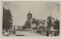
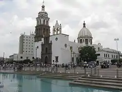 Catedral de Nuestra Señora de la Soledad | |
 Flag  Seal | |
| Nickname(s): | |
| Motto(s): | |
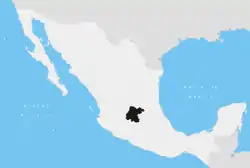
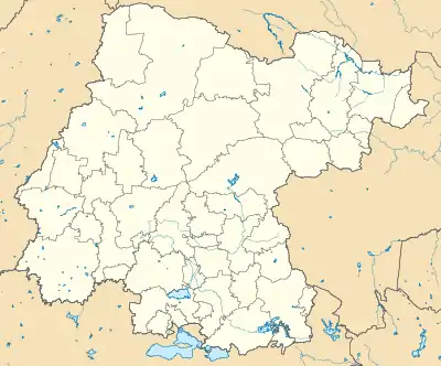 Irapuato Location within Guanajuato 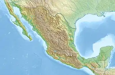 Irapuato Location within Mexico | |
| Coordinates: 20°40′N 101°21′W | |
| Country | |
| State | |
| Municipality | |
| Founded | February 15, 1547 |
| Founded as | Congregación de San Marcos Irapuato |
| Founded by | Vasco de Quiroga[1] |
| Government | |
| • Municipal President | Ricardo Ortiz Gutiérrez |
| Area | |
| • Total | 845.16 km2 (326.32 sq mi) |
| Elevation | 1,724 m (5 676 ft) |
| Population (2010) | |
| • Total | 380,941 city; 529,440 municipality |
| • Density | 626.44/km2 (1,622.5/sq mi) |
| Demonym(s) | Irapuatense, Fresero |
| Time zone | UTC-6 (Central Standard Time) |
| • Summer (DST) | UTC-5 (Central Daylight Time) |
| ZIP code | 36590 - 36899 |
| Area code(s) | 462 |
| Website | Official Website of the City of Irapuato |
| Average temperature 19°C | |
History
Prehispanic era
In the pre-Hispanic era, the site was inhabited by the Chichimecas (c. 1200 AD), a group of semi-nomadic hunter-gatherers. Later on, the Purépechas conquered the region and initiated the establishment of a permanent settlement. They constructed buildings in the Purépecha architectural style, produced pottery, and practiced agriculture. They called the settlement Xiriquitzio (or Iriquitzio), which the Spanish conquerors pronounced "Jiricuato" (or Jiricuicho), which meant "the place with houses (or low dwellings)".[4] The initial growth period, however, was short lived. The downfall of the Purépecha Empire led to the abandonment of the settlement, at which point it was once again inhabited by the Chichimecas.
Conquest
In the 16th century, vasts amounts of silver ore were discovered at the present day site of the capital city of Guanajuato. This discovery led to a massive migration of Spanish settlers to the area.[5]
Flood
On 18 August 1973, thousands of homes were destroyed and an estimated 300 people killed when a dam burst, sending a seven-foot-high wall of water crashing into the city.
Massacres
Mass shootings occurred at drug rehabilitation centres on 6 June and 1 July 2020.
Climate
It has a humid subtropical climate (Cwa in the Köppen climate classification) with an average temperature of 20 °C (67 °F). The large majority of rainfall occurs from June - September. It is at an altitude above sea level of 1724 meters (5676 ft).
| Climate data for Irapuato | |||||||||||||
|---|---|---|---|---|---|---|---|---|---|---|---|---|---|
| Month | Jan | Feb | Mar | Apr | May | Jun | Jul | Aug | Sep | Oct | Nov | Dec | Year |
| Record high °C (°F) | 31.0 (87.8) |
35.0 (95.0) |
35.0 (95.0) |
38.0 (100.4) |
42.1 (107.8) |
38.0 (100.4) |
35.0 (95.0) |
32.0 (89.6) |
34.0 (93.2) |
33.5 (92.3) |
33.0 (91.4) |
32.0 (89.6) |
42.1 (107.8) |
| Average high °C (°F) | 24.4 (75.9) |
26.3 (79.3) |
29.1 (84.4) |
31.1 (88.0) |
32.3 (90.1) |
30.2 (86.4) |
28.2 (82.8) |
28.0 (82.4) |
27.5 (81.5) |
27.1 (80.8) |
26.3 (79.3) |
24.9 (76.8) |
28.0 (82.4) |
| Daily mean °C (°F) | 15.2 (59.4) |
16.7 (62.1) |
19.4 (66.9) |
21.8 (71.2) |
23.7 (74.7) |
23.2 (73.8) |
21.6 (70.9) |
21.4 (70.5) |
20.9 (69.6) |
19.5 (67.1) |
17.5 (63.5) |
15.9 (60.6) |
19.7 (67.5) |
| Average low °C (°F) | 6.0 (42.8) |
7.1 (44.8) |
9.6 (49.3) |
12.5 (54.5) |
15.1 (59.2) |
16.1 (61.0) |
15.1 (59.2) |
14.9 (58.8) |
14.3 (57.7) |
11.8 (53.2) |
8.7 (47.7) |
6.9 (44.4) |
11.5 (52.7) |
| Record low °C (°F) | −3.0 (26.6) |
−2.5 (27.5) |
0.0 (32.0) |
4.0 (39.2) |
5.0 (41.0) |
10.0 (50.0) |
6.5 (43.7) |
9.0 (48.2) |
4.8 (40.6) |
2.0 (35.6) |
0.0 (32.0) |
−2.0 (28.4) |
−3.0 (26.6) |
| Average precipitation mm (inches) | 11.5 (0.45) |
4.6 (0.18) |
3.8 (0.15) |
10.0 (0.39) |
30.5 (1.20) |
116.5 (4.59) |
164.3 (6.47) |
141.7 (5.58) |
105.9 (4.17) |
37.9 (1.49) |
9.6 (0.38) |
8.2 (0.32) |
644.5 (25.37) |
| Average precipitation days (≥ 0.1 mm) | 1.6 | 1.2 | 1.1 | 2.0 | 4.8 | 10.8 | 15.3 | 14.1 | 10.1 | 4.3 | 1.5 | 1.8 | 68.6 |
| Source: Servicio Meteorologico Nacional[6] | |||||||||||||
Transportation
Airport
Irapuato is a 2 or 3 hour flight from cities including Los Angeles, Houston, Dallas, Mexico City, Monterrey, Guadalajara and Puerto Vallarta, among others. Located just 25 minutes from the city of Irapuato the Del Bajío International Airport (its correct name is Aeropuerto Internacional de Guanajuato (Guanajuato International Airport)) (IATA: BJX) is an international airport located in Silao, close to Irapuato, Guanajuato, Mexico. It handles national and international air traffic of the area that includes the cities of León, Irapuato, and the state capital, Guanajuato. Guanajuato International Airport is an important connecting point for some flights from Mexico City to the United States.
Major highways
Major highways in Irapuato and their starting and ending points:
 Mexican Federal Highway 45 Ciudad Juárez, Chihuahua - Panales, Hidalgo
 Mexican Federal Highway 90 Irapuato, Guanajuato - Zapotlanejo, Jalisco
 Mexican Federal Highway 43 Salamanca, Guanajuato - Morelia, Michoacán
 Mexican Federal Highway 110 Armería, Colima - Xoconostle, Guanajuato
Education
The city of Irapuato is home to some private universities, and a single public university, the Higher Technological Institute of Irapuato (ITESI).
The city is also home to a research center of the Center for Advanced Research and Studies (CINVESTAV) specializing in plant biotechnology and genetics and the newly created National Center of Plant Genomics.
Sport
The local football team is Irapuato FC.
Stadiums and arenas
- Estadio Sergio Leon Chavez
- Plaza de Toros
- Parque Irekua
- Golf Club Santa Margarita
Notable people
- Amalia Macías – singer and actress who toured Europe
- Enrique del Moral – architect.
- Silvia Navarro – actress.
- Natalia Guerrero – actress.
- Carlos Cordero – athlete for Mexico at the 2012 London Olympics.
- Samuel Ruiz – Catholic prelate.
- Mario Castañeda – Mexican voice actor.
- Chucho Navarro – founding member of the Trio Los Panchos.
- Miguel Ángel Chico Herrera – president of PRI from 2005-2009.
- Roberto Alvarado – professional soccer player who plays for Cruz Azul in the Liga MX, and the Mexico National Team.
- Claudio González – professional soccer player who plays for Club Leon in the Liga MX.
- Óscar Razo – professional soccer player who played for Club Atlas in the Liga MX.
- Francisco Rotllán – professional soccer player who played for Mexico at the 1992 Summer Olympics in Barcelona.
- Sergio Ávila – professional soccer player who played for Chivas de Guadalajara and the Mexico U-23 national team.
- José Antonio Patlán – professional soccer player who played for Chivas de Guadalajara in 2006
Images
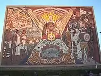
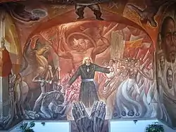 Mural depicting Miguel Hidalgo y Costilla and the Mexican Independence movement. |
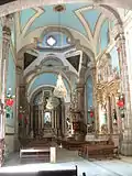
 Hospitalito Church |
|
 Aguas Danzarinas Fountain |
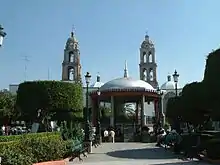 Irapuato's Hidalgo Garden |
 Templo de la Soledad |
Sister cities
References
- "Historia de Irapuato". Enciclopedia de los Municipios de México. Archived from the original on 2012-03-20. Retrieved 2007-03-22.
- "2005 Census". INEGI: Instituto Nacional de Estadística, Geografía e Informática. Archived from the original on 2007-03-28. Retrieved 2007-03-22.
- "Irapuato". Questia Encyclopedia. Retrieved 2007-03-21.
- "Irapuato History". irapuato.gob.mx. Retrieved 2007-03-20.
- "Historia de la Conquista". irapuato.gob.mx. Retrieved 2007-03-20.
- NORMALES CLIMATOLÓGICAS 1971-2000 Archived 2010-11-08 at the Wayback Machine, National Meteorological Service of Mexico. Retrieved August 4, 2012 .
External links
| Wikivoyage has a travel guide for Irapuato. |
- D IRAPUATO.COM SPANISH
- Presidencia Municipal de Irapuato Official website
- Irapuato Article on Wikipedia Español